Download
1 / 21
210 likes | 377 Vues
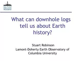
What can downhole logs tell us about Earth history? Stuart Robinson Lamont-Doherty Earth Observatory of Columbia University. Introduction. As discussed in the last two days logs yield data related to the physical properties of sediments and rocks .

E N D
What can downhole logs tell us about Earth history?Stuart RobinsonLamont-Doherty Earth Observatory of Columbia University
Introduction • As discussed in the last two days logs yield data related to the physical properties of sediments and rocks. • We can use such data to reconstruct various aspects of ocean and earth history
Local significance • Compaction of sedimentary pile • Presence of unconformities (gaps in sedimentation) • Changing mineralogical composition • Changing lithological composition • Presence of organic matter
Global significance • Presence of organic matter • Changes in the earth’s magnetic field • Changes in sea-level • Recognition of cycles driven by changes in the earths orbital parameters • Identification of geological events
The physical history of the sedimentary pile • Most useful logs are density, porosity and electrical resistivity • Used to unravel the history of deposition, compaction, erosion and subsequent diagenesis “Diagenesis means any chemical or physical process that alters the chemical and/or physical nature of the original sediment while it is at or near the Earth’s surface” e.g. squashing of grains during burial or dissolution and reprecipitation of calcite
The physical history of the sedimentary pile Leg 198, Shatsky Rise (Bralower et al., 2002)
Changes in mineralogical/lithological composition • PEFL - reveals gross mineralogical changes (i.e. SiO2 vs. CaCO3) • Gamma-ray - reveals changes in clay content • Density, porosity and resistivity can also be influenced by sediment composition
Changes in mineralogical/lithological composition Leg 198, Shatsky Rise (Bralower et al., 2002)
Presence of organic matter • Evident on natural gamma-ray logs • From the NGT, can calculate % Total organic carbon • Globally significant in some geological time periods - represent massive perturbations to the global carbon-cycle
Presence of organic matter Leg 198, Shatsky Rise (Bralower et al., 2002) Shale with <34.7 % total organic carbon
Changes in mineralogical/lithological composition Leg 198, Shatsky Rise (Bralower et al., 2002)
Changes in sea-level • To determine sea-level changes need to use multiple data types • Identify (with complete certainty) facies changes that are caused by sea-level change (e.g. using FMS logs - Leg 144) • Or: Identify surfaces related to sea-level change (e.g. using gamma-ray logs to identify erosional horizons)
Changes in sea-level Arrows mark interpreted lithologic cycles seen in the Pleistocene (Plio-Pleistocene boundary at ~520 mbsf). The cycles correspond to abrupt decreases in clay content followed by gradual upward increase in clay, and are interpreted to reflect changes in sea level. These cycles match closely the changes in grain size seen in the core as well as changes in the pore water chemistry. Leg 174A, NJ margin (Austin et al., 1998)
Changes in sea-level • However, gamma-ray peaks can be caused by other things than organic enrichment caused by sea-level change (e.g. glauconite enrichment - see Hesselbo, 1996; Leg 150) From Hesselbo (1996).
Cycles in paleoclimate • Paleoclimatic cycles (on geological timescales e.g. >10,000 years) caused by variations in the earths orbit that alter the amount of energy received from the sun • These cycles are known as Milankovitch Cycles and are responsible for glacial-interglacial cycles Taken from Zachos et al. (2001).
Cycles in paleoclimate • Milankovitch cycles can be seen in sediments as changes in lithology and mineralogy • In order to recognize cyclicity need high resolution tool (as many measurements per m) and a minimum sedimentation rate (which depends on the tool resolution) • For example, if tool has a minimum resolution of 15 cm, and the sedimentation rate is 5 cm/10, 000 year, then cycles of 30,000 years or less will definitely be missed
Cycles in paleoclimate Leg 166, Bahamas (Williams & Pirmez, 1999)
Cycles in paleoclimate Leg 172, NW Atlantic (Keigwin et al., 1998)
Identification of geological events • Some geological events can be observed in the logging data • Can only recognize changes in the nature of the sedimentary record - but biological changes are often associated with such sedimentary changes. • Fossils record the biological change, whereas sediments record environmental change. • Examples include major volcanic eruption events and the Cretaceous–Tertiary boundary impact event
Identification of geological events From Leg 165, Caribbean Ocean (Sigurdsson et al., 1999).
References Austin, J.A.Jr., Christie-Blick, H., Malone, M.J. et al., 1998. Proceedings of the Ocean Drilling Program, Initial Reports, 174A, College Station, TX, (Ocean Drilling Program) Bralower, T.J., Premoli Silva, I., Malone, M.J. et al., 2002. Proceedings of the Ocean Drilling Program, Initial Reports, 198, College Station, TX, (Ocean Drilling Program) Hesselbo, S.P. 1996. Spectral gamma-ray logs in relation to clay mineralogy and sequence stratigraphy, Cenozoic of the Atlantic margin, offshore New Jersey. In: Mountain, G.S., Miller, K.G., Blum, P., Poag, C.W. & Twichell, D.C. (eds). Proceedings of the Ocean Drilling Program, Scientific Reports,150, 411-422. College Station, TX (Ocean Drilling Program) Keigwin, L.D., Rio, D., Acton, G.D. et al., 1998. Proceedings of the Ocean Drilling Program, Initial Reports, 172, College Station, TX, (Ocean Drilling Program) Sigurdsson, H., Leckie, R.M., Acton, G.D. et al., 1997. Proceedings of the Ocean Drilling Program, Initial Reports, 165, College Station, TX, (Ocean Drilling Program) Williams, T. and Pirmez, C. 1999. FMS Images from carbonates of the Bahama Bank Slope, ODP Leg 166: Lithological identification and cyclo-stratigraphy. In: Lovell, M.A., Williamson, G & Harvey, P.K. (eds). Borehole Imaging: applications and case histories. Geological Society, London, Special Publications, 159, 227-238. Zachos, J. Pagani, M., Sloan, L., Thomas, E. & Billups, K. 2001. Trends, Rhythms, and Aberrations in Global Climate 65 Ma to Present. Science,292, 686-693.