Download
1 / 1
10 likes | 182 Vues
-2. +2 (m/s). ESTIMATION OF OCEAN CURRENT VELOCITY IN COASTAL AREA USING RADARSAT-1 SAR IMAGES AND HF-RADAR DATA Moon-Kyung Kang 1 , Hoonyol Lee 2 , Chan-Su Yang 3 , Wang-Jung Yoon 4

E N D
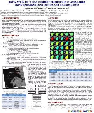
-2 +2 (m/s) ESTIMATION OF OCEAN CURRENT VELOCITY IN COASTAL AREA USING RADARSAT-1 SAR IMAGES AND HF-RADAR DATA Moon-Kyung Kang1, Hoonyol Lee2, Chan-Su Yang3, Wang-Jung Yoon4 1 Ocean Satellite Research Group, Korea Ocean Research & Development Institute (KORDI), Ansan, Republic of Korea, mkkang@kordi.re.kr 2 Department of Geophysics, Kangwon National University, Chuncheon, Republic of Korea, hoonyol@kangwon.ac.kr 3 Ocean Satellite Research Group, Korea Ocean Research & Development Institute (KORDI),Ansan, Republic of Korea, yangcs@kordi.re.kr 4 Department of Geosystem Engineering, Chonnam National University, Gwangju, Republic of Korea, wjyoon@chonnam.ac.kr • INTRODUCTION • This study presents the results of the surface current velocity estimation using 6 RADARSAT-1 SAR images and high frequency (HF) radar data acquired in west coastal area near Incheon, Korea. • We extracted the surface velocity from SAR images based on the Doppler shift approach [1] in which the azimuth frequency shift is related to the motion of surface target in the radar direction. • The extracted SAR current velocities were statistically compared with the current velocities from the HF-radar data. The corrected SAR current velocity inherits the average of HF-radar while maintaining high-resolution mature of the original SAR data. • RESULTS • Firstly, the parameter optimization for the SOP processing has been performed based on the statistical test on the results from various parameter sets. The results then compared with the HF-radar data and then a correction procedure has been implemented to complement the possible errors in the nominal Doppler centroid during SAR focusing. • To compensate for the possible errors caused by the nominal Doppler centroid, the difference of averages between the current velocities from SAR and HF-radar was subtracted from the SAR current velocity as: • After the correction, the SAR current velocity images (3rd columns) are much similar to the HF-radar current images (2nd column). There is also a significant improvement in the difference images before (4th column) and after the correction (5th column). In case of the difference images, red color appear when the SAR velocity is higher than the current velocity of HF-radar and the blue color is for the opposite. From this result we confirmed that the nominal Doppler centroid anomaly during SAR focusing processing can be corrected by using a reference data such as the HF-radar current velocity data. • Table 2 shows that the corrected SAR current velocity (vsarc) inherits the average of the HF-radar current velocity (urg) and the standard deviation of the SAR current velocity before correction (vsar). This means that a constant error in the nominal Doppler centroid has been corrected by the HF-radar data while the advantage of higher resolution of the SAR current velocity has been maintained. • METHODOLOGY • The study area: Fig. 1 • The west coastal sea near Incheon of the Korean Peninsula • The tidal current speed is much higher than that of the eastern or southern sea of Korea • Total 6 Radarsat-1 SAR images: Table 1 • May 6 and 30, July 17, August 10, September 27, and October 21, 2003 • C-band (5.3 GHz) in HH polarization, all in an ascending orbit • The HF-radar data • By National Oceanographic Research Institute (NORI) of Korea • At the same time of SAR data acquisition • In the West Sea: 37°17´34˝ to 37°28´7˝ N • and 126°25´7˝ to 126°36´52˝ E. • The current velocity data: in east (uE) and north (uN) direction. • The overall procedure: Fig. 2 • The used software: SAR Ocean Processor (SOP) • The estimation of the surface current velocity from Radarsat-1 SAR images and HF-radar data • The SAR current velocity (vsar) extracted from the SOP is in range direction only • The HF-radar current velocity should be rotated to range (urg) and azimuth (uaz) directions for comparison. vsarc vsar-urg vsar urg vsarc-urg (a) (b) (c) (d) Fig. 3. The ocean current velocity maps in range direction (m/s): The acquisition dates of the Radarsat-1 SAR images are (a) May 6, (b) May 30, (c) July 17, (d) August 10, (e) September 27, and (f) October 21, 2003. The 1st column is the SAR current velocity (vsar) and the 2nd is the HF-radar current velocity (urg). The 3rd column is the corrected SAR current velocity (vsarc). The 4th and the 5th columns are vsar-urg and vsarc-urg. (e) • The geocoded map of the SAR and HF-radar current velocities were overlaid and masked out so that the area includes the coastal ocean surface only and keeps a good distance from the lands nearby. • The velocities from HF-radar in range direction (urg) and SAR image data (vsar) were compared and analyzed by a simple statistical method such as averages, standard deviations, and root mean square (RMS) errors. • Assuming the HF-radar data as a reference, the SAR velocity was corrected (vsarc) accordingly. 37°34′49″ N (f) Incheon Yeongjong 127°4′21″ E Table 2. Statistical analysis of the current velocity from SAR and HF-radar data. Study Area Deokjuck Daebu HF-Radar Data SAR Velocity Estimation Data Gridding (uE , uN) Gridding ( vsar) Angular Transform (urg, uaz) GCPs Correction West Sea Overlay & Masking (uE , uN , urg , uaz , vsar) Tae-An Peninsula Statistical Analysis (Avg., Std, RMSE) • CONCLUSIONS • This study presented the results of estimating the ocean surface current in West Sea near Incheon of the Korean Peninsula using SAR images and HF-radar data. • The retrieval of current velocity from SAR images was processed by the SOP program based on the Doppler shift approach. The extracted SAR current velocity was compared with the HF-radar current velocity by statistical method such as averages, standard deviations, and RMS errors. • We concluded that 1) the problem related to the unreliable nominal Doppler centroid estimation during the SAR focusing can be corrected by a reference data such as the HF-radar data; 2) the corrected SAR current velocity has the average of HF-radar data while maintaining the advantage of high-resolution SAR. Velocity Correction (vsarc) Evaluation 125°35′59″ E Azimuth (km) Range 50 0 25 36°25′54″ N Fig. 1. Study Area depicted in a RADARSAT-1 SAR image. Table 1. The used RADARSAT-1 SAR images. • REFERENCES • [1] B. Chapron, C. Fabrice, and A. Fabrice, “Direct Measurements of Ocean Surface Velocity from Space: Interpretation and Validation,” J. of Geophysical Research, Vol. 110, pp. 1-17, 2005. • [2] M. -K. Kang, H. Lee, M. Lee, Y. -W. Park, and W. -J. Yoon, “The Extraction of Ocean Wind, Wave, and Current Parameters Using SAR Imagery,” Proceeding of IGARSS 2007, Barcelona, Spain, pp. 507-510, 2007. Fig. 2. The overall procedure for estimation of the surface current velocity from SAR and HF-radar data. IGARSS2008,BOSTON