COASTAL OCEAN
670 likes | 925 Vues
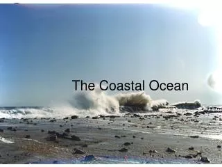
COASTAL OCEAN. • We will start with chapter 11 first, then chapter 10. Coastal ocean. Shallow ocean area over continental shelf Complex shorelines. Currents are more or less parallel to the shoreline – 1. tides and winds have strong influence – 2. affected by river discharge

COASTAL OCEAN
E N D
Presentation Transcript
Coastal ocean • Shallow ocean area over continental shelf • Complex shorelines
Currents are more or less parallel to the shoreline – 1. tides and winds have strong influence – 2. affected by river discharge – 3. estuarine circulation prevails (will see this later) – 4. Davidson coastal: geostrophic currents (arises from a balance between the down-slope component of the gravitational force and the Coriolis effect that deflects it) that parallel the coast (Fig 11.4 p 317)
Currents are more or less parallel to the shoreline cont. – 5. seasonal change - summer wind diminish or little river discharge, and weaken coastal currents - winter storms - coastal currents are re-established
Example • surface waters can be blown toward shore and held there by winds, depressing the pycnocline (where water density changes markedly with depth - changes in either temperature, salinity or both, can cause the marked change in density). A sloping sea surface results, creating geostrophic currents that parallel the coast. Because of this parallel flow transfer of freshwater across the coastal ocean is slow - residence time of freshwater is long, 1/2 year to 2+ years
Words from previous chapters • 1. pycnocline • 2. geostrophic current • 3. residence time • 4. up welling • 5. boundary currents • 6. fetch • 7. lagoon
Boundary currents • Western boundary current - strongest in oceans – 1. deep, narrow, swift – 2. intensified by Earth's rotation – 3. often meander and spin off rings that move separately • Eastern boundary currents – 1. broad, shallow, slow-moving – 2. often associated with up welling areas
Up welling • Up welling induced by winds or river discharge cause nutrient-rich waters to move into surface zone • Coastal up welling occurs along the California-Oregon coast (good fishing) and western coasts of South America (good fishing) • These waters usually come from about 200 meters depth (cold plus nutrients)
Temperature and salinity • Marked changes in temp and salinity along coast and offshore due to winds (Fig 11.2, & 11.3 p 316) • Strong seasonal changes – winter, cold winds bring on rain and lower salinity – summer, dry winds from the continent cause evaporation - while blowing across coastal waters increase salinity through evaporation
Temperature and salinity • Evaporation occurs from all oceans • Lowest salinity occurs near large rivers (Amazon discharges fresh water about 1 mile out) • Extreme temperatures occur in surface coastal waters - surface temp > 40o C 3 points: – 1. no mixing - warm water on top of cooler water
Temperature and salinity cont. – 2. limited fetch (distance over which the wind blows in a constant direction) in small ocean areas limits wave action - inhibit vertical mixing – 3. lower surface-water temperatures are controlled by freezing sea water at -2oo C • large surface area - shallow bays and lagoons - low salinity (river discharge)
Estuary- a semi-inclosed body of water where fresh water from the land mixes with saltwater - found on stable (sinking Atlantic-type) margin a – Formed by flooding of indentations along the coast – Drowned river a valleys – Coastal plain estuaries are typically broad, and gradually deepen seaward
Estuaries, fjords, and lagoons cont. • Fjords - flooded glacially eroded high latitude coastlines b – Glaciers removed the soil cover and carved deep valleys and when these valleys were flooded they formed fjords – U shaped
Estuaries, fjords, and lagoons cont. • Lagoon - wide shallow estuarine system • Bar-built estuaries separate shallow lagoons coastal ocean c (barrier islands) Review Fig. 2.27 p 65 • Are seen commonly along the U.S. Gulf Coast and much of the Atlantic coast up to Long Island
Estuaries, fjords, and lagoons cont • Where mountain building is active, and the coast is rising, estuaries or bays d (tectonic estuaries) are cut off from the ocean by young mountain ranges. On such a coast, there are few estuaries or lagoons. The Pacific coast of North America is an example. (Rising Pacific type margin)
Estuarine circulation • Estuarine circulation - long term Average flow seaward in the surface layers and a net landward flow along the bottom Fig. 11.7 a, b, c, d p 319
Estuarine circulation cont. • Two-layered flow with sea-ward-moving low-salinity surface water over landward moving flow of higher-salinity water • Mixing between layers depends upon the magnitude of river flow and tidally induced mixing • Nutrients supplied from land and by estuarine circulation cause high productivity
Salt-wedge estuary • Salt-wedge estuary Fig. 11.7 d p 319 • friction between fresh and salt water - pycnocline • observed only where river flow is large and tidal range low – Columbia river during floods Fig. 11.8 p 320 (book)
Estuaries • Vertically mixed estuary - (well mixed) salinity at any point is uniform from the surface to the bottom - river water mixes evenly Fig. 11.7 a p 319 – shallow - low volume - little or no transport of sea water inward
Estuarys cont. • Slightly stratified estuary - (partially mixed) two basic water layers - fresher on top, increased salinity at bottom, with mixing in the middle Fig. 11.7 b p 319 – deeper - salinity increasing from head to mouth
Estuaries cont. • Highly stratified estuary - (Fjord type) • Fig. 11.7 p 319 • deep water has uniform salinity • upper water increases in salinity from head to mouth • relatively strong halocline
MARGINAL SEAS • partially isolated from coastal ocean – have varying degrees of exchange with the open oceans - salinity and temperature is different than those of typical sea water
Marginal seas of the Atlantic • 1. Mediterranean Sea Fig. 11.12 a p 323 T 106 – a. number of small seas connected by narrow necks – b. remains of the Tethys Sea that separated former continents of Laurasia and Gondwanaland – c. opposite to the pattern characteristic of estuaries (where surface freshwater flow goes into the open ocean and saline subsurface flow enters the estuary) Fig. 11.12 b p 341
Marginal seas of the Atlantic cont. • 2. Caribbean Sea T 107 – a. connects to Atlantic by way of the Anegada Passage (very deep 2300 m) – b. four major basins - Venezuela, Colombia, Cayman, Yucatan depths > 4000m – c. cold nutrient rich upwellings
Marginal seas of the Atlantic cont • 3. Gulf of Mexico T 107 – a. connected to the Atlantic by way of the Straits of Florida (1000m) – b. Florida current - part of the Gulf stream – c. Loop Current
Marginal seas of the Atlantic cont • 3. Gulf of Mexico T 107 – Vertical Salinity in Caribbean and Gulf of Mexico T 108 • a. saltier warmer water does not sink
Marginal seas of the Pacific • 1. Gulf of California • 2. Bearing Sea triangle shaped – a. volcanic island arc of the Aleutians with a broad continental shelf T 109 – b. three domains • 1. coastal 50 m deep and 80-150 km from shore • 2. middle 100 m deep 350-400 km from shore • 3. outer 170 m deep 500 km from shore T 110
2. Bearing Sea triangle shaped cont. – c. biological productivity T 111 – d. nutrient supply from upwelling T 112 – e. large phytoplankton biomass T 113
Marginal seas of the Mediterranean Area • 1. Black Sea - estuarine like circulation T 106 – a. water flows in via several large rivers - Danube which drains Central Europe (flowing generally eastwards for a distance of some 2850 km (1771 miles), passing through several Central and Eastern European capitals, before emptying into the Black Sea via the Danube Delta in Romania.) – b. high salinity (38.52) flows in from the Mediterranean Sea along the bottom of the Bosporus (a narrow channel with a shallow sill)
Mediterranean Area • 1. Black Sea - estuarine like circulation T 106 cont. – c. low -salinity water (17.2) flows out in the surface layers – d. isolated bottom waters devoid of dissolved oxygen - only bacteria that use sulfite survive - SO2+ HOH -> usable O2+ H2S – e. high hydrogen sulfide concentration
Mediterranean Area • 2. Mediterranean Sea - convective currents – a. strong evaporation -> high salinity (39) Fig. 11.12 b p 323 – b. Atlantic <=> Strait of Gibraltar : Black Sea -> Bosporus : Red sea -> Suez Canal – c. no water from the Nile because of the dam – all other rivers are small
Mediterranean Area • 2. Mediterranean Sea - convective currents cont. – d. salty water from the Mediterranean causes the North Atlantic to have the highest salinity of any of the major ocean basins (salty Mediterranean water enters the Atlantic as subsurface water, while surface water from the Atlantic enters the Mediterranean)
Mediterranean Area • 3. Red Sea - antiesturinecirculation – a. high salinity surface water (>40) – b. narrow basin connecting to the Indian Ocean through a narrow opening at its southern end – c. no large rivers empty into it – d. circulation is controlled by winds which shift seasonally (monsoon)
Mediterranean Area • 3. Red Sea - antiesturinecirculation – e. bottom of the Red Sea has hydrothermal circulation in the newly formed ocean crust – f. hot (60) and salty (257) these highly saline brines are extremely dense and do not mix with overlying waters – g. still forming, plates separating
Coastal processes 10.1 p 286 • Shoreline - where land, air, and sea meet - most dynamic part of the ocean – 1. shaped by tides, winds, waves, changing sea level, and humans – 2. storm surges - relatively sudden large changes in sea level resulting from strong winds blowing across a shallow and partially enclosed body of water • cause flooding with wide changes to shoreline • occur only every few decades or even centuries
Coastal processes cont. – Shoreline cont. – 3. glacier retreats and advances resulted in sea level changes - if the glaciers in Antarctica and Greenland melted the sea surface would be as high as 50 meters above its present level
Coastal processes cont. • Coastlines – Some are formed mainly by terrestrial processes – increased water level • 1. drowned river valleys • 2. fjords – Volcanoes • 1. island of Hawaii • 2. crater that has lost the seaward portion of its rim • 3. See next slide
Coastal processes cont. • Coastlines cont. – Bluffs are eroded and deposited near shore – Barrier islands and spits - sand is moved along coasts by long shore currents Fig. 10.3 p 288 – Waves in the surf zone produce a long-shore current that transports sediment - arrows indicate on-shore and long-shore water movement Fig 10.3 p 288 – wave rays perpendicular to wave crest p 247
Coastal processes cont • Beaches - sediment deposit in motion Fig. 10.18 p 304 – 1. sand beaches, barrier islands, and bays boarder the U.S. Atlantic Coast from New York to Key West, Florida – 2. barrier islands and lagoons on Gulf Coast Fig. 10.9 p 293 in book and migration of barrier islands Fig 10.10 p 295 – 3. sediment supplied by rivers or by erosion of bluffs Fig. 10.4 p 289 – 4. moved by wave action or tidal currents Fig. 10.3 p 288