Download
1 / 15
150 likes | 299 Vues
Remote sensing of snow in visible and near-infrared wavelengths. Jeff Dozier – UCSB NASA Snow Remote Sensing Workshop Boulder, August 2013. Visible, near-infrared, and infrared Independent scattering Weak polarization Scalar radiative transfer Penetration near surface only

E N D
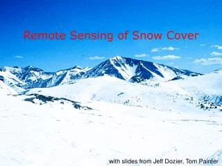
Remote sensing of snow in visible and near-infrared wavelengths Jeff Dozier – UCSBNASA Snow Remote Sensing WorkshopBoulder, August 2013
Visible, near-infrared, and infrared Independent scattering Weak polarization Scalar radiative transfer Penetration near surface only ~0.3 m in blue, few mm in NIR and IR Small dielectric contrast between ice and water Microwave and millimeter wave Extinction per unit volume Polarized signal Vector radiative transfer Large penetration in dry snow, many m Effects of microstructure and stratigraphy Small penetration in wet snow Large dielectric contrast between ice and water Different concepts in different parts of spectrum
Optical properties of ice & water — visible and near-infrared wavelengths (Warren, Applied Optics, 1982) wavelength, m
N=n+ik, Index of refraction (complex) i r dx I0 I
Spectra with 7 MODIS “land” bands (500m resolution, global daily coverage)
Landsat Thematic Mapper (TM, on Landsats 4,5,7) • 30 m spatial resolution • 185 km FOV • 16 day repeat pass • Landsat 8 launched in February 2013
Bands 3 2 1(visible) Bands 5 4 2 (V,nIR,swIR) Landsat snow-cloud discrimination Benefit of shortwave-infrared
MODIS: similar bands, wider swath (2300 km), bigger pixels (500 m), daily coverage
Comparison of MODIS (500m) and Landsat (30m) fSCA 32 scenes with coincident MODIS and Landsat images Average RMSE = 7.8% Range from 2% to 12%