Download

1 / 18
190 likes | 378 Vues
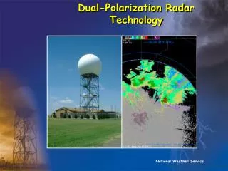
Dual-polarization Radar upgrade. Emergency Manager Workshop Feb 5 2013 Chad Entremont. what will be covered. What is dual-pol ? Why can we see a larger variety of targets ? Benefits of detecting different targets Snow / melting snow /melting layer Hail cores Better heavy rain detection

E N D
Dual-polarizationRadar upgrade Emergency Manager Workshop Feb 5 2013 Chad Entremont
what will be covered • What is dual-pol ? Why can we see a larger variety of targets ? • Benefits of detecting different targets • Snow / melting snow /melting layer • Hail cores • Better heavy rain detection • Tornadic debris detection
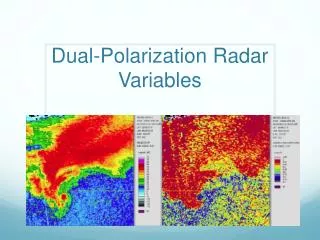
Differential reflectivity (zdr) • Definition:Positive values of ZDR indicate that dominant hydrometeors are larger in the horizontal than in the vertical. Negative values indicate particles are larger in the vertical than the horizontal. Values near zero indicate that hydrometeors are similar in size in the vertical and horizontal. • Uses:ZDR can be used to help identify hail shafts, detect updrafts, determine rain drop size, and identify aggregation of dry snow.
Correlation coefficient (cc) • Definition:Correlation coefficient provides a measure of the consistency of the shapes and sizes of targets within the radar beam. A higher value shows a higher consistency in the size and shape of radar targets, while a lower value indicates greater variability in shapes and sizes. • Uses:CC can be used to help distinguish between meteorological and non-meteorological targets, find the melting layer, identify giant hail, & identify tornadicdebris.
KDP is an indication of an increase in the size and concentration of rain drops, and thus, an increase in rain rate.
Precip estimations • Dual Pol has shown to offer better precip estimates (most of the time) • Issues still exist with inaccurate estimates • Should improve with time
TDS Hard to detect further away from radar
TDS example 0109z • Tornado started • Tight vel couplet 105kts gtg • Nrot 2.0 • Potential for a strong tornado per velocity data • CC data not indicating any TDS yet
TDS example 0114z • TDS! Confirmed Tornado • CC hole, .45 to .55 • A few ZDR values near Zero • KEYS! • Collocated with circ • 45-53 dbz values • Intesevel couplet 160kts gtg !! • Nrot 2.4 • Strong Tor very likely
Training Links http://www.srh.noaa.gov/jan/?n=dualpolupgrade http://www.wdtb.noaa.gov/courses/dualpol/Outreach/index.html