Download
1 / 23
230 likes | 385 Vues
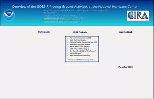
The National Hurricane Center GOES-R Proving Ground . Mark DeMaria NOAA/NESDIS, Fort Collins, CO GLM Science Meeting, Huntsville, AL September 26, 2013. Outline. Overview of the NHC Proving Ground Preliminary results from 2013

E N D
The National Hurricane Center GOES-R Proving Ground Mark DeMaria NOAA/NESDIS, Fort Collins, CO GLM Science Meeting, Huntsville, AL September 26, 2013
Outline • Overview of the NHC Proving Ground • Preliminary results from 2013 • Changes to the lightning-based rapid intensification index for 2013
Goals of NHC PG Experiment • Demonstrate identified GOES-R surrogate products in real-time at NHC during the 2013 hurricane season • Ensure that NHC forecasters can use and get familiar with GOES-R surrogate products • Evaluate products and provide valuable feedback to GOES-R Program Office and developers • Begin evaluation of NPP products
Project Schedule • Apr 24-25, 2013 – New product presentations to NHC • Aug 1, 2013 - NHC PG begins • Sep 17, 2013 – Mid-project review at NHC • Oct 31, 2013 - Mid-project report completed • Nov 30, 2013 – NHC PG ends • Jan 2014 - Project debriefing • Feb 28, 2014 - Final report completed • Mar 2014 - IHC Presentation and 2014 planning
2013 NHC Proving Ground Products(Continued from 2012) • Hurricane Intensity Estimate (HIE) • Super Rapid Scan Imagery • Objective Tropical Overshooting Tops (TOT) • Saharan Air Layer (SAL) Product • Pseudo Natural Color Imagery • GOES-R Natural Color Imagery • Red-Green-Blue (RGB) Air Mass Product • RGB Dust Product • Rapid Intensification Index (RII) with Lightning Data
Local Data Manager (LDM) Feed from SPoRT • Most PG products obtained via SPoRT • wget script at NHC could not be modified due to lack of technical support staff experience • M. DeMaria was acting TSB chief Aug 14-Sep 25 • Permission obtained from NCEP/NCO to open LDM feed to SPoRT • NHC/SPoRT coordination allowed replacement of wget script • New products for NHC now available • Bandwidth analysis showed 30% reduction due to LDM efficiency
2013 NHC Proving Ground Products(New for 2012) • EUMETSAT RGB Day Time Microphysics • EUMETSAT RGB Convective Storms • NPP Day-Night Band GLD360 Lightning Density Product also being added • Now part of N-AWIPS Baseline
The 2013 Hurricane Season as of Sept 23rd Atlantic: 9 TS, 2 hurricanes, 0 major hurricanes East Pacific: 13 TS, 7 hurricanes, 0 major hurricanes Combined Atlantic and East Pacific: Only one cat 2 hurricane 5 RI cases (43 in typical year)
First Half Summary • Very quiet season in both basins • No SRSO cases from GOES-14 • 05/22 12Z GLD360 lightning data used for continuity during GOES-east outage • 06/13 18Z: Dust product used in easterly wave analysis • 07/13 12Z: Lightning flare up during Chantal lowers probability of intensification • 08/16 18Z: Air Mass product suggests dry air will slow the development of TS Erin • 08/29 00Z: TOT product highlights convective bursting in TS Juliette • 09/05 06Z: Lightning burst near center of TS Gabrielle lowers probability of intensification • 09/13 10Z: Higher refresh of HIE provides better scene type estimate for Hurricane Humberto • 09/19 12Z: Suggestion to smooth lightning density product • 09/21 18Z: First Day/Night band image available in N-AWIPS
VIIRS Day-Night Band for Hurricane Manuel (East Pacific) in N-AWIPS
The Rapid Intensification Index • Define RI as 30 kt or greater intensity increase in 24 hr • Find predictors that separate RI and non-RI cases • Linear Discriminant Analysis technique • Use training sample to convert discriminant function value to a probability of RI
Linear Discriminant Analysis • 2 class example • Objectively determine which of two classes a data sample belongs to • Rapid intensifier or non-rapid intensifier • Predictors for each data sample provide input to the classification • Discriminant function (DF) linearly weights the inputs DF = a0 + a1x1 + a2x2 • Weights chosen to maximize separation of the classes
Graphical Interpretation of the Discriminant Function DF chosen to best separate red and blue points
2013 RII Modifications • Previous PG versions included 3 classes • Rapid weakening, typical IC, Rapid Intensification • Two class version used in 2013 • Much higher max probabilities • 95% compared with 60% • Inner and outer lightning regions modified • Old: Inner=0-100 km, Outer=200-300 km • New: Inner=0-200 km, Outer=200-400 km • Inner weakening, Outer intensification • New predictor (GFS Vortex) • New probability table
RII Predictors • Previous 12 h max wind change (persistence) • Maximum Potential Intensity – Current intensity • Oceanic Heat Content • 200-850 hP shear magnitude (0-500 km) • 200 hPa divergence (0-1000 km) • 850-700 hPa relative humidity (200-800 km) • 850 hPa tangential wind (0-500 km) • IR pixels colder than -30oC • Azimuthal standard deviation of IR brightness temperature • Inner region lightning density (0-200 km) • Outer region lightning density (200-400 km)
Lightning RII Text Product Chantal 09 Jul 2013 18 UTC ftp://rammftp.cira.colostate.edu/demaria/NHCPG
Summary • 2013 NHC Satellite Proving Ground underway • Very inactive season in both basins • Main accomplishment so far is new LDM feed • Rapid Intensification Index reformulated • Larger averaging areas • Increases sensitivity to lightning input • Dependent results show significant improvement in skill with lightning data • 2013 RII cases will be verified after the season