Download
1 / 17
170 likes | 280 Vues
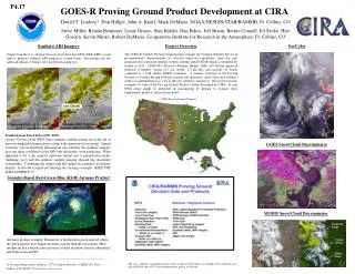
SPoRT GOES-R Proving Ground Activities. GOES-R Risk Reduction Annual Meeting 22 September 2011, Huntsville, Alabama. Geoffrey Stano 1 and Matt Smith 2 1 ENSCO / SPoRT 2 UAHuntsville / SPoRT Huntsville, AL. Webpage: http://weather.msfc.nasa.gov/sport

E N D
SPoRT GOES-R Proving Ground Activities GOES-R Risk Reduction Annual Meeting 22 September 2011, Huntsville, Alabama Geoffrey Stano1 and Matt Smith2 1 ENSCO / SPoRT 2 UAHuntsville / SPoRT Huntsville, AL Webpage: http://weather.msfc.nasa.gov/sport Blog: http://weather.msfc.nasa.gov/sportblog
Short-term Prediction Research and Transition (SPoRT) • SPoRT is focused on transitioning unique NASA observations and research capabilities to the operational weather community to improve short-term weather forecasts on a regional and local scale. • Mainly work with WFOs in Southern Region • SPoRT activities began in 2002, first products to AWIPS in February 2003 • SPoRT Paradigm • Match observations to forecast challenges • Develop and assess solution in “testbed” environment • Transition solution to decision support system • Develop/conduct training, product assessment and impact • Benefit • Demonstrate capability of NASA experimental products to weather applications and societal benefit • Prepares forecasters for use of data from next generation of operational satellites (NPP/JPSS, GOES-R)
Partnered with NOAA / University community • Access to real-time experimental • data / products • NASA instruments data and • model products • Collaborations with NOAA CIs • for GOES-R proxy products • End users • Regular interactions with 20 WFOs • National Centers and “testbeds” • Private sector users • Data / transition / dissemination • Suite of over 30 satellite derived products, analyses, forecast products • Public ftp, Local Data Manager (LDM), http server • AWIPS, NAWIPS, AWIPS2, Google Earth Collaboration National Center Partnerships and End Users Collaborating WFO Partner Regional HQ Real-Time Data Source
GOES-R Products • Pseudo Geostationary Lightning Mapper P-GLM Products • Flash extent density and maximum density products derived from ground-based LMA data (4 networks), AWIPS and AWIPS II • Similar to AWG optical proxy GLM product (not yet available) • GOES-MODIS Hybrid Product • Replicates spatial resolution of selected ABI channels • Derived from MODIS imagery combined with GOES-East 15 minute imagery for animation, AWIPS • 8 WFOs participating in comprehensive evaluation • Convective Initiation Product – obtained from AWG • Reformat and disseminate to SPC/HWT/ Spring Experiment • AWIPS and AWIPS II • ABI Quantitative Precipitation Estimate (QPE) Proxy Product • OCONUS applications • Available late Fall 2011 from Bob Kuligowski (NESDIS)
Red-Green-Blue (RGB) channel composites simulating ABI capabilities – more information than a single channel • Collaboration with CIRA and CIMSS for product development • Generated from MODIS, SEVIRI, GOES Sounder, simulated ABI radiance data • SPoRT disseminates RGB products to NHC, SPC, HPC, OPC, others • Focus on specific products and forecast problems • High-resolution SST Composite • 2-4x daily AMSR-E and MODIS derived SSTs combined contiguous field • No planned proxy AWG product for ABI • AWIPS, GRiB for model ingest, WFOs, SPoRT WRF for SPC/HWT Spring Experiment LFA • Lightning Forecast Algorithm (LFA) • Total lightning forecast product • Based on forecast model microphysics • Aids in GOES-R GLM lightning data assimilation GOES-R Products Future Products
Ongoing Demonstration Activities GOES-MODIS Hybrid to WFOs - assessments RGB products to National Centers for their Proving Ground activities – NHC, OPC, HPC, AWC HWT/SPC /Proving Ground Spring Experiment participation Training – variety training for end users, many in NWS Learning Management System ABI QPE proxy product to Alaska and Pacific Regions – beginning 2012 Transition products to AWIPS II with custom plug-ins for SPoRT products
Integration of SPoRT Data into AWIPS2 • Make all SPoRT products available with operational release of AWIPS2 • Custom plug-ins to display data • Example datasets • Total lightning products • Models products and analyses (WRF, LIS, LFA, ADAS) • SPoRT satellite imagery such as hybrid, SST composites, RGB products, etc. • Proving ground products – PGLM, suite of proxy products
Multispectral Data as “RGB” Imagery Products shown in 95-color NAWIPS • Suite of multispectral channel composites to enhance identify features not readily apparent in single channel imagery • based upon EUMETSAT guidelines for consistency with SEVIRI data • provided to partners in AWIPS and NAWIPS systems • collaborate with CIRA to demonstrate RGB products over CONUS using the GOES Sounder • product available for use in NAWIPS at NHC for Joint Hurricane Testbed activities GOES Sounder “Air Mass” RGB from CIRA SEVIRI Natural Color SEVIRI Air Mass
Spring Experiment: Pseudo-GLM • SPoRT providing the Pseudo Geostationary Lightning Mapper • Mimics future GOES-R GLM • 8-km resolution • Flash extent density product • produced from 4 LMAs • Provided to the Spring Program • Emphasis on total lightning uses • situational awareness and lightning safety • improved warnings • Educate forecasters on GLM • Receive forecaster feedback on best visualization approaches Pseudo GLM for the Kennedy Space Center LDAR Pseudo GLM Flash Extent LMA Source Densities
Lightning Jump Associated with Developing Severe Storm Radar Reflectivity Pseudo GLM
GOES-MODIS Hybrid Product to simulate or serve as “proxy” for GOES- R ABI ABI will have advanced imaging capabilities 16 multispectral channels similar to MODIS Spatial and temporal resolution improvements over GOES Imager While MODIS can be used to replicate spatial and spectral resolution of ABI, the polar orbit limits its temporal resolution Combine MODIS and GOES to simulate GOES-R ABI capabilities
Hybrid Imagery Feedback Results 4/14 to 5/16(8 day break due to loss of power from tornadic events) 30 total survey/ evals, 4 blog posts from 7 WFOs and SMG 2/3 of users providing feedback have high experience/knowledge regarding satellite imagery in operations. IR, SW, WV, and Vis. imagery included in at least 10 assessments each (multiple products can be included in single assessment) 21 said the imagery had some to large impact, while 9 indicated little impact generally a normal distribution with most in the “some” category “expert” users mostly indicated some to little impact in cases examined with occasional high impact, less experienced users had ~equal amount of high and low impact cases 26 indicated that they recommended the product to other forecasters 21 indicated that they zoomed into features vs. using a large-scale view look at mesoscale features vs synoptic
MODIS - AMSR-E Composite SST – ABI SST “Proxy” Composite SST product from multi-day composite of MODIS and AMSR-E 1-2 km resolution, 2-4x a day based on Terra/Aqua Great Lakes product includes GLERL ice mask Available in AWIPS, NAWIPS, KML, GRIB NOAA/GLERL Ice Mask
Spring Experiment Products: Lightning Flash Algorithm (LFA) • LFA is forecast total lightning product • WRF model microphysics proxies • Upward graupel flux at -15°C • Vertically integrated ice • Blend of these two fields • Aids in future GOES-R data assimilation techniques • Incorporated in numerous models • 4-km NSSL WRF runs • 4-km SPoRT WRF runs • Storm Scale Ensemble Forecast System (~40 members) MaxVal=61.33 MaxVal=16.95
Spring Experiment: UAH CI Product • SATellite Convection AnalysiS and Tracking (SATCAST) – Dr. John Mecikalski, John Walker • Depicts clouds likely to initiate convection within 2 hours • Identifies potential convective- form clouds as “objects” • Tracks select cloud objects between consecutive images • Applies 6 spectral/time differencing tests on objects • Provides extended lead-time on CI • SPoRT disseminates AWG product and assists in training