Download
1 / 1
10 likes | 132 Vues
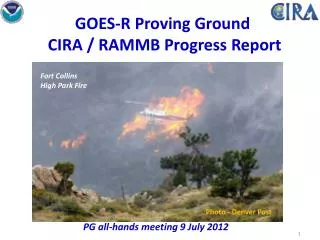
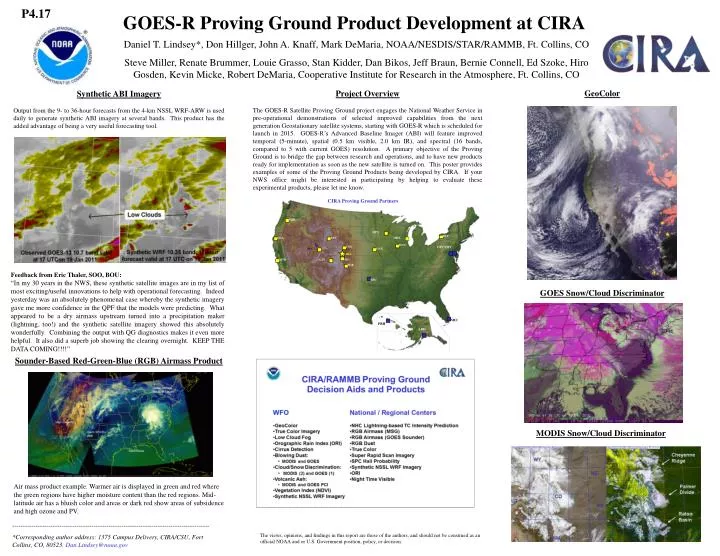
CIRA Proving Ground Partners. P4.17. GOES-R Proving Ground Product Development at CIRA. PQR. MPX. BUF. EKA. RIW. MKX. DVN. Daniel T. Lindsey*, Don Hillger, John A. Knaff, Mark DeMaria, NOAA/NESDIS/STAR/RAMMB, Ft. Collins, CO

E N D
CIRA Proving Ground Partners P4.17 GOES-R Proving Ground Product Development at CIRA PQR MPX BUF EKA RIW MKX DVN Daniel T. Lindsey*, Don Hillger, John A. Knaff, Mark DeMaria, NOAA/NESDIS/STAR/RAMMB, Ft. Collins, CO Steve Miller, Renate Brummer, Louie Grasso, Stan Kidder, Dan Bikos, Jeff Braun, Bernie Connell, Ed Szoke, Hiro Gosden, Kevin Micke, Robert DeMaria, Cooperative Institute for Research in the Atmosphere, Ft. Collins, CO CYS OPC/HPC SLC OAX CIRA BOU MTR GJT PUB SPC GeoColor NHC Project Overview The GOES-R Satellite Proving Ground project engages the National Weather Service in pre-operational demonstrations of selected improved capabilities from the next generation Geostationary satellite systems, starting with GOES-R which is scheduled for launch in 2015. GOES-R’s Advanced Baseline Imager (ABI) will feature improved temporal (5-minute), spatial (0.5 km visible, 2.0 km IR), and spectral (16 bands, compared to 5 with current GOES) resolution. A primary objective of the Proving Ground is to bridge the gap between research and operations, and to have new products ready for implementation as soon as the new satellite is turned on. This poster provides examples of some of the Proving Ground Products being developed by CIRA. If your NWS office might be interested in participating by helping to evaluate these experimental products, please let me know. Synthetic ABI Imagery Output from the 9- to 36-hour forecasts from the 4-km NSSL WRF-ARW is used daily to generate synthetic ABI imagery at several bands. This product has the added advantage of being a very useful forecasting tool. PRH ARH Feedback from Eric Thaler, SOO, BOU: “In my 30 years in the NWS, these synthetic satellite images are in my list of most exciting/useful innovations to help with operational forecasting. Indeed yesterday was an absolutely phenomenal case whereby the synthetic imagery gave me more confidence in the QPF that the models were predicting. What appeared to be a dry airmass upstream turned into a precipitation maker (lightning, too!) and the synthetic satellite imagery showed this absolutely wonderfully. Combining the output with QG diagnostics makes it even more helpful. It also did a superb job showing the clearing overnight. KEEP THE DATA COMING!!!!” GOES Snow/Cloud Discriminator Sounder-Based Red-Green-Blue (RGB) Airmass Product MODIS Snow/Cloud Discriminator Air mass product example. Warmer air is displayed in green and red where the green regions have higher moisture content than the red regions. Mid-latitude air has a bluish color and areas or dark red show areas of subsidence and high ozone and PV. -------------------------------------------------------------------------------------------- *Corresponding author address: 1375 Campus Delivery, CIRA/CSU, Fort Collins, CO, 80523. Dan.Lindsey@noaa.gov The views, opinions, and findings in this report are those of the authors, and should not be construed as an official NOAA and or U.S. Government position, policy, or decision.