Download
1 / 12
120 likes | 314 Vues
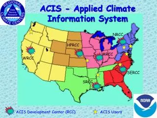
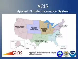
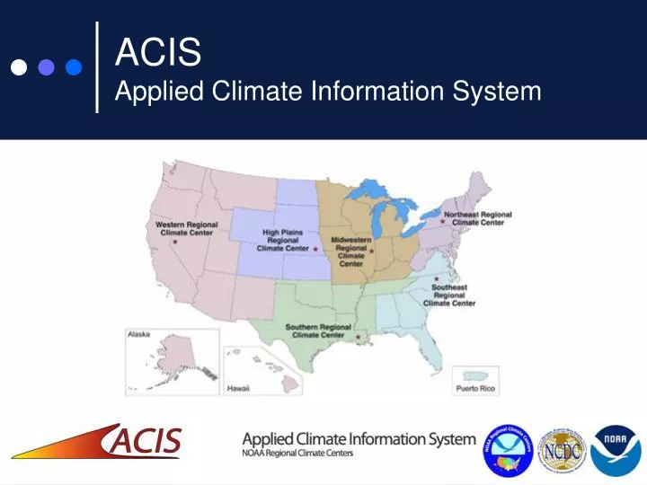
ACIS Applied Climate Information System. System Architecture. Takes advantage of the internet and the latest web tools Distributed/Synchronized data bases Redundancy built in to handle system failures Flexible interface can link to part or all of the ACIS product suite

E N D
System Architecture • Takes advantage of the internet and the latest web tools • Distributed/Synchronized data bases • Redundancy built in to handle system failures • Flexible interface can link to part or all of the ACIS product suite • Object-oriented programming design allows for extension of capabilities
State-of-the-Art Techniques • netCDF Data Structures • PostgreSQL RDBMS (for metadata) • Python and JAVA programming languages • Quixote (web application server) • CORBA compliant network software • Open Source software components
Integrated Data Sources • Time-integrated datasets • Coop-3206, 3200 (final, preliminary, keyed), and NOAAport (SHEF, DSM, local) • 9641 (normals) • 3280 (surface airways) • 3220 (monthly) – planned • Integrated with other data sources • Mesonets: AWDN - Operational • RAWS, SNOTEL, SCAN, USGS, CoCoRaHS - planned • Meta data to support all stations • Resolution of inconsistencies
Quality Assurance Programs • Built on open architecture concept with high speed algorithms • Procedures tuned to site and season • Refined interpolation leads to tighter confidence intervals • Estimates provided but original data retained • Real time data are manually QC’d by RCCs
Mapping Products • Standard and Regional map products • Analyses match at the boundaries • Over 22,000 maps generated and maintained on-line • 38 types of maps updated daily • 14 types of maps for latest month/season • Archive of monthly and seasonal maps • Maps regenerated as high-quality data obtained • SHEF (QC-tool) key entered NCDC prelim NCDC final • http://www.hprcc.unl.edu/maps/current/
Recent ACIS Developments • NCDC includes ACIS maps in reports • Drought Monitor and VegDRI teams use ACIS maps to characterize precipitation • NCDC and USDA provided with ACIS daily data • USDA/JAWF & Delta Research Station provided with XML-RPC clients • NOWData • xmACIS, agACIS, scACIS
ACIS Supported Access • Public Users • Web interface to standard ACIS products • Custom interfaces to selected products • Wholesale Users • Manual or automated scripting via XML-RPC • Access to standard ACIS products • ACIS outputs ‘feed’ local products • Efficient access to recurring products • Product Developer • Programs within ACIS environment • Develops new products to satisfy needs
For more information High Plains Regional Climate Center 713 Hardin Hall 3310 Holdrege Street Lincoln, NE 68583-0997 Phone: (402) 472-6706 Fax: (402) 472-8763 Email: Please use contact form