Download
1 / 55
550 likes | 656 Vues
Project co-PI. Collaborator. CUAHSI Hydrologic Information System. Monday 8:30 to 10 Project Overview 10:30 – noon Project PIs Lunch provided here 1-3 Live HIS demos 3:30 – 5PM Discussion and feedback, User Assessment. Tuesday 8:30 – 10AM Summary of User Assessment

E N D
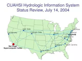
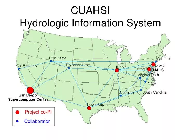
Project co-PI Collaborator CUAHSI Hydrologic Information System
Monday 8:30 to 10 Project Overview 10:30 – noon Project PIs Lunch provided here 1-3 Live HIS demos 3:30 – 5PM Discussion and feedback, User Assessment Tuesday 8:30 – 10AM Summary of User Assessment 10:30 – noon Related programs 1-3 National data sets 3:30 – 5PM Other projects related to HIS Wednesday --Training HydrologicDigital Library Digital Watershed Meeting Agenda
Environmental Cyberinfrastructure • Part of NSF Cyberinfrastructure program • Special emphasis on environmental sciences fostered by Margaret Leinen (Asst Dir for GeoSciences) • CUAHSI Hydrologic Information Systems is one of several pilot projects
Contains documents, datasets, tools, presentations, tutorials More data at ftp sites linked to CD http:// links to project websites at individual universities Link to CD
1. Hydrologic Observations Database Hydrologic System Sampling Sensing Transmission Recording Laboratory Analysis Transmission Recording Editing Storage Off-Site Measurement On-Site Measurement Retrieval
A relational database stored in Access, PostgreSQL, SQL/Server, …. Stores observation data made at points Access data through web interfaces Fill using automated data harvesting Hydrologic Observations Database Streamflow Groundwater levels Precipitation & Climate Soil moisture data Water Quality Flux tower data
Time, T D Space, L Variables, V Data Cube
Data Cube in Arc Hydro Time, TSDateTime TSValue Space, FeatureID Variables, TSTypeID
Value Time Geospatial Time Series Time Series Properties (Type) A Value-Time array A time series that knows what geographic feature it describes and what type of time series it is Shape
ArcIMS Website for hydrologic observational data Neuse basin Thanks to ESRISan Antonio
Output from the ArcIMS website Data open directly in Excel
Database Design Relationships
Begin with a site file showing where data are available Develop automated harvesting tools to ingest observations from agency websites John Helly has done this for the NWIS data Automated Data Harvesting NWIS Surface Water Sites (Ken Lanfear) ACIS Climate Stations (Bill Noon)
Hydrologic Statistics Upmanu Lall is our expert in this area Time Series Analysis D Geostatistics Multivariate analysis How do we understand space-time correlation fields of many variables?
What kind of ecological observation data should we be collecting? What kind of HIS does an aquatic ecologist need? LeRoy Poff is our expert in this area Aquatic Ecology Hydrology Ecology Geomorphology
Some Conclusions • Hydrologic Observations Database design works and is ready for independent review and testing • Automated data harvesting may produce a “one stop shop” for observational data • There will never be enough database fields to describe all we want to know about data • We need a hybrid database—files solution • This is what the San Diego Supercomputer Center is doing for us “Pile of files” Relational database
Sensor Network Interfaces to Digital Library John Helly is our expert in this subject! Example is for wireless network in Santa Margaritawatershed, San Diego
HydroViewer Provides Access to… http://cuahsi.sdsc.edu Neuse Watershed Collection Santa Margarita Watershed Collection + your Hydrologic Observatory Data Collection
CUAHSILink enables ArcMap to read files directly from the Digital Library through an application programming interface
New Concept of Publication Hydrologic Digital Library Normal Method +
Numerical Models Prediction HSPF Sensor Arrays NGDC NWS NCDC USGS NWIS NCEP Air-Q MM5 Individual Samples Data Centers Page 3 The Demands METADATA Drexel University, College of Engineering
Hydrologic Metadata Hydrologic Metadata Semantic WEB Semantic WEB A consistent suite of geographic information schemata that will allow Geographic information to be integrated with information technology. ISO norm 19115. Hydrologic Ontology Definition: The Semantic Web is the representation of data on the World Wide Web. It is based on the Resource Description Framework (RDF), which integrates a variety of applications using XML for syntax and URIs for naming. http://www.w3.org/2001/sw/ www.isotc211.org "The Semantic Web is an extension of the current web in which information is given well-defined meaning, better enabling computers and people to work in cooperation." Page 10 Ontologies for Metadata Profile Prepare the CUAHSI Metadata Profile for the Future! Drexel University, College of Engineering
Upper Hydrologic Ontology Hydrologic ProcessesSedimentation Many More Many More Many More Many More ARCHydro ISO 19115 Geospatial ISO 19108 Temporal Objects ISO 19103 Units/Conversion USGS Hydrologic Unit Code Page 21 More Ontologies We currently have What we need is Michael Piasecki is our expert in this subject! Ontology Examples Drexel University, College of Engineering
2. Hydrologic Representation Hydrologic Observation Data Geospatial Data (GIS) (Relational database or delimited ascii) Digital Watershed Remote Sensing Data Weather and Climate Data (EOS-HDF) (NetCDF)
Hydrologic Data Model Hydrologic Fluxes and Flows Digital Watershed(Atmospheric, surface and subsurface water) We need to represent the physical environment and water flowing through it
Digital Watershed:An implementation of the CUAHSI Hydrologic Data Model for a particular region Created first for the Neuse basin
Neuse Atmospheric Water • Daily precipitation data from NCDC gages • Nexrad daily rainfall rasters • Land surface – atmosphere fluxes from North American Regional Reanalysis of climate
Streamflow, water quality hydrologic observational data GIS: River network, water bodies, watersheds, monitoring points Land cover, soils, MODIS remote sensing (Praveen Kumar) Neuse Surface Water MODIS Terrain and Land Cover
http://neuse.crwr.utexas.edu/ ArcIMS Web Server displaying data compiled in Neuse HO Planning Study
Neuse Basin: Coastal aquifer system Section line Beaufort Aquifer * From USGS, Water Resources Data Report of North Carolina for WY 2002
Neuse Groundwater Geovolumes of hydrogeologic units from US Geological survey (GMS)
Create a 3 dimensional representation Geovolume Each cell in the 2D representation is transformed into a 3D object Geovolume with model cells
HIS-USA • Base map information for building digital watersheds anywhere in the US • Hydrologic Observatory regions • Monitoring site files • National river network connected to HUC watersheds • Hydrologic landscape regions
3.Hydrologic Analysis Statistics and Hypothesis Testing Hydrologic Process Modeling Digital Watershed Visualization Data Mining and Knowledge Discovery
Data Driven Discovery Tools Praveen Kumar is our expert on this subject!
Time, T D Space, L Time Series Analysis Variables, V D Geostatistics Multivariate analysis Data to Knowledge D2K Jan Feb 4-D Data Model Image to Knowledge i2K Data Files
Hydrologic Flux Coupler Hydrologic Fluxes and Flows Digital Watershed(Atmospheric, surface and subsurface water) We want to do water, mass, energy and water balances
HydroVolumes Take a watershed and extrude it vertically into the atmosphere and subsurface A hydrovolume is “a volume in space through which water, energy and mass flow, are stored internally, and transformed”
Watershed Hydrovolumes Hydrovolume Geovolume is the portion of a hydrovolume that contains solid earth materials USGS Gaging stations
Continuous Space Data Model -- NetCDF Time, T Coordinate dimensions {X} D Space, L Variable dimensions {Y} Variables, V
Discrete Space-Time Data Model Time, TSDateTime TSValue Space, FeatureID Variables, TSTypeID
Flux Coupling Table All Hydrofeatures have a unique HydroID Coupling table links all features that have flux and flow data needed for the water balance 9748 9614 9623 9749 Flux and flow data