Download
1 / 34
340 likes | 363 Vues
Thomas.vonDeak@nasa.gov NASA HQ Spectrum Management Office. Passive Remote Sensing: allocations, sensors, measurements and applications. REMOTE SENSING WORKSHOP Geneva, Switzerland 11 December 2007. Passive Sensing. Radio Regulation No. 1.183 (definition)

E N D
Thomas.vonDeak@nasa.gov NASA HQ Spectrum Management Office Passive Remote Sensing: allocations, sensors, measurements and applications REMOTE SENSING WORKSHOP Geneva, Switzerland 11 December 2007
Passive Sensing • Radio Regulation No. 1.183 (definition) • Passive Sensor: A measuring instrument in the earth exploration-satellite service or in the space research service by means of which information is obtained by reception of radio waves of natural origin. Radio waves of natural origin are emissions from the ground, air, and water. All objects emit radio waves and the emissions convey information about those objects.
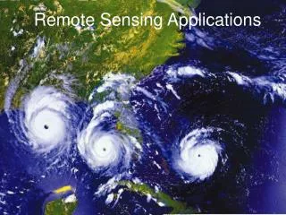
The complete remote sensing system addresses societal concerns
Use of the Passive Bands • Passive sensors are designed to receive and measure natural emissions produced by the Earth’s surface and its atmosphere. The frequency and strength of these natural emissions characterize the type and status of many important geophysical, which describe the status of the Earth/Atmosphere/Oceans System: • Earth surface parameters such as soil moisture, sea surface temperature, ice extension and age, snow cover, rainfall over land, etc ... ; • Three-dimensional atmospheric parameters(low, medium, and upper atmosphere) such as wind circulation, temperature profiles, water vapour content and concentration profiles of radiatively and chemically important trace gazes (for instance O3, SO2 and ClO).
Use of the Passive Bands • Microwave observations at frequencies below 100 GHz enable studies of the Earth’s surface and its atmosphere from spaceborne instruments even in the presence of clouds, because clouds are almost transparent at these frequencies. This "all-weather" observing capability has been very important for EESS in achieving the repetitive global coverage mandatory for meteorological, climatological, and environmental monitoring and surveying. • The impressive progress made in recent years in weather analysis, warning and forecasts, especially for dangerous weather phenomena that affect all populations and economies is largely attributable to the spaceborne observations and their assimilation in numerical models. • Play a major role in the prediction and detection of disasters.
Use of the Passive Bands Typical bands and their main application: 1400-1427 MHz: salinity (ocean), soil moisture (ground) 10.6-10.7 MHz: rain, snow, ice, sea state, ocean wind 23.6-24 GHz: total content of water vapour 31.3-31.5 GHz: the lowest cumulated effects due to oxygen and water vapour in the vicinity of the 50 GHz band. Optimum window channel to see the Earth’s surface: reference for the other channels. 36-37 GHz: cloud liquid water, vegetation structure, surface roughness 50.2-50.4 GHz: temperature profile
Sensitivity of Brightness Temperature to Geophysical Parameters over Land Surface
Microwave and Millimeter-wave SpectrumSpectral Sensitivity to Environmental Parameters: Ocean Scene
Aqua Instruments – AMSR-E • Advanced Microwave Scanning Radiometer for EOS • 12-Channels, 6 frequencies 6.9-89.0 GHz • dual-polarization • 5.4-56 km footprint at nadir • All weather
AMSR-E Products • Precipitation Rate • Cloud Water • Surface wind speed over oceans • Sea Surface Temperature • Ice, Snow and Soil Moisture
Aqua Instruments – AMSU/A • Advanced Microwave Sounding Unit • 15 Microwave Channels 15-90 GHz • ~40 km footprint at nadir • All-Weather
Global composite of brightness temperature (K) From AMSU-A Channel 3
Radiation Measurements to Vertical Soundings • AIRS and AMSU data combined to create vertical soundings of temperature and humidity • Air and/or water vapor at various heights (pressures) contribute to the total radiation measurement viewed from space. • The contribution peaks at different pressures for different wavelengths
Microwave Imagery and Sounding products improve prediction of precipitation, surface wind speed and direction Increase in hurricane landfall forecast skill saves an estimated $1 million per mile of coastline that does not have to be evacuated Improved observations yield improved early warnings, which in turn mitigate the devastating effects of floods through disaster planning and response Improve Accuracy of Severe Weather Warnings
Disaster Management Data EARTH SYSTEM MODELS • Earthquake: MMI, Quakesim • Hurricane: HURRSIM • Flood: SLOSH, WAVEwatch, STWAVE, HURSURGE • Land: GPS Network, SBEACH • Building Cost Models: ATC-13 • Building Structure Models: EPEDAT Predictions DECISION SUPPORT TOOLS • HAZUS-MH (Hazards U.S. - Multi Hazard) • Earthquake prediction • Floods • Hurricane & Typhoons • Land Surface Topography • Global Precipitation • Ocean Surface Winds • Surface Deformation • Motions of the Earth’s Interior VALUE & BENEFITS • Disaster Recovery/ Mitigation • Land use decision • Potential economic loss • Estimation of direct damage, induced damage, direct losses, and indirect losses • Accurate risk prediction to communities • Loss estimates of buildings, essential facilities, transportation & utility lifelines, and population • Social impacts • Identify/ Prioritize high-risk communities • Reduction in lives lost • Reduction in damage cost • Anticipate the scope of disaster-related damage • Improve disaster response • Community Planning *Supported Non-NASA Model EARTH OBSERVATORIES • Land: Landsat, SRTM, GPS, SCIGN, Terra, Aqua • Ocean: QuickSCAT, Seawinds, IceSAT, GOES, POES, SSMI, JASON, TOPEX/POSEIDON • Atmosphere: TRMM, GOES, POES, GPM, NPP, NPOESS Observations *Future Mission
Disaster Related Remote Sensing Applications Weather Prediction: a key input to numerical weather prediction models used globally for weather forecasting. (Microwave(passive)) Global Warming: concentrations and distributions of atmospheric gases, sea and land ice thickness and change, and ozone measurements are key components to studying and prediction of global warming. (Microwave(passive), Infrared) Severe Weather Events: the prediction of severe weather events requires accurate measurements of rain rates in storms over the oceans which is only possible with remote sensing satellites. (Microwave(passive)) Forest Fires: detection of fires through smoke by their microwave radiation. (Infrared)
Key Applications (continued) Management of Natural Resources: measurements of biomass, deforestation, and water resources through systematic environmental monitoring. (Microwave (passive), Infrared, Optical) Volcanoes: used to detect volcanic activity even before eruptions and to track and predict the volcanic fallout effects. (Optical, Microwave (active), Infrared, SubM) Shipping: used to track sea ice, ice floes, and ocean storms to steer ships out of harm’s way. (Optical, MW(active)) Long Range Climate Forecasts: study of global atmospheric and oceanic events such as El Niño requires sea surface temperature, ocean winds, ocean wave height, and many other components used in the prediction of long range weather forecasting and climatic trends. (Microwave (active/passive))
Remote Sensing Report • ITU-D SG 2 Question 22/2“Utilization of ICT for disaster management, resources, and active and passive space-based sensing systems as they apply to disaster and emergency relief situations” • Work Item 2: Identification and examination of active and passive sensing system applications for their potential effect in enhancing disaster mitigation. Version 1 of the Report is complete and available upon request from the presenter.
THANK YOU! Thomas vonDeak NASA HQ Spectrum Management Office (VIEWS EXPRESSED ARE THOSE OF THE PRESENTER AND DO NOT NECESSARILY REFLECT THOSE OF NASA.)
Capabilities of Space-Based Sensing Societal Benefit Three: Understanding … climate variability and change.
Capabilities of Space-Based Sensing Societal Benefit Eight: Improving… terrestrial, coastal, and marine ecosystems..
Capabilities of Space-Based Sensing Societal Benefit Eight: Improving… terrestrial, coastal, and marine ecosystems..
Capabilities of Space-Based Sensing Societal Benefit Three: Understanding … climate variability and change.
Capabilities of Space-Based Sensing Societal Benefit One: Reducing loss of life and property … from disasters.. Prediction
Capabilities of Space-Based Sensing Societal Benefit One: Reducing loss of life and property … from disasters.. Prediction
Capabilities of Space-Based Sensing Societal Benefit One: Reducing loss of life and property … from disasters.. Prediction, Disaster Event Assessment, Monitoring