Download
1 / 20
200 likes | 357 Vues
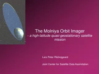
HIGH-LATITUDE WINDS FROM MOLNIYA ORBIT a mission concept for NASA’s Earth System Science Pathfinder Program. Lars Peter Riishojgaard Global Modeling and Assimilation Office/ Goddard Earth Science and Technology Center. Mission overview.

E N D
HIGH-LATITUDE WINDS FROM MOLNIYA ORBITa mission concept for NASA’s Earth System Science Pathfinder Program Lars Peter Riishojgaard Global Modeling and Assimilation Office/ Goddard Earth Science and Technology Center
Mission overview • Fly a geostationary-class atmospheric imager in a Molniya orbit • Aim is to demonstrate capability of time-continuous coverage of atmospheric imagery and winds for all of the northern hemisphere (“GOES to the pole!”) • Scientific heritage provided in part by GOES/Meteosat, in part by the MODIS winds • Mission can help fill the “water vapor gap” between MODIS and NPOESS (VIIRS FM4) • Potential for a substantial future upgrade to the GOS • Proposal being developed by the Goddard Space Flight Center for NASA’s Earth System Science Pathfinder program Molniya Orbit Imager, Multitemp 2005, Biloxi MS, 05/17/2005
Primary science application: High-latitude winds • Known shortage of high-latitude wind observations • Mid-latitude forecast busts often have high-latitude origins • (Winds from MODIS shown to have positive impact especially on sub-par forecasts) Molniya Orbit Imager, Multitemp 2005, Biloxi MS, 05/17/2005
Status of satellite wind observations • No operational satellite winds beyond 55-60 deg latitude • Polar winds from MODIS (until 2008) • Data latency is problematic; 4 to 6 hours after real time • Image refresh problematic; 15 minutes is optimal, MODIS: ~100 minutes • No water vapor channel on VIIRS (until at least 2015) • Latitudinal coverage gap between MODIS and GEO winds • => Need for “geostationary-type” imagery over high-latitude regions; Molniya Orbit Imager is a good candidate Molniya Orbit Imager, Multitemp 2005, Biloxi MS, 05/17/2005
Molniya orbit characteristics • Highly eccentric Kepler orbit • Apogee height 39750 km (geostationary orbit height ~36000 km) • Perigee height ~600 km • Inclination 63.4 degrees • Orbital period ~11h 58m (half a sidereal day) • Location of apogee w.r.t. Earth is fixed and stable! • Platform in quasi-stationary imaging position near the apogee for about two thirds of the duration of the orbit • Used extensively by USSR (to a lesser degree by the US) for communications purposes • First suggested for meteorological applications by Kidder and Vonder Haar (1990) Molniya Orbit Imager, Multitemp 2005, Biloxi MS, 05/17/2005
Example orbit (Molniya 3-53); all areas N of solid line visible from western cusp Molniya Orbit Imager, Multitemp 2005, Biloxi MS, 05/17/2005
Additional applications for Molniya imagery • Nowcasting for aviation, shipping, fishery, exploration users • Volcanic ash monitoring (aviation safety) • Polar lows and other intense/rapid weather systems • Nowcasting/forecasting • Development and life cycle • Global change • Arctic is a sensitive region and an early indicator of e.g. climate change • Sea ice extent and monitoring • … possibly others (Multi Temp 2005 ?) Molniya Orbit Imager, Multitemp 2005, Biloxi MS, 05/17/2005
High-level mission requirements • High temporal (15 minutes) and spatial (1 km VIS, 2 km IR) resolution imagery for all regions of the northern hemisphere for multitemporal applications and derived products • a spacecraft in Molniya orbit is the most efficient single-satellite complement to the geostationary systems to achieve this goal • Full-disc view every 15 minutes within 60% of apogee • Special events rapid-scan capability: 1000 x 1000 km in one minute • Nominal 3-year mission duration (goal is 5 years: 2010-2015) • Nominal end of life for MODIS is 2008; no water water channel on VIIRS until 2015 (earliest possible date); 2010 launch strongly desirable • Real-time “operational” dissemination of images and derived products Molniya Orbit Imager, Multitemp 2005, Biloxi MS, 05/17/2005
Mission implementation studies • Overall mission design based on series of concurrent engineering studies by the Integrated Design Capability at Goddard • Key IDC results: • Mission is technically feasible and classified as “low risk” • Total costs of three-year mission: $212M • Space segment • Instrument vendor selected • RFI for spacecraft issued on 04/22 through by the Rapid Spacecraft Development Office at Goddard • Ground segment • NESDIS is helping to draft plans for data processing chain and has indicated possibility of ground support (Fairbanks station) • Finland has indicated possibility of ground support (Sodankyla station; data processing) Molniya Orbit Imager, Multitemp 2005, Biloxi MS, 05/17/2005
Instrument • Raytheon selected as partner for baseline ESSP mission • Design draws heavily on JAMI, a geostationary imager launched in February 2005 on the Japanese MTSAT-1R satellite • Main differences are: • Scan mode (software change) • Data processing (software change) • Channels (new filters, different operating mode) • Radiation environment (minimal impact) • Flight heritage (low risk) • Performance meets requirements in almost all areas Molniya Orbit Imager, Multitemp 2005, Biloxi MS, 05/17/2005
Molniya Orbit Imager(deployed configuration; Goddard IMDC) S/C Buss Ø1.0m x 2.25m 65 kg propulsion Solar Array 4.0 m² shown 2.98m² required Dual axis drive Y Instrument ACE box X Dual Axis Comm antenna Ø0.5m Active cooler Instrument Package Instrument Thermal radiator Dewar Z
Science Team • Lars Peter Riishojgaard, UMBC, PI • Bob Atlas, GSFC, Simulation/impact experiments • Dennis Chesters, GSFC, Instrumentation, mission • Ken Holmlund, EUMETSAT, Algorithm development • Jeff Key, NESDIS/ORA, Data processing • Stan Kidder, CIRA, High-latitude applications • Paul Menzel, NESDIS/ORA, Cloud applications • Jean-Noël Thépaut, ECMWF, Global NWP applications • Chris Velden, CIMSS/UW, Algorithm development • Tom Vonder Haar, CIRA, Satellite meteorology Molniya Orbit Imager, Multitemp 2005, Biloxi MS, 05/17/2005
Summary • Molniya Orbit Imager to be proposed to NASA as a pathfinder for high temporal and spatial resolution imagery for regions beyond reach of the geostationary sensors • Numerous applications, both scientific and operational • Primary initial thrust is numerical weather prediction; many other fields in Earth Science can benefit • Data from this mission are directly applicable to 6 of the 9 (and indirectly to all 9) GEOSS Societal Benefits areas • The mission concept is steadily maturing; there is still time to influence this • The mission is a prime candidate for national (e.g. NOAA, DoD) and international (e.g. ESA, EUMETSAT, NWS) collaboration Molniya Orbit Imager, Multitemp 2005, Biloxi MS, 05/17/2005