Download
1 / 63
670 likes | 1.15k Vues
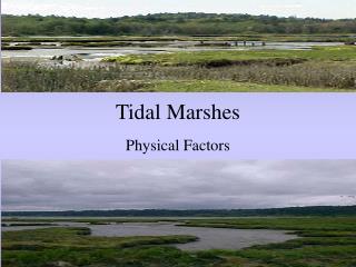
Tidal Marshes. Physical Factors. Presented By:. Maureen Harding Jennifer Arp. Introduction.

E N D
Tidal Marshes Physical Factors
Presented By: • Maureen Harding • Jennifer Arp
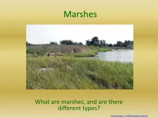
Introduction • Salt marshes are transitional areas between land and water, occurring along the intertidal shore of estuaries and sounds where salinity ranges from near ocean strength to near fresh in upriver marshes • Marshes are subject to rapid changes in salinity, temperature and water depth • Physical characteristics of marshes include: • Development • Effects of salinity • Effects of tides • Nutrients
Basic Definition • Wetlands are partially or periodically submerged lands • Tidal marshes are predominantly intertidal and have a gentle slope that allows for tidal flooding • Tidal salt marshes are found along protected coastlines • Plants and animals must adapt to stresses of salinity, periodic flooding and extremes in temperature
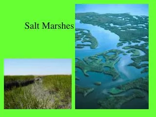
Distribution • Salt marshes are most frequent in the temperate zones and are replaced by mangroves in the tropics • Most prevalent in the United States along the Eastern Coast from Maine to Florida and in the Gulf of Mexico in Louisiana and Texas
Tidal Marsh Development • Sediment builds up on a sheltered shore to above the highest high tide level. Build up of vegetation aids in continued sedimentation. As the level rises the area becomes fully vegetated with the exception of drainage channels (creeks) and isolated depressions (pans) • The rate of formation is determined by the effectiveness of the protecting coastal feature
Development • There are two broad classifications for development: • Formed from reworked marine sediments on marine-dominated coasts • North American Coastline • Formed in deltaic areas where the main source of sediment is riverine • South Atlantic and Gulf of Mexico
Marine-Dominated Development • There must be shelter to prevent erosion from wave action and to permit the build up of sediment. • Protection can come from spits, offshore bars or islands • Formation from protected bays • Chesapeake Bay
River Dominated Marsh Development • Major rivers carrying large sediment loads build marshes into shallow estuaries or out onto the shallow continental shelf where there is little wave action • Typically begin as freshwater marshes, but as the river course shifts, more ocean water comes in • Mississippi River Delta
Types of Salt Marshes • Most types of salt marshes must have a physical feature providing protection against the full energy of waves • Lagoonal marshes may occur where a spit partially encloses a body of tidal water with only a narrow connection to the sea • Beach plains are either partially protected by bars that are overwashed at high water or they are unprotected-usually narrow
Types of Salt Marshes • Chesapeake Bay • Lagoonal marsh in North Carolina
Types of Salt Marsh • Barrier island marshes occur where a chain of islands provides an offshore barrier, creating calmer waters on the landward side. • Estuarine marshes form on sheltered inner curves of estuaries or may have no physical barrier-shallowness of estuaries results in the reduction of wave energy • Semi-natural marshes have been significantly and deliberately modified by man • Artificial marshes are created by man
Stability of Marshes • The long-term stability of marshes is determined by the rates of two processes: • Sediment accretion on the marsh, which causes it to grow upward and expand outward • Coastal submergence caused by rising sea level and marsh surface subsidence
Physical and Chemical Variables • Important physical and chemical variables that determine the structure and function of the salt marsh include: • Salinity of water and soil • Tidal flooding frequency and duration • Nutrient limitation
Salinity • Salinity in the marsh soil and water depend on several factors: • Frequency of tidal inundation • Rainfall • Tidal creeks and drainage slopes • Soil texture • Vegetation • Depth to water table • Fresh water inflow • Fossil salt deposits
Salinity • Frequency of tidal inundation-the lower salt marshes retain a consistent salinity close to that of sea water • Rainfall-high rainfall tends to lower salinity while periods of drought will increase salinity because of evaporation • Tidal creeks and drainage slopes-lower salinity because they allow saline water to drain
Salinity • Soil texture-silt and clay soils reduce drainage rates and retain more salt than clay soils • Vegetation-evaporation is reduced by vegetation and transpiration is increased • Depth to water table-when groundwater is close to the surface, salinity is lower and more stable • Fresh water inflow-reduces salinity • Fossil salt deposits-increase salinity in the root zone
Salinity Distribution • Salt wedge • Partially mixed • Mixed, or vertically homogenous
Salinity of Soil • In the lower marsh, the soil salinity is relatively constant and rarely exceeds that of the flooding water • In the upper marsh, there is more of an influence from flooding and the climate • High rainfall will reduce soil salinity • During dry periods, evaporation increases soil salinity • Sometimes to the point that a salt crust will form
Water • Water in tidal marshes is often brackish • Influence of fresh water from rivers and creeks and salt water from ocean • Water table is near or above the soil surface • Influenced by ebb and flow of tides • Little or no wave action
Tidal Range • Horizontal width depends on • tidal amplitude, slope of the shore and fresh water • Lower limit depends on • depth and the duration of flooding • mechanical effects of waves, sediment availability and erosional forces • Upland side extends to the limit of flooding on extreme tides
Influence of Tides • The environmental feature which distinguishes coastal salt marshes from terrestrial habitats is tidal submergence • Tides control • soil salinity • degree of water logging • carry sediment into the marshes
Zonation • Salinity of water and soil determines zonation of plants • Often divided into two zones: • Upper marsh (high marsh)-flooded irregularly • At least 10 days continuous exposure • Lower marsh (intertidal marsh)-flooded almost daily • No more than 9 days continuous exposure
Physical Features • Network of drainage creeks • Small pools or salt pans, mud barren • Small cliffs or ridges • Gentle slope
Tidal Creeks • Tidal creeks serve as • passageways for material and energy transfer between the marsh and its adjacent body of water • Salinity similar to adjacent estuary or bay • Depth varies with tide fluctuations • Flow in the channels is bi-directional • As marshes mature and sediment deposition increases elevation, tidal creeks tend to fill in
Pans • Pans are bare, exposed or water-filled depressions in the marsh • Sand barrens/Salt Pan-upper marsh • Form where evaporation concentrates salts in the substrate, killing the rooted vegetation • Mud barrens/Mud Flat-lower marsh • Tend to have standing water and high salinity
Types of Sediment • Typically sandy sediments, though others may include: • Muddy sand • Soft clay or silty mud • Firm clayey soils
Sedimentation • Sedimentation-natural filtration system • Adds organic and nutrient-rich matter to the marsh system • Sediments originate from • upland runoff • marine reworking the coastal shelf sediments • organic production within the marsh itself
Sediment: How it works • Water floods over a marsh • slows down to zero velocity • suspended particles fall out onto marsh surface • Tidal creek rises and overflows its banks • coarser grained sediments drop near the stream edge, creating a slightly elevated streamside levee • finer sediments drop out farther away from the creek
Anaerobic Soil • When water fills in pore spaces in soils, rate at which oxygen can diffuse through the soil is reduced • It is estimated that the diffusion of oxygen is 10,000 slower in flooded soil than in an aqueous solution
Anaerobic Soil • Surface –thin layer oxygenated soil • Lower layers-have decreased oxygen levels • prevents plants from carrying out normal aerobic root respiration • as the oxygen concentration declines, the carbon dioxide concentration increases • Peat formed • anaerobic conditions • high biomass-becomes trapped • does not completely decompose • compacted into peat
Nutrients Saturation of soil from the water table causes oxidized to reduced chemical gradients (e.g. sulfate to sulfide) with depth • If soil does not have adequate oxygen, bacteria will use other electron acceptors for oxidation, which causes substances to be converted to a reduced state Excessive nutrients accelerate the process of eutrophication
Nutrients • Nitrogen is often the limiting factor of growth of vegetation • The near anaerobic conditions of the marsh soil prevent the buildup of nitrate • Ammonium nitrogen is the primary form available
Nutrients • Phosphorus accumulates in high concentrations and does not appear to limit growth • Iron is also available in high concentrations