SEVERE WEATHER
SEVERE WEATHER. Cloud classification. High clouds (above 6km). Cirrocumulus clouds – puffy, high clouds. Cirrus – thin, wispy. Cirrostratus – cover the sky. Can give us solar and lunar halos. Halo around the sun through a cirrostratus cloud. Mid-level clouds (1.8 to 6 km)

SEVERE WEATHER
E N D
Presentation Transcript
Cloud classification High clouds (above 6km) Cirrocumulus clouds – puffy, high clouds Cirrus – thin, wispy Cirrostratus – cover the sky. Can give us solar and lunar halos.
Mid-level clouds (1.8 to 6 km) Have prefix alto- No halo Altocumulus clouds Altostratusclouds
Low-level clouds (ground level to 1.8km) Stratus clouds – low to ground, blanket-like Nimbostratus – low clouds that accompany precipitation Stratocumulus – low puffy clouds
Clouds with vertical development Cumulus clouds Cumulonimbus clouds - thunderstorms
Unusual cloud shapes Lenticular altocumulus Mammatus clouds
Fog – Moist air is cooled and condenses. Advection fog – moist air moves over a cool surface. Radiation fog – radiative heat loss cools the ground. Nearby air is cooled, leading to condensation. Morning fog is often radiation fog.
Steam fog – occurs on cold days when a body of water is warmer than the air.
Fig. 12.6 Billion-dollar climate and weather disasters, 1980-2005
Fig. 12.8 DROUGHT Stratford, TX in 1935
Fig. 12.7 Hot, dry conditions caused by high pressure ridge
Fig. 12.9 Drought map of the United States in 1934 – DUST BOWL
Fig. 12.10 HEAT WAVE Temps in Chicago, July 1995
Fig. 12.11 Blue areas cooler than usual 10°C hotter than July 2001 European heat wave, July 2003
Fig. 12.12 Mid-latitude cyclones
Fig. 12.15 BLIZZARDS AND ICE STORMS
Freezing rain – occurs when water freezes as soon as it touches an object rather than in the air
Fig. 12.19 THUNDERSTORMS
Fig. 12.18 Warm, buoyant air mass is rising
Fig. 12.20 Early stage of thunderstorm growth. Updrafts creating tall, moisture-rich clouds
Fig. 12.21 A mature thunderstorm Downdrafts creating wind and heavy rain.
Table 12.7 DERECHO – widespread, powerful straight-line winds. Can be as damaging as a small tornado.
Fig. 12.22 Number of days with thunderstorms per year
Fig. 12.23 Localized areas of high rainfall, central TX
Fig. 12.27 Number of lightning deaths, 1959-2004
Fig. 12.28 Number of lightning deaths by month 1959-1980
Lightning isdeadly! • Lightning Safety • Take shelter inside a building. • Do not use a land-line phone or electrical equipment like computers, etc. • Stay away as much as possible from anything that has pipes (sinks, bathtubs, showers, toilets). • DO NOT take shelter under a tree or the overhang of a tall building. Go inside. • If you’re on a lake, get to shore and find shelter immediately.
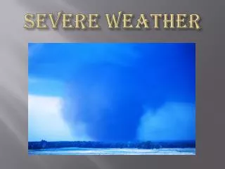
Fig. 12.32 TORNADOES Tornado near Dimmitt, TX 1995

