Severe Weather
Severe Weather. ATS 351 Lecture 10 November 9, 2009. Types of Severe Weather. Thunderstorms Hail Lightning Flood Tornado Severe Wind (Straight-Line Winds) . Thunderstorm Distribution. Favorable Conditions. Instability Fuel Initial Lift Shear Capping Inversion. Instability.

Severe Weather
E N D
Presentation Transcript
Severe Weather ATS 351 Lecture 10 November 9, 2009
Types of Severe Weather • Thunderstorms • Hail • Lightning • Flood • Tornado • Severe Wind (Straight-Line Winds)
Favorable Conditions • Instability • Fuel • Initial Lift • Shear • Capping Inversion
Instability • Steep lapse rate • Means warm, moist air near the surface • Colder air above it • Needs to be calculated from a sounding
Fuel • Just like any other weather phenomenon, a storm needs fuel to sustain itself • The fuel for a storm is just a continued supply of what started it • - Heat • - Moisture • - Lift • The storm needs to remain in areas of warm, moist air. If storm moves into a colder region, it will die
Sources of Lift • Convective lifting • Boundaries • Fronts • Drylines • Outflow boundaries • Orographic • Convergence
Shear • Because of the way a thunderstorm works, it needs to be tilted to remain strong • Therefore, winds need to change with height • Two kinds of shear • Speed Shear: Wind is faster as you go up • Directional Shear: Wind changes direction with height
Capping Inversion • If the atmosphere is unstable all the way up, you get a constant updraft • It is more effective when the energy is held back and released all at once • This can happen by having a stable layer near the surface that suppresses convection • As ground heats during the day, energy builds up until it can “break the cap” • Also referred to as a “capping inversion” • CIN
Back to the Skew-T • Meteorologists have formulated various numbers that can tell how favorable the weather is for a storm. These quantities can describe things such as: • Instability • Shear • Or a combination of both • CAPE (Convective Available Potential Energy • How unstable atmosphere is • LI (Lifted Index; normally at 500mb levle) • LI = Tenvironment – Tparcel
Thunderstorm Development • Stages • Cumulus • Mature • Dissipation
Cumulus Stage • Warm moist air rises, condenses • Latent heat release keeps air in cloud warmer than environment • Grows to a towering Cu • Cloud particles grow larger, begin to fall • No precipitation at surface
Mature Stage • Marked by appearance of downdraft • Falling cloud drops evaporate, cooling the air • Storm is most intense during this stage • Cloud begins to form anvil • May have an overshooting top • Lightning and thunder may be present • Gust front forms • Downdraft reaches the surface and spreads out in all directions • Gust front forces more warm, humid air into the storm
Dissipation Stage • Usually follows mature stage by ~15-30 min • Gust front moves out away from the storm, and moist air is no longer lifted into the storm. • Downdrafts become dominant • Low level cloud drops can evaporate rapidly, leaving only the anvil as evidence of the storm’s existence
Types of Thunderstorms • Thunderstorms come in many varieties • Likelihood of severity proportional to storm lifetime • NWS definition of severe (one or more of the following elements) • ¾” or larger diameter hail • 50 kt (58 mph) or greater winds • tornadoes
Single Cell Thunderstorms • Also referred to as ordinary, • pulse, or air mass thunderstorms • Typically do not produce severe weather • Three stages • Cumulus • Mature • Dissipating • Life span: ~45-60 min.
Multi-Cell Storms • Cluster of storms moving as a single unit • Stronger wind shear than the ordinary • cell case • More organized multi-cells • Bow Echoes • Squall Lines • New cells tend to form on the upwind • (W or SW) edge of the cluster, with mature cells located at center and dissipating cells found along the downwind (E or NE) portion of the cluster • Multiple cells compete for warm, moist low-level air so not incredibly strong and have short life spans
Multi-cell Storms • Cell 1 dissipates while cell 2 matures and becomes dominant • Cell 2 drops heaviest precipitation as cell 3 strengthens • Severe multicell storms typically produce a brief period of hail and/or downbursts during and immediately after the strongest updraft stage
Updrafts and Downdrafts • Degree of instability and moisture determine the strengths of updrafts and downdrafts
Vertical Wind Shear • Change of wind speed and/or direction with height • Weak vertical wind shear: short-lived since rainy downdraft quickly undercuts and chokes off the updraft • Sheared environments are associated with organized convection
Gust fronts • An area of high pressure created at the surface by cold heavy pool of air from downdraft called a mesohigh • Gust front: leading edge of cold air from downdraft • Passage noted by calm winds followed by gusty winds and a temperature drop then precipitation • Convergence region between cold outflow and warm, moist inflow • Can generate new cells • Leads to multi-cell storms • Production of shelf and roll clouds
Mesoscale Convective Systems (MCS’s) • Individual storms can grow and organize into a large convective system (weak upper level winds) • Definition: 100km contiguous group of t-storms • Range of lifetimes • New storms grow as older ones dissipate (reinvigorates itself) • Provide widespread precipitation • Can spawn severe weather • Hail, high winds, flash floods, tornadoes • Formation (in U.S.) • Usually during summer when a cold front stalls beneath an upper level ridge of high pressure • Surface heating and moisture can generate thunderstorms on the cool side of the front
Squall Lines • Multicell storms can form as a line of storms extending for hundreds of km, called a squall line • Squall lines often form along or just ahead of a cold frontal boundary (called pre-frontal squall lines) • Supercells may be embedded within prefrontal squall lines • Leading line of thunderstorms may be followed by large region of stratiform precipitation where the anvil cloud trails behind the main storm.
Bow Echoes • Bow Echo – a bowed convective line (25 – 150 km long) with a cyclonic circulation at the northern end and an anticyclonic circulation at the southern end • Strong jet in from behind • Can produce long swaths of damaging winds • Form in conditions of large instability and strong low level shear • Observed both as isolated convective systems or as substructures within much larger convective systems (such as a squall line) • May contain strong winds or tornadoes
Supercells • Characterized by rotating updrafts (called a mesocyclone) • Differ from multicell cluster because of rotation and that updraft elements merge into a main rotated updraft rather than developing separate and competing cells • Can persist for 12 hours and travel hundreds of miles • Forms in environments of strong winds aloft • Winds veer with height from the surface • Can be classified as either High Precipitation (HP) or Low Precipitation (LP)
Hail • Storms contain updraft and downdraft • Not same strength everywhere • Hail that swept upwards in a region of lesser updraft • Begins to fall, can fall into stronger updraft • Cycling may occur • Important contributors to creating charged regions in clouds
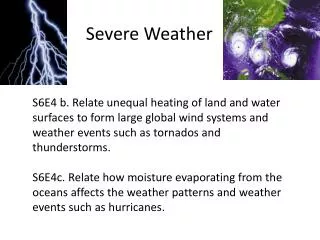
Lightning • Inside a cloud, updrafts and turbulence toss ice particles around • Each collision creates a small amount of electric charge • After a few million of those, the charge is too much to be held back by the air • Discharges all at once in a flash of lightning
Lightning • The temperature of lightning is roughly 30,000 degrees C • The surface of the sun is only about 5700 degrees C • One bolt of lightning carries enough electricity to power the entire United States for 0.1 seconds • Lightning has been known to strike up to 15 miles from the actual storm
Lightning Misconceptions • Lightning comes down from the clouds • It actually comes down AND goes up. • As a bolt begins the trip down, a “streamer” from the ground shoots upward toward the oppositely charged cloud. • The flash happens when they meet in the middle. • Entire process happens in under 0.001 seconds • Lightning always hits the tallest object • Not true. It may seem that way, but lightning simply takes the “path of least resistance”. • If you conduct electricity better than the 30 ft. tall tree next to you, you will get hit • Lightning never hits the same place twice • That’s just wrong. • There are many documented cases of lightning hitting twice in the same spot • Sometimes only a few seconds apart!
Thunder • If air is heated from 75 to 90 degrees, it will expand • If air is heated from 75 to 50,000 degrees, it will expand quickly • Thunder is a compression wave due to this rapid heating • The thunder you hear is not lightning “hitting the ground” but actually a sonic boom
Tornadoes • Formation • Life Cycle • Definition • Types • Damage • EF-scale
Wall clouds • Lowering of cloud base • Visible manifestation of the mesocyclone at low levels (contains significant rotation) • Develop when rain-cooled air is pulled upward, along with more buoyant air • Rain-cooled air usually very humid so upon being lifted, will quickly saturate to form the lowered cloud base • Tornado often forms from within • wall cloud
Formation • Tornadogenesis is the formation of tornadoes • We know relatively little about this process • Basic formation steps are known • Details are missing, but they are very crucial details
Vertical wind shear crucial Rotation tilting • After horizontal rotation is established, the storm’s updraft works to tilt it upright • Now the storm has a vertically rotating component
Mesocyclone • The new rotating storm is called a mesocyclone • Characterized by rotating updraft • At this point, the rotation can be picked up on Doppler radar if it is strong enough
Funnel Cloud • Area of rotation that does not touch the ground • Often mistaken for a tornado
Ground Contact - Tornado • Once the rotation reaches the ground, the downward moving air will spread out • Some will go back toward the center of the funnel, converging and forcing it back up • The upward motion will begin to kick up debris
Suction Vortices • Many violent tornadoes contain smaller whirls that rotate inside them • Rotate faster, and do a great deal of damage • How these form is still not completely understood
Damage • The highest (strongest) winds on Earth are found inside tornadoes • The strongest tornado ever recorded had winds over double that of the strongest hurricane • Damage can be devastating
Fujita Scale • In 1973, Ted Fujita of the Univ. of Chicago devised a scale for rating the intensity of a tornado • Subjective damage scale that classified a tornado on a scale from F0 to F5 • Assessed by going to damage sites and using a checklist Enhanced Fujita Scale • Proposed in early 2005, adopted in 2007 • Replaces Fujita Scale • Uses more criteria to assess damage • Has 28 “damage indicators” that surveyors look at
FUJITA SCALE DERIVED EF SCALE OPERATIONAL EF SCALE F Number Fastest 1/4-mile (mph) 3 Second Gust (mph) EF Number 3 Second Gust (mph) EF Number 3 Second Gust (mph) 0 40-72 45-78 0 65-85 0 65-85 1 73-112 79-117 1 86-109 1 86-110 2 113-157 118-161 2 110-137 2 111-135 3 158-207 162-209 3 138-167 3 136-165 4 208-260 210-261 4 168-199 4 166-200 5 261-318 262-317 5 200-234 5 Over 200 http://www.spc.noaa.gov/efscale/ef-scale.html
EF2 - “Considerable damage” EF0 - “Light damage” EF1 - “Moderate damage” EF4 - “Devastating damage” EF5 - “Incredible damage” EF3 - “Severe damage”

