Download
1 / 97
990 likes | 1.32k Vues
Meteorological Concepts for Soaring in the Western U.S. . Dan Gudgel Meteorologist/Towpilot/CFIG. Presentation Points. Weather Information Sources Meteorology Points Synoptic Scale Weather Patterns A Forecast Funnel Miscellaneous Info. 1. Weather Information Sources. Weather Data.

E N D
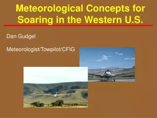
Meteorological Concepts for Soaring in the Western U.S. Dan Gudgel Meteorologist/Towpilot/CFIG
Presentation Points • Weather Information Sources • Meteorology Points • Synoptic Scale Weather Patterns • A Forecast Funnel • Miscellaneous Info
1. Weather Information Sources Weather Data • Internet (use “search engines”) • Site addresses change frequently for this medium • Customize access list for efficient data retrieval • Review AC-006, Aviation Weather • Review AC-45E, Aviation Weather Services • Other Information Sources
Internet Weather Data • Upper Air Temperature Soundings • Observed and Forecast Weather Charts • Model Forecasts • Satellite Imagery • Education / Explanations • Soaring Category Info
National Weather Service <http://www.weather.gov> • NWS National Homepage • Select area of interest (‘clickable’ map) • All Western Region NWS Offices listed • Numerous weather links • Current weather • Forecast models • Satellite images • Aviation Wx Center • Other sites
Forecast Systems Laboratory <http://www-frd.fsl.noaa.gov/mab/soundings> • Forecast Upper Air Temperature Soundings • 40Km grid resolution • Out to 16 Hours • Spot forecasts • (By airport)
Unisys Weather <http://weather.unisys.com/index.html> • Upper Air Temperature Soundings • Constant Pressure Charts • Model Forecast Charts • Education / Explanations
National Center for Atmospheric Research (NCAR) [et al.] <http://www.rap.ucar.edu/weather/> • Upper Air Data • (Temperature/Relative Humidity/Wind Info) • Other weather data
Other Weather Info Sources For the Aircraft Category • Fixed base operators • Soaring Society of America • Associated sites • Other Sources • Newspapers • NWS Weather Radio • FAA DUATS
2. Meteorology Points • Atmospheric Soundings • Great Basin Applications • Convection concepts • Climate Aspects • Local Influences
Sounding Basics • Small day-to-day changes can make big • differences in a soaring day's characteristics • Spot observation versus • need to assess task area • air mass, including discontinuity lines • Altitude noted by Pressure • 850 mb . 5000 Feet (MSL) • 700 mb . 10,000 Feet • 500 mb . 18,000 Feet
Sounding Sources • University of Utah Upper Air Link http://www.met.utah.edu/jhorel/html/wx/skewt.html • Unisys Weather Upper Air Link http://weather.unisys.com/upper_air/skew/index.html
Lapse Rates Dry and Moist Adiabatic 14
Definitions - Stable/Unstable Dry Atmospheric Conditions A - Temperature decreasing greater than Dry Adiabatic Lapse Rate denotes unstable atmospheric conditions + A B Altitude B - Temperature not decreasing as fast as Dry Adiabatic Lapse Rate denotes more stable atmospheric conditions ( d + Temperature
Temperature Inversions • Surface-Based and Aloft 16
Wind Shear • Wind velocity is a change in speed and/or direction • Temperature inversions are boundaries of air layers • Shear zone may not be deep or turbulent but... • Each layer of aircan have a different characteristics: - Wind velocity - Moisture - Parameter gradients + Wind SHEAR Altitude ZONE Wind + Temperature
Profiles • A mixed atmosphere is near-adiabatic (left) • Subsidence from high pressure “caps” convection but high enough to facilitate soaring over terrain (right) Alt. Alt. d d 18 Temperature Temperature
Surface-Based Inversion Established with Time d Alt. (0600 LT) 19 (0100 LT) (2000LT) (1700 LT) Time of Day Temperature
Surface-Based Inversion Erosion with Time d Alt. Time of Day 20 (0600 LT) (0900 LT) (1100 LT) (1400 LT) Temperature
Cloud Base / Moisture Layers • T / DP Closure • Possible Cloud • Layers • Moist Adiabatic • Lapse Rate
The Drying Process Sinking, Heating Drying Moisture, Deficit Air 10000 Ft MSL Rising,Cooling Condensing 5K Ft Sierra Nevada White Mtns 5000 Ft MSL Owens Valley Great Basin MSL San Joaquin Valley
De-Stabilizing Process Colder Air Advection above, and/or Warm Air Advection below will de-stabilize • Delta-T increase! • Moisture presence • also de-stabilizes
Basin Thunderstorm / Microbursts • Develop Adjacent cells • Classic short duration • 60Kt+ Sink Rates • Regardless of cell size • Wind shifts • Degrade ceiling and visibility
Mojave Desert Downburst Courtesy of Caracole Soaring, California City, CA) 25
Thunderstorm Activity (#1) • Presence of "cap"; and "penetration" of cap (observed time vs. forecast time?) • Winds aloft • Cell movement • Anvil spread
Thunderstorm Activity (#2) • Air mass Thunderstorms • Favored spots • Outflow
N Hook echo Classic Supercell Thunderstorm Light Rain Moderate/Heavy Rain & Hail Gust Front Hook echo Anvil Edge Supercell Thunderstorm (top view) Nautical miles 10 5 0 WSR-88D Radar Image 30 National Weather Service www.weather.gov
Convection Circulation Temperature Differences • Uneven heating leads to differing air density and ultimately supports a thermal circulation • Terrain/slope contributions • Surface heating capacity = f(ground and lower air mass moisture content)
Elevated Thermal Source Great Basin Mountains • Mountain slopes normal to incoming energy • Less attenuation • Air density • Moisture • Pollutants • Less mass of air to heat for greater buoyancy
Climate and Other Influences • Climate and Terrain Considerations • Modifying Influences and Contributions • Thunderstorm Indices
Climate and Terrain Great Basin • Time of year • Diurnal temperature spread • Humidity factors • Terrain rising aspects (and TAS)
Sunset / Sunrise / Normal Temps Reno, NV • Sunrise / Sunset • June 1 5:34 AM PDT / 8:20 PM PDT • July 1 5:35 AM PDT / 8:30 PM PDT • Aug 1 5:58 AM PDT / 8:12 PM PDT • Sep 1 6:27 AM PDT / 7:30 PM PDT • Normal Maximum/Minimum Temperatures • June 81.5 / 44.3 ()T=37.2F) • July 91.0 / 49.3 ()T=41.7F) • Aug 89.7 / 47.2 ()T=42.5F)
The Drying Process Sinking, Heating Drying Moisture, Deficit Air 10000 Ft MSL Rising,Cooling Condensing 5K Ft Sierra Nevada White Mtns 5000 Ft MSL Owens Valley Great Basin MSL San Joaquin Valley
Major Modifying Influences(#1) • Washoe Zephyr • Nevada Sinks • Mono Lake Shear • Basin Air • Terrain "Holes"
Major Modifying Influences(#2) • Topaz Flow • Mammoth Lakes • June Lake
Pressure Patterns Favorable for Great Basin Soaring • High location (aloft) • Ridge aloft east of task area (or far west) • Low pressure (aloft) • Not strong or close enough to bring strong gradient wind • De-stabilizing Influences • Split flow in the upper wind field with weak trough • Allows for Instability aloft but good surface heating • Thermal Trough (surface) • Through interior CA (better if along the coast!)
Pressure Gradients(#1) Stable Air Movement to the Western Great Basin • Great Basin to Interior California • 4 mb Reno to Sacramento delta-P inhibits Washoe Zephyr development
Pressure Gradients(#2) Stable Air Movement to the Western Great Basin • South CA Coast to Desert Interior • Depth of marine layer greater than 1500' MSL • 3+ mb Los Angeles (LAX) to Daggett (DAG) • Central CA Coast to Desert Interior • 6+ mb San Francisco to Las Vegas • Depth of marine layer greater than 2000' MSL
Thermal Detractors Macro-scale Level • <Cirrus Anvil from Thunderstorms • <Cirrus • Around jet stream cores • Small pressure perturbations / waves • <Convective Cloud Cover • More than 50% sky cloud cover • <Other • Relative Humidity gradients
Thermal Enhancers Great Basin • <Rising terrain steps to southeast of Minden • Minden to Patterson/Bridgeport +2000' • Patterson to Whites +1000' and more • <Convergence / Shear • Mono Lake Shear Line • Flying “M” Shear Line • <Small air basins • Fixed volume of air to heat (valley vs. plain) • <Other • Summer wave or wave-encouraged cloud streets
Mono Lake Shear Line • Mono Lake Shear Line • “Typically” present • Example: 6/13/99 47
Flying “M” Shear Line • Flying “M” Shear Line • “Typically” present • Example: 6/14/99 50