Download

1 / 16
160 likes | 362 Vues
Lower Adirondack GIS Users Group Meeting. Warren County Street Centerline Project December 1, 2004. Background. Warren County : ~ 1200 miles of public roads ~ 600 miles of private roads County completed in-house : ~ 450 miles geometry ~ 200 miles attribution Error checking of 1 town

E N D
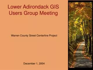
Lower Adirondack GIS Users Group Meeting Warren County Street Centerline Project December 1, 2004
Background Warren County : ~ 1200 miles of public roads ~ 600 miles of private roads County completed in-house : ~ 450 miles geometry ~ 200 miles attribution Error checking of 1 town Summer 2004 – the Sheriff’s Department hired a consultant, (Applied GIS, Inc.) to complete the project
Existing Road Data • NYS DOT roads • TIGER roads • NYS Accident Location Information System (ALIS) These data sources have inaccuracies in geometry and attribution (especially consistency with E-911 address ranges)
Data Sources for Geometry Development • 2001 Digital Orthoimagery • Tax Parcel layer with RPS • Road Centerlines from ALIS • GPS field work
GPS used to delineated roads that were not visible on the orthoimagery
Geometry Methodology • Divided Roads: Line segments head’s up digitized following the road’s centerline (where visible) • Undivided and Dirt Roads: Line segments within the edge of the roadbed
Geometry Methodology • Complex Features: • Cul-de-sacs • Multiple lane highways • Divided highways • Follow ALIS Project Rules
Attribution Methodology • Based on Warren County’s Dispatch System • Primarily manual coding, referencing Sheriff Department Excel spreadsheets • 14 fields manually entered • Additional fields obtained from Sheriff Department Excel
Attribution Methodology • Manual Attributes Coded:
Attribution Methodology • Address ranges interpolated from Excel data fields • Cross reference with other sources: • Spreadsheets listing residents’ names and house numbers (available for ~ half the towns) • Real Property data (BUT! not consistently accurate for E-911 addresses)
Error Checking • Type 1: Compare Sheriff Excel spreadsheet address ranges to other available sources • Error report of unresolved cases provided to Sheriff’s Department • Sheriff’s Department field checked, corrected data sent back to Applied GIS for update
Error Checking • Type 2: Geocode in ArcGIS the County’s Voter Registration database for each town. • Errors identified as either: • Mistake in address ranges of data (correction by consultant) • Error in voter registration database
Problem • County’s address ranges were developed independent of GIS, therefore address ranges may not be consistent with road length