Download
1 / 49
490 likes | 1.01k Vues
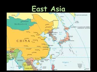
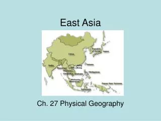
EAST ASIA. Geography 200 Dr. Stavros Constantinou . CHINA: LOCATION AND SIZE. China is located between 54 degrees N and 18 degrees N (the latitudinal extent of the country is 36 degrees). The Tropic of Cancer passes close to the city of Guangzhou (Canton).

E N D
EAST ASIA Geography 200 Dr. Stavros Constantinou
CHINA: LOCATION AND SIZE • China is located between 54 degrees N and 18 degrees N (the latitudinal extent of the country is 36 degrees). • The Tropic of Cancer passes close to the city of Guangzhou (Canton). • China is the world's third largest country (after Russia and Canada) with an area of 9,572,899 sq km (3,696,100 sq mi). • China has the largest population of any country in the world. • In 2003, China had a population of 1,288,700,000 or 20% of the world total. • The rate of natural increase at 0.6 % per year is below the world average of 1.3 %.
CHINA: LANDFORMS • The landforms of China are dominated by the Alpine System. • The physical environment is mostly mountainous, alternating with hills and depressions. • They may be classified into the following distinctive regions:
CHINA: LANDFORMS • Rivers Basins and Highlands of Eastern China. • Valleys of the Huang He, Chang Jiang, and Xi Jiang rivers. • All three rivers rise on eastern slopes of the Xizang--Yunnan Plateau and flow eastward, the Huang He passes through the most circuitous and longest course, the Xi through the most direct and shortest. • The Huang He is known as “China’s Sorrow” because of violent flooding. • The upper courses of the Huang and Chang lie in close proximity, but are in different provinces; their lower reaches lie in the Eastern Lowlands. • The Eastern Lowlands is China's most important region including the North China Plain and the cities of Beijing and Tianjin, and the productive lower Chang Valley with Nanjing (Nanking) and China's largest city, Shanghai. • The Eastern Lowlands extend into the Northeast, where the lowland of the Liao River and the city of Shenyang, China's Pittsburgh, form part of it.
CHINA: LANDFORMS • North China Plain: This region includes the Mongolian Border upland, the Shandong Peninsula, the Loess Plateau, and the lower valley of the Huang He. • The Huang He originates on the Qinghai-Xizang Plateau and is fed by snow as it follows a tortuous course to Bohai Gulf. • In its upper part, the Huang He Jiang makes an immense clockwise bend and in the process almost encircles one of China's driest areas, the Ordos Desert. • Downstream from the Ordos, the river enters the Loess Plateau (Yellow Earth in Chinese).
CHINA: LANDFORMS • North China Plain (continued): • Loess is a wind-blown deposit whose origin in this area is attributed to nearby deserts (possibly the Ordos) and the Pleistocene glacial epoch, during which the deposits were laid down in a mantle up to 76 m (250 feet) thick, covering the pre-existing landscape. • The loess is quite fertile and is dominated by intensive cultivation and dense population. • Each year 1.6 billion tons of this soil washes into the river, and 3/4 of that amount reaches the Yellow Sea. The balance builds up in the river bed, five to 12 m (15 to 40 feet) through the centuries.
CHINA: LANDFORMS • North China Plain (continued): • The Huang He has been marked by violent floods and frequent changes in the course. • For this reason, it has been nicknamed "China's Sorrow." • Alternately, it has drained north into the Gulf of Chihli or to the south of the Shandong (Shantung) Peninsula with numerous distributaries forming and shifting positions over time. • Because of flooding, local inhabitants have constructed dikes and artificial levees in order to stabilize the river's various channels. • The Shandong Peninsula is a hilly area that the Chinese have nicknamed “China’s California.” • The Mongolian Border Upland is a hilly forested area that separates the North China Plain from the steppes surrounding the Mongolian desert.
CHINA: LANDFORMS • Southeast China: This region is dominated by the Chang Jiang (Yangtze Kiang). • It is divided into three basins: (1) The Upper Chang - the westernmost, the Sichuan (Red Basin ), contains China's largest population clusters. • The hilly country has been transformed by terraces and rice grows in summer and wheat in winter. • Other major crops include corn, soybeans, sweet potatoes, sugarcane and a wide range of fruits; on the warmer slopes, tea flourishes. (2) Middle Chang - Begins in the vicinity of Yichang to the area west of Nanjing. • An important city on the middle course is the metropolis of Wuhan. • It is largely built up of river sediments and is flat and low, and dotted with lakes: (3) Lower Chang (Land of Rice and Fish) forms a delta that merges with that of the Huang He. Yangzi. • Large ocean craft ascent to Nanjing at all seasons. • This area produces about 1/4 of China's rice. • There are three harvests per year, two of rice and one of wheat.
CHINA: LANDFORMS • South China: This region extends from the margins of the valley of the Xi River to the borders with Southeast Asia. • The Xi is a shorter stream than either the Huang He or Chang Jiang. • The Xi Jiang flows through uplands except for the Guangzhou Delta, which is separated from the Chang Jiang by a wide belt of hills and low mountains (Southeast Uplands). • This region has been one of China's most outward-looking regions, with considerable emigration (via Guangzhou) to the Philippines and Southeast Asia. • Tea was the leading commercial crop, and the people of Fujian Province developed a significant seafaring tradition.
CHINA: LANDFORMS • The Northeast (formerly Manchuria): The Liao-Songhua Lowland is essentially an erosional plain rather than a depositional basin. • The Liao-Songhua Lowland and the Northeast Uplands converge on the silt-plagued Liaodong (Liaotung) Gulf, where Luda (Dalian) is the port city near the tip of the adjacent Liaodong Peninsula. • In the Heilongjiang Province the emphasis is on corn and soybeans because of a short growing season of 120 days.
CHINA: LANDFORMS • Plateau-Steppe of Mongolia: This region constitutes the southern rim of the Gobi Desert (North and Northwest of the Great Wall). • It is an area of rolling uplands, barren mountains and lifeless basins which stretch into the arid interior of Asia. • Summer temperatures are hot and winters are bitterly cold and vicious winds often blow up sand and dust. • This area is sparsely populated with an average of 12 persons per sq km (30 persons per sq mi), compared to densities of 300 people per rural square kilometer. • Only Xinjiang and Xizang are less populous.
CHINA: LANDFORMS • Desert Basins of Xinjiang: The Desert Basins of Xinjiang (Sinkiang) are a Muslim stronghold. • They cover an area of 635,000 sq. mi. and have about 14 million people. • Capital is Urumqi. • In physical terms, they consist of the Tarim Basin to the south and the basin of Junggar (Dzungarian) to the north. • These basins are separated by the lofty Tian Shan mountain range. • Both are areas of internal drainage and arid or semiarid. • The Tarim Basin is occupied by the Takla Makan Desert, perhaps the driest region in Asia. • Along its southern margin lies a string of oases.
CHINA: LANDFORMS • Desert Basins of Xinjiang (continued): • Since 1949 canals and qanats (karez) were built, oases enlarged and the acreage of productive farmland quadrupled. • Turfan Depression is the second lowest surface point on earth, after the Dead Sea. • Major crops include cotton and wheat. • Junggar (Dzungarian) has been the site of strategic east-west routes. • It contains sizable oil fields, notably around Karamay, not far from the Russian border. • The main westward rail line toward Kazakhstan and Russia runs from Xian in China proper via Yumen in Gansu and Urumqi in Junggar, which is its present terminus. • The Silk Road is 4, 000 miles long.
CHINA: LANDFORMS • The high plateaus and Mountains of Qinghai-Xizang (Tibet): The Xizang (Tibetan Highlands) comprises about 1/4 of China's land area. It is framed by the Kunlun Mtns to the north and the Himalayas to the south. • They are made up politically of Xizang Zizhigu (the Tibetan Autonomous Region), Qinghai (Tsinghai) Province and the western portion of Sichuan (Szechwan) and small areas of other adjoining provinces. • Tibet is culturally dominated by the Xizang (Tibetans) who practice Lamaism (the Tibetan variant of Buddhism). • Most of this region is plateau country averaging nearly 3 miles in elevation. • Its borders are: the Himalayas on the south, containing the world's highest peak, Mt. Everest (29,035 feet) on the Nepal-Tibet border; the Karakoram and other ranges to the northwest; the Kunlun, Altyn Tagh, and the Nan Shan range to the north; and the Great Snowy Range of mountains in the east.
CHINA: LANDFORMS • The high plateaus and Mountains of Qinghai-Xizang (Tibet): • The Xizang (Tibetan Highlands) is subdivided into two major physical regions: A very high northwestern or inner plateau and a more varied southeastern or outer plateau region. • Inner Plateau • The inner Qaidam (Tsaidam) basin is characterized by internal drainage and a number of large salt lakes, low annual precipitation, scanty vegetation and a very sparse almost entirely nomadic population. • Large areas are uninhabited. • Outer Plateau • The outer plateau region contains the Yarlung Jiang (Brahmaputra River) and the headwaters and upper courses of several other major rivers-the Salween, Mekong, Chang Jiang (Yangtze) and Hwang He (Yellow). • The population, although small and dispersed, is considerably greater than that of the inner plateau and consists of settled agricultural communities as well as nomads. • The Qaidam (Tsaidam) Basin- • It has an elevation of 2,743 to 3,048 m (9,000 to 10,000 feet) and is composed of a barren sand and gravel western half that merges eastward into salt flats, marshy depressions and bogs.
CHINA: CLIMATE China's Climatic controls: • The continental location • The location on eastern margins of continent • The wide latitudinal range of the country • Wind systems
CHINA: CLIMATE • Climatic types: • Desert - (BWk), Western China • Steppe - (BSk), North Central China and Mongolia • Humid Subtropical - (Cfa), warm summer • Humid Continental, (Cwa) • Highland, (H)
CHINA: VEGETATION • Needleleaf evergreen trees. Mainly in the mountains of northwestern China. • Grass and other herbaceous plants. Mostly in all of arid China. • Broadleaf deciduous trees. Mostly in coastal eastern China (lower valleys of Huang He, Chang Jiang, and Liao). • Broadleaf evergreen trees. Area south of Hangzhou in a coastal belt. • Semi-deciduous: broadleaf evergreen and broadleaf deciduous trees. Area west of the broadleaf evergreen zone. • Mixed: broadleaf deciduous and needleleaf evergreen trees. An area in the upper valley of the Chang Jiang and in the Northeast.
CHINA: SOILS • Ultisols: Soils of warmer soil temperature regimes with an argillic horizon and low base status (also occur in the Southeast U.S.). • They develop under forest vegetation in climates with a slight to pronounced seasonal soil-water deficit alternating with a surplus. • Common in humid subtropical, wet-dry tropical, and monsoon and trade wind littoral.
CHINA: SOILS 2. Entisols: Soils consisting of mineral solid lacking soil horizons that would persist after normal plowing. • They are found in any climate and under any vegetation. • Lack of distinct horizons is the result of parent material, i.e., quartz sand or deposits of volcanic ash or alluvium. • Entisols and inceptisols of flood plains and deltaic plains in warm and moist climates are among the most highly productive agricultural soil because of their favorable texture, ample nutrient content, and large soil water storage. • Examples: Central China and the Ganges and Brahmaputra plains in India and Bangladesh.
CHINA: SOILS 3. Aridisols: Soils of dry climates, with or without argillic horizons, and with accumulations of carbonate or soluble salts. • Alfisols: Soils of humid and sub-humid climates with high base status and an argillic horizon (B horizon). • They are highly productive soils when moderate amounts of lime and fertilizer are applied. 5. Highland
CHINA: RESCOURCES • Coal is the dominant industrial resource and China is the world's leading producer of coal, with 29.2% of the global production. • China ranks third in proven coal reserves with 11.1% (after the U.S. 23.7% and Russia 19.3%). • More than 60% of China’s coal is located in the northern and northeastern portions of China, in the great bend of the Huang He and Dongbei. • Major production centers are located at Shenyang and Baotou. • Outside the northeast, coal is important at Wuhan, Yichang and Chengdu. • Oil production is important in Dongbei and on the lower Huang He. • China ranks third in the exploitation of iron ore deposits (13.8%), which are scattered all over the country. • China produces 12.9 % of the world’s steel.
CHINA: RESOURCES • China has a wide array of minerals. • The country leads the world in the production of tungsten (74.8 %), pyrites (71.2 %), tin (32%), lead (18.7%), pig iron (18.6%), and smelted zinc (14.6%). • China ranks second in the production of manganese(16.6%), phosphate rock (16.4%), zinc (14.3%), and crude steel (12.9%). • China ranks third in the production of vanadium (24.9%), iron ore (13.8%), and smelted lead (10.7%).
CHINA: POPULATION GEOGRAPHY • China is the world's largest country in terms of population, with 1,288,700,000 in 2003. • This number excludes : • The 6,900,000 inhabitants of Xianggang (Hong Kong) which became a part of China on 1 July, 1997 as Special Administrative Region (SAR). • The 400,000 residents of Macau which became a Special Administrative Region on 31 December, 1999. • Second largest is India with 1,068,600,000. • According to the 1982 census, China's population was 1,008,175,288, an increase of more than 300 million over the previous census in 1964. • China has a natural population increase of 0.6 % annually, which is lower than the world rate of natural increase which is 1.3 %. • About four hundred million Chinese live along the Pacific shore. • More than 90% of the Chinese population is crammed into an area roughly equal in size to the U.S. east of the Mississippi River.
CHINA: POPULATION GEOGRAPHY • Migration: • An estimated 55,000,000 Chinese form one of the world's largest ethnic groups in a diaspora. • They are found mainly in Southeast Asian countries and constitute one of the world's great economic engines. • The overseas Chinese have experienced a long period of exile from the mother country to which a deep feeling of ethnic attachment persists. • The Chinese have demonstrated a strong bent for commerce and trade.
CHINA: URBAN GEOGRAPHY • China is a predominantly rural society with only 39% (502,593,000) of the Chinese population classified as urban. • China's cities are gaining people faster than they can add floor space. • Average living space in some districts of Beijing is roughly two square yards per person. • Many families live three generations in two rooms. • China's enormous rural population resides in small rural villages, which are estimated to number over one million.
CHINA: URBAN GEOGRAPHY Cities may be organized into four groups: • Chang Jiang (Yangtze) Valley City-System: Cities on or near the Chang Jiang river. • Shanghai • Nanjing • Wuhan in the Middle Basin • Chongqing in the Sichuan (Red Basin) • Chengdu northwest of the Sichuan (Red Basin). • The North China City-System:Cities on or near the edges of the Huang He river in North China and along major routes leading to and from the Plain. • Beijing, located near the pass to Mongolia • the main seaports of North China, Tianjin and Quingdao • Zhengzhou, Xian, and Lanzhou located along the major route from the Huang He to Xinjiang • Jinan, located at a major railway crossing of the Huang He River
CHINA: URBAN GEOGRAPHY • The Northeast ( formerly Manchuria): Six cities are clustered in the Southern Northeast with emphasis on heavy industry: • Shenyang, Fushun and Anshan. • To the south lies the Northeast's port of Dalian (Luda) • To the north are the regional transport, industrial and commercial centers of Changchun and Harbin. • The large cities south of the Chang Jiang Valley, • Guangzhou in the Xi delta • Kunming, a transport focus located in the mountains near strategic border crossings into Southeast Asia.
CHINA: CULTURAL GEOGRAPHY Languages: • The main languages of China are the following: • Mandarin Chinese (official), • Shanghai, • Guangzhou (Canton), • Fukien, • Hakka dialects, • Tibetan, • Bigus (Turkic).
CHINA: HISTORICAL GEOGRAPHY • China endured a long period of European Colonialism, with Britain, Germany,France, Russia and Portugal all claiming parts of China. • These European powers imposed a doctrine of extraterritoriality on the Chinese, a principle according to which a foreign government has jurisdiction over a certain territory located within the host country's boundaries. • Under extraterritoriality, foreign diplomats and traders were exempt from local laws and Chinese citizens were excluded from extraterritorial areas. • Following the Long March (1934-1935), the Communist Revolution prevailed in 1949 with the defeat of Chiang Kai-shek and his retreat to Taiwan; Mao Zedong proclaimed the communist Peoples Republic of China (PRC) on October 1, 1949 at Beijing’s Tiananmen Square.
CHINA: CULTURAL GEOGRAPHY Ethnic composition: • Although approximately 91.53% of China's population is Han Chinese, the remaining 8.47% are Mongolian, Korean, Manchu, and others. • About 93,000,000 Chinese belong to minorities which are concentrated in the arid and mountainous parts of China -- they inhabit more than half the country's territory, much of it desert, steppe or mountainous. • The Chinese government recognizes a total of 55 national minorities (ethnic groups). • The largest ethnic group are the Zhuang who live in the rugged hills west of Guangzhou and numbered 16,755,596 (1.3%) in 2000. • The second largest group are the Manchu with 11,084,471 (0.86%) followed by the Hui who number 10,182,247 (0.79%). • Other minority groups which number more than 5,000,000 members are: Miao (0.72%), Uighur (0.68%), Tujia (0.65%), and Yi (0.62%), Mongolian (0.47%), and Tibetan (0.44%). • The smallest national minority are the Russians, numbering 600.
CHINA: CULTURAL GEOGRAPHY • Historically, China’s most influential philosopher and teacher was Kongfuzi or Kongzi (Confucius). • Following the Communist Revolution (1949), 30 ethnic groups were given written languages, which they lacked up until then. • This was part of comprehensive policies for minorities issued after the Communist revolution and included regional limited autonomy, training programs, freedom to develop native languages and cultural and economic assistance. • Use of the symbol for dog as part of written characters for ethnic names was abolished and the symbol for man substituted.
CHINA: CULTURAL GEOGRAPHY • During the Great Leap Forward (1958-76), and the tumultuous Cultural Revolution (1966-76), the rights of minorities were restricted. • Rebellions were suppressed in Tibet in 1959 and in Xinjiang in 1962. • In recent years the rights of minorities have been reaffirmed and their development accelerated. • They have also been exempted from the national birth control campaign. • These diverse people supply most of China's livestock, have in their territories most of China's mineral resources and inhabit China's borders with, among others the former U.S.S.R. and Vietnam. • The Great Wall was 4,800 km (3,000 mi) long and extended from an area on the Yellow Sea to a point on the Silk Road in northern Gansu Province.
CHINA: ECONOMIC GEOGRAPHY • Agriculture: • China's arable land accounts for only 10% of the total land area of the country. • This figure represents 7% of the world's farmland. • Two-thirds of China’s vast territory is mountainous or desert and only one-tenth is cultivated. • Labor force in agriculture is 44.3%. • Rolling topography rises to high elevations in the North in the Daxinganlingshamai separating Manchuria and Mongolia; the Tian Shan in Xinjiang, the Himalayan and Kunlun Shan in the SW and in Xizang (Tibet). • The length is 1,800 miles from North to South, and the width is more than 2,500 miles from East to West.
CHINA: ECONOMIC GEOGRAPHY • Environmental conditions are the circumscribing factors for agriculture. For example, the land higher than 3,000 m and much of the land higher than 2,000 m is largely unproductive. • A third of the land (33%) is higher than 2,000 m. • Most of the grasslands are extremely dry (33%), deserts (12%), forests (12%), farmland (10%). • Rain-fed, 5.5%; irrigated 4.5%. • The basic unit of farming is the commune (96%) of the agricultural area of China. • Baogan daohu --farming policy in China that allows the farmer to grow crops beyond the limit set by the quota system and market them for himself. • The chief crops include grain, rice, cotton, tea and silk.
CHINA: ECONOMIC GEOGRAPHY Secondary sector: • Despite significant gains in industrial output, China remains essentially an agricultural country. Manufacturing accounts for 10.9% of the labor force. • The major industrial regions of the country are the following: • The Northeast (formerly known as Manchuria). its major centers include Shenyang (China's Pittsburgh), Fushun, Anshan, Jilin, Changchun, and Harbin. • The area extending from Baotou to Beijing, Tianjin, and Tangshan. • The cluster of cities that extends from Huang He to Shanghai. The most important centers include Jinan, Zhengzhou, Qindgdao, Nanjing, and Shanghai. • The Middle Chang Jiang. This extensive industrial region includes such centers as Chengdu, Chongqing, Changsha, Wuhan, and Nanchang. • The Lower Xi Jiang. This industrial region includes the city of Guangzhou and its vicinity.
CHINA: ECONOMIC GEOGRAPHY • Special Economic Zones (SEZ): • Manufacturing and export centers within China, created in the 1980s to attract foreign investment and technology transfers. Six SEZs – all located on southern China's Pacific coast -- currently operate: • Shenzen, adjacent to Xianggang (Hong Kong) • Zhuhai • Shantou • Xiamen • Hainan Island, in the far south • Pudong (still building) across the river from Shanghai
CHINA: POLITICAL GEOGRAPHY • China is divided into the following administrative units: four Central-Government-Controlled Municipalities (Shi’s); five Autonomous Regions; 22 provinces, and 2 Special Administrative Regions (SAR).
XIANGGANG (HONG KONG) • Xianggang (Hong Kong) consists of three parts: • The island of Xianggang (Hong Kong) (82 sq km or 32 sq mi). • The Kowloon Peninsula on the mainland opposite this island. • The New Territories. • The total area of this former British colony is just more than 1,000 sq km (400 sq mi) • In 2003 6,800,000 people were crowded in this small area. • Xianggang (Hong Kong) Island and Kowloon Peninsula were ceded permanently by China to Britain in 1841 and 1860, respectively, but the rest of the New Territories were leased on a 99-year basis in 1898.
XIANGGANG (HONG KONG) • Hong Kong is a major entrepôt of the western Pacific between Shanghai and Singapore. • Hong Kong depends on China for fresh water and food. • Textiles and fabrics make up more than 40% of the exports by value (their manufacture employs half the labor force), and electrical equipment and appliances are expanding. • Hong Kong accounted for 80% of all foreign investment in China and 22% of the total external trade of PRC. • The former British colony was returned to China on 1 July 1997. • The Chinese promised to allow Hong Kong's way of life to continue unchanged for 50 years following 1997. • Xianggang enjoys the status of a Special Administrative Region. • China granted the same status to Macau which was returned to China by Portugal in 1999.
TAIWAN • Taiwan (formerly Formosa) is a pear-shaped island that is less than 200 km (125 mi) from mainland China. • A mountainous spine exceeds 3,000 m (10,000 ft) in places and is forested. • The majority of the country's 22,600,000 people are found on the western coastal plain. • The capital city of Taipei (4,500,000 people) is located near the northern edge of this plain. • In 1895, Taiwan became part of Japan as a result of the war of 1894-1895. • Japanese rule ended in 1945 following the collapse of Japan at the end of WWII. • Japan laid the foundations for Taiwan's development that involved roads, railroads, irrigation projects, mines and factories.
TAIWAN • From 1945-1949, Taiwan was officially part of China. • Rice is the leading staple, about two thirds of which is from double-cropped land. • Wheat and sweet potatoes are also important staples. Sugarcane grows in the lower areas and tea in the uplands. • Taiwan has a high proportion of its population (77%) that is classified as urban. This degree of urbanization is comparable with similar figures in other industrial countries of the world. The rate of natural increase stands at 0.8% which is below the world average of 1.3%. • Recently, the Taiwanese economy is moving away from labor-intensive manufacturing to high-technology industries particularly personal computers, telecommunications, and precision electronic instruments
MONGOLIA • A vast, landlocked, buffer state wedged between Russia and China. Larger than Alaska in area has only 2,500,000 people. • From the 1600s until 1911, Mongolia was part of the Chinese Empire. With Soviet help, the Mongols resisted Chinese efforts to regain control of the country and Mongolia became a People’s Republic in the Soviet model. • The economy is based on animal products (cashmere wool). The country has 800,000 herders with millions of sheep. During the severe winters of 2000 and 2001, human and animal losses were most severe. • Ulaanbaatar, the capital city, adjoins Russia’s Eastern Frontier.
KOREA • Korea is a divided country, a communist North Korea and a capitalist South Korea. • Korea has been a dependency of China and a colony of Japan. • Following its freedom from Japan in 1945, Korea acquired two masters, the Soviet Union and the United States. • The Soviets acquired the territory north of the 38th parallel and the U.S. the area to the south. • In 1950, North Korea sought to reunite the country by the use of force and invaded South Korea across the 38th parallel. • A devastating conflict lasted from 1950-1953 and resulted in the cease-fire that was arranged in 1953. • The dividing line remains unchanged to this day. It is still actively patrolled on both sides and is considered a potential flashpoint for world conflict.
KOREA • South Korea is moister than North Korea and the soils are more productive. • South Korea possesses a zone of broadleaf evergreen trees like that of southern Japan. • Most of the rest of the Korean Peninsula has a deciduous forest. • The North is continental, the South peninsular. • The North is more mountainous than the South. • The North can grow only one crop annually and depend on wheat and millet, whereas the South has multiple cropping and the staple is rice.
KOREA • The North, with a population of 22,700,000, has significantly fewer people than the South, population 47,900,000. • The North has severe food deficits and the South comes close to feeding itself. • North Korea produces vastly more coal and iron ore than the South. • North Korea has maintained a lead in hydroelectric production. • The two Koreas are potentially interdependent.
CHINA AND ITS PERIMETER: LIST OF TERMS • PinyinThe system that was adopted by the Chinese for the standardization of their language. • Loess A wind-borne and deposited material of buff color. • Manchuria A former name of the region of China now known as Northeast. • Degradation The wearing down of an exposed surface by the action of running water. • Aggradation The building up of the channel of a river so that it can flow toward the sea. • Hydraulic Operated, moved, or affected by means of water. • Oasis The presence of water in a dry environment. • Karez (qanat) An underground tunnel for the movement of water from the mountains to a dry environment.
CHINA AND ITS PERIMETER: LIST OF TERMS • Humid China The eastern part of China which receives about 50 centimeters (20 inches) of rain or more. • Arid China The section of China west of the 50 centimeters (20 inches) isohyet. • Commune The basic unit of land collectivization in China. • Baogan daohu A Chinese farming policy that allows the farmer to grow crops for his own use after he meets the quota set by the government. • Han Chinese The Chinese people, especially as distinguished from Mongols and other non-Chinese elements • Treaty ports Ports along the eastern seaboard of China that the Chinese ceded by treaty to the Europeans. • Extraterritoriality A principle according to which a foreign government has jurisdiction over a certain territory located within the host country's boundaries.