Chile earthquake and tsunami
590 likes | 1.17k Vues
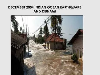
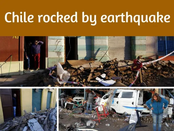
Chile earthquake and tsunami. Magnitude 8.8; hypocenter 21 miles. Tsunami. Deep-ocean Assessment and Reporting of Tsunami. Changed the planet’s axis by three inches. Chile: M 8.8 earthquake. Large mass of rock moved Nearby island uplifted 2 feet Steep sloping subduction zone

Chile earthquake and tsunami
E N D
Presentation Transcript
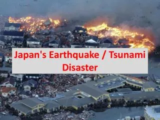
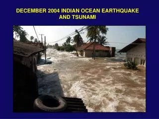
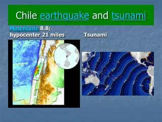
Chile earthquake and tsunami Magnitude 8.8; hypocenter 21 miles Tsunami
Changed the planet’s axis by three inches Chile: M 8.8 earthquake Large mass of rock moved Nearby island uplifted 2 feet Steep sloping subduction zone Each day should be 1.26 microsecond shorter (hundredth of a second)
Chile: aftershocks Magnitudes: 6, 5.1, 4.9 Tsunami warning
Mitigation: measures to reduce risk • Understanding the potential hazards • Hazard maps • Monitoring • Emergency plan in place and practiced • Education of government officials and public
This process begins with the gathering of scientific information
Understanding the Past • The eruptive history is very important. • Ancient volcanic deposits are dated to determine frequency of eruptions.
Understanding of hazards: provide definition and potential location • People will evacuate when there is an understanding of the potential destruction from a hazard.
The Philippine government used volcanic hazard videos and other information to educate the public Successful evacuation Successful prediction of Mt. Pinatubo, 1991
The people of Armero did not understand the potential hazards of a lahar Government officials knew about the potential hazard 23,000 fatalities Disaster Nevado del Ruiz volcano, Columbia, 1985
Map ancient volcanic deposits. Hazard Map of Mt. Rainier: map indicates previous lahar and pyroclastic flows Results: where one would expect these hazards to occur in the future
Lassen Peak, Hazard Map • Vents that have produced eruptions • Yellow- lava flow zones • Gold- ash fall zone • Orange-combined • Pink-mudflows • Aqua- floods
Monitoring Precursors • Physical changes are known to precede a volcanic eruption. • Name changes in volcanic activity. These changes are called precursors. • Seismicity • Deformation • Snow melt • Water levels and chemistry • Gas emission • Small eruptions
Monitoring VolcanoesGround Deformation • Movement of magma into the system tends to inflate the volcano’s surface • Tiltmeters • Global Positioning Stations (GPS) • Radar interferometry- satellite
Deformation Tiltmeter • Direct measurements are made when the volcano is increasing in precursor activity Global Positioning Satellites record vertical and horizontal movement of the volcano
Monitoring VolcanoesSeismicity Mt. St. Helens • Magma fractures cooler rock causing earthquakes • An increase in the number of earthquakes may indicate an imminent eruption
Seismometer • Seismic waves move through the crust and reach the seismometer • The seismometer records the strength and type of movement • The information is sent to a station and recorded through radio waves or satellite communication Seismometer placed near Mt. St. Helens
Monitoring the Long Valley Caldera • Ground deformation • Resurgent dome grew is 80 centimeters from the late 1970’s to 1999 • minor subsidence since 1999
Monitoring the Long Valley Caldera • Seismicity averages 5-10 earthquakes per day since 1999 • Occasionally swarms of earthquakes cause alarm (200-300/week) • generally less than M=2
Mt. St. Helens • Seismic activity increased in 2005 • Increased monitoring of activity • Seismicity • Visual inspections • Gas emissions
Mt. St. Helens • Alert level 2: activity increasing that lead to a hazardous volcanic eruption • Aviation level orange- ash to 30,000 feet, traveling 100 miles
Seismicity • With more than three stations the initial rupture of the earthquake is located • Outlining the size and location of the magma chamber
Mt. St Helens • Green dots represent activity in the past 24 hours.
Gas Emissions: as magma ascends, decompression melting releases gas Sulfur dioxide cloud, three hours after eruption • Direct and indirect measurements • Increase in gas emissions may indicate an imminent eruption
Mt. St. Helens Volcanic watch
Monitoring the Long Valley Caldera • Carbon dioxide escape from the magma chamber • Associated with faults that act as pathways • 50-150 tons per day since 1996 • level remains the same • Horseshoe lake
Gas Emissions • Direct sampling is completed by collecting the gas in a liquid • Analysis is done at a laboratory
Satellite images can monitor movement of ash in the atmosphere. Ash abrades windows and can cause engine failure Composite satellite image of ash produced from Mt. Spur, Alaska over a one week period
Thermal Change indicates magma moving closer to the surface • Satellite sensors are able to detect increased temperatures before an eruption • Used for remote active volcanoes or if seismicity does not precede an eruption Pavlov Volcano, Alaska
Lahar Warning System • Sensors detect high frequency vibrations produced by lahars moving down a stream channel • Sensors are placed downstream from volcano but upstream from population
Warning System • Normal: Typical background activity; non-eruptive state • Advisory: Elevated unrest above known background activity • Watch: Heightened/escalating unrest with increased potential for eruptive activity • Warning: Highly hazardous eruption underway or imminent
Aviation Warning System • Green: normal activity • Yellow: exhibiting signs of elevated unrest • Orange: heightened unrest with increased likelihood of eruption (specify ash plume height) • Red: eruption’s forecast to be imminent with significant emission of ash into the atmosphere (specify ash plume height)
Communication Most important: think of the disasters in the past 6 years
Volcanic Disaster Assistance Program • The primary purpose is to save lives in developing countries. • Works with the Office of /Foreign disaster Assistance • U.S. Agency for International Development
Volcanic Disaster Assistance Program • The Volcanic Disaster Assistance Program was developed after the 1985 eruption of Nevada del Ruiz. • Since 1986, the response team organized and operated by the U.S.G.S. responds globally to eminent probable volcanic eruptions. Nevada del Ruiz lahar that killed 23.000 people.
Increase in seismic activity in 1996 Alaska Prevent evacuation of 1,000 residents Prevent closing of fishing industry Communication to Public
The eruption of Rabaul, Papua New Guinea, September, 1994. • Residents who witnessed the 1937 eruption explained what occurred • Education of the local population through community groups • Successful evacuation due to following the plan
Successful Prediction • Mount Pinatubo, 1991 Approximately 330,000 people evacuated prior to the eruption
Evaluation of Risk • Zones of highest to lowest risk should be identified • Urban planning should take in account the areas of highest risk • These areas should be evacuated first
Risk • Applying the Volcano Explosivity Index • Mt. Pinatubo- 6-7 • Amount of property damage • Population • This equates to the amount of risk