Download
1 / 24
240 likes | 458 Vues
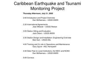
Caribbean Earthquake and Tsunami Monitoring Project. Thursday Afternoon, July 21, 2005 2:00 Introduction and Project Overview Dan McNamara – USGS ANSS 2:30 International Agreements Jean Weaver – USGS Reston 3:00 Station Siting and Evaluation Jack Odum – USGS ANSS

E N D
Caribbean Earthquake and Tsunami Monitoring Project Thursday Afternoon, July 21, 2005 2:00 Introduction and Project Overview Dan McNamara – USGS ANSS 2:30 International Agreements Jean Weaver – USGS Reston 3:00 Station Siting and Evaluation Jack Odum – USGS ANSS 3:30 Station Design and Installation: Engineering Overview Bob Hutt – USGS ASL 4:00 Training and it's role in Operations and Maintenance Gary Gyure –ASL Honeywell 4:30 Data Flow to Local Institutions, the NEIC and NOAA Dan McNamara – USGS ANSS 5:00 Cerveza
Project OverviewDan McNamara USGS ANSS Golden, CO Capabilities of the Proposed Stations Participants and Partners Timeline (finish by September 2006) Project Website Questions for site evaluation and installation Questions for the USGS?
9 Proposed Stations and Partners Trinidad/Tebago Seismic Research Unit of the University of the West Indies in Trinidad. Barbados Seismic Research Unit of the University of the West Indies in Trinidad. Antigua Seismic Research Unit of the University of the West Indies in Trinidad. Dominican Republic Instituto Sismológico Universitario Universidad Autónoma de Santo Domingo, PRSN Cuba, Guatnanamo Bay USGS International Programs office, US Navy Jamaica Jamaican Seismic Network: University of the West Indies, Mona Honduras The Departamento de Fisica, Universidad Nacional Autonoma de Honduras Panama Instituto de Geociencias,Universidad de Panama Turks and Caicos Islands Turks and Caicos Disaster Management, PRSN
Response Time Improvement Minutes
US Participants USGS International Programs Office, Reston, VA USGS Central Region GHT, ANSS Golden, CO USGS Central Region GHT, ASL GSN Albuquerque, NM USGS Western Region, Menlo Park, CA National Oceanic and Atmospheric Administration – NOAA
Coordinate with other Interested Organizations MIDAS GSN Standing Committee of IRIS Intergovernmental Oceanographic Commission- IOC of UNESCO IOCARIBE – sub-commission for the Caribbean
Timeline Phase 1: Pre-deployment Planning 5/05-8/05 Phase 2: Station Siting and Permitting 5/05-02/06 Phase 3: Procurement of Equipment 6/05-01/06 Phase 4: Equipment Testing and Config. 12/05-02/06 Phase 5: Training 01/06-02/06 Phase 6: Station Deployment 12/05-09/06 Phase 7: Data Integration at NEIC 09/06 Phase 8: Long Term O&M beyond 09/06 September 2006 May 2005
USGS Website Project Webpage http://geohazards.cr.usgs.gov/staffweb/mcnamara/Projects/Caribbean/Caribbean.html Caribbean Geological Conference Information Package http://geohazards.cr.usgs.gov/staffweb/mcnamara/Projects/Caribbean/GeologicalConf/GeolConference.html
Information Package Questions for site evaluation and installation List of Participants Meeting Agenda USGS Fact Sheet on the Caribbean Earthquake and Tsunami Warning System: DRAFT July 12, 2005 Caribbean Project Implementation Plan: DRAFT July 12, 2005 J. McMillan, Methods of installing United States National Seismographic Network (USNSN) stations; a construction manual, Open-File Report, No.OF 02-0144, 23. TA vault design document Planned Caribbean Stations with Seismicity: POSTER MAP Planned Caribbean Stations with Seismicity and Earthquake Hazard: POSTER MAP List of Regional Seismic Networks in the Caribbean Region Station Siting/Installation Requirements and Survey
Questions for the Session • 1. Who are the primary partner contact? • 2. Level of partner expertise for O&M? • people, training and timeline • 3. Site location options? • people and timeline • 4. Permitting? • people and timeline • 5. Infrastructure? • tasking, local and/or USGS • 6. partner concerns? • Questions for USGS • available research and operational products • 7. data distribution to partners?
Permits and Agreements (MOUs)Jean Weaver USGS Reston What institute? How do we approach agreement gov to gov? what ministry? contact info? Timeline? permits should cover, vsat dish, transmission of data, and long term land use
Station Site EvaluationJack Odum USGS Golden, CO New or existing? Station Requirements Scouting Trips (begin by August-September 2005) Trip Needs - Visas, hotels, truck, tools, contacts Webform for Site information - does not exist yet…
Site Evaluation • All stations will be evaluated on the following criteria: 1. Large utility vehicle (backhoe, concrete truck) accessibility. • 2. Return visit accessibility--how easy is it to access the site in different conditions throughout the year. • 3. Site conditions such as proximity to bedrock and drainage. • 4. Security - Locks and fencing required? Should the site should be hidden from view of the casual observer? • 5. Infrastructure (e.g., enclosure requirements, power). • 6. Availability of telecommunications, and satellite view. • 7. Availability of reliable AC power. • 8. Local contacts and maintenance personnel. • 9. Cultural noise characteristics. • 10. Daily solar radiation. • 11. Hurricane resistance.
GSN Station Access Survey HOTELS: RESTAURANTS: WHERE TO GET BEST CURRENCY CONVERSION RATES: LOCAL MEDICAL FACILITIES, HOSPITALS: TRANSPORTATION AVAILABILITY: FLIGHT INFORMATION: SUPPLIES / HARDWARE STORE INFORMATION: OBSERVATIONS & NOTES:
Noise Tests http://geohazards.cr.usgs.gov/staffweb/mcnamara/Projects/Caribbean/staeval.html
Engineering OverviewBob Hutt - USGS ASL Instrumentation Vault design - need Aug. meeting participants. Telemetry Power systems
Data Integration at the NEIC VSAT to NEIC for automatic processing in HYDRA HYDRA is a new earthquake processing system based on earthworm QC analysis system for archiving at IRIS DMC
Data Flow to Local Institutions Data Format Options earthworm - internal format, offers most connectivity and products output in SAC, SEED LISS - real-time feed in miniSEED autodrm - future support uncertain IRIS DMC - BUD offers real-time feed.