Download
1 / 24
240 likes | 614 Vues
Hurricane Katrina (2005): Complex Lifecycle of an Intense Tropical Cyclone. Eyad Atallah, Ron McTaggart-Cowan, Lance Bosart and John Gyakum. Outline. Focus: External influences on Katrina’s intensity over Florida and the Gulf. 1. Ingredients for tropical cyclogenesis:

E N D
Hurricane Katrina (2005): Complex Lifecycle of an Intense Tropical Cyclone Eyad Atallah, Ron McTaggart-Cowan, Lance Bosart and John Gyakum
Outline Focus: External influences on Katrina’s intensity over Florida and the Gulf • 1. Ingredients for tropical cyclogenesis: • Persistent troughing over Hispaniola • Transient easterly wave forcing • Remnant TD10 vortex 1800 UTC 23 August 2005
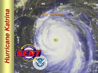
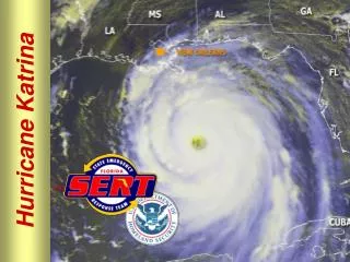
Outline Focus: External influences on Katrina’s intensity over Florida and the Gulf • 2. South Florida landfall: • Category 2 hurricane over the Gulf Stream • Little weakening over the peninsula • Emerges organized into the Gulf 0000 UTC 26 August 2005
Outline Focus: External influences on Katrina’s intensity over Florida and the Gulf • 3. Rapid intensification: • Two periods of rapid deepening on 26 and 28 August • Increased symmetry and size • Superintense 150 kt Category 5 1200 UTC 28 August 2005
1. Tropical Cyclogenesis Weekly mean DT pressure (colour) and deep shear (barbs in ms-1) for 17-23 August. Brightness temperature for period is shaded. 850 hPa relative vorticity for 0000 UTC 17 August is shown in red (2x10⁻⁵ s-1 intervals) Midlatitude trough penetrates to 20oN for more than 1 week before Katrina’s development
1. Tropical Cyclogenesis Weekly mean DT pressure (colour) and deep shear (barbs in ms-1) for 17-23 August. Brightness temperature for period is shaded. 850 hPa relative vorticity for 0000 UTC 17 August is shown in red (2x10⁻⁵ s-1 intervals) Downshear QG-forced ascent (still effective at 20oN) leads to a region of persistent convection N of Hispaniola
1. Tropical Cyclogenesis Weekly mean DT pressure (colour) and deep shear (barbs in ms-1) for 17-23 August. Brightness temperature for period is shaded. 850 hPa relative vorticity for 0000 UTC 17 August is shown in red (2x10⁻⁵ s-1 intervals) 21 August Remnant TD10 vortex provides lower-level focusing mechanism to organize convection but continues west
1. Tropical Cyclogenesis Weekly mean DT pressure (colour) and deep shear (barbs in ms-1) for 17-23 August. Brightness temperature for period is shaded. 850 hPa relative vorticity for 0000 UTC 17 August is shown in red (2x10⁻⁵ s-1 intervals) Katrina forms on the mean trough axis and is declared a TD by NHC at 1800 UTC 26 August NE of Cuba
1. Tropical Cyclogenesis Brightness temperature for 0000 UTC 24 August as Katrina emerges from convective regions over the Caribbean islands
2. South Florida Landfall • During spin-up: • SST climbs to >30oC • shear stays below 10 ms-1 • winds increase to 33 ms-1 (Category 1) • PI stays high (near 75 ms-1)
2. South Florida Landfall Katrina moves over anomalously warm (>30oC) water in the Gulf Stream as it moves northwestward towards South Florida SST (contours) and anomaly (shaded) for 23 to 26 August
2. South Florida Landfall • Miami WSR-88D radar shows Katrina's landfall near 0000 UTC 26 August: • Initial asymmetry despite Category 1 intensity • Dry slot fills in while much of the TC is over Florida • Full eyewall present as Katrina enters the Gulf • Katrina's intensity does not change during the storm's passage of South Florida
2. South Florida Landfall GOES IR brightness temperatures as indicated on the greyscale bar for 0000 UTC 26 and 27 August Satellite imagery shows that Katrina experiences very little overall decrease in deep convection and loses very little symmetry while crossing Florida How common is Katrina's lack of sensitivity to landfall in South Florida?
2. South Florida Landfall • Criteria for an analog study of hurricane landfalls in South Florida: • named storm (implies 1948-present) • passes through a 2ox2o box centered at 26oN,81oW • crosses South Florida on a zonal track • spends 12h or less over land • Eight storms meet these criteria: How (1951) Isbell (1964) Betsy (1965) Dawn (1972) Andrew (1992) Mitch (1998) Harvey (1999) Wilma (2005)
2. South Florida Landfall • A Two One-Sided Test (TOST) analysis is used to check for significant intensity trends during passage across South Florida • Equivalence tests are commonly used in biometical research to test the effectiveness of generic drugs • Equivalence interval is 10 ms-1 (approx one Category)
2. South Florida Landfall • Null Hypothesis: • “Landfall in South Florida leads to a significant change in TC intensity” The null hypothesis is rejected by the TOST at the 95% level. This indicates that: Katrina's lack of sensitivity to landfall in South Florida is consistent with the historical record of such events
3. Rapid Intensification • During intensification: • SST stays above 29.5oC • shear increases to 15 ms-1 • winds increase to 77 ms-1 (Category 5) • PI drops to 69 ms-1 • Katrina becomes superintense on 28 August
3. Rapid Intensification The central Gulf remains >29oC during Katrina's passage, but is not anomalously warm. Shelf waters are very warm, and may limit weakening as Katrina moves northward on 28 August. SST (contours) and anomaly (shaded) for 26 to 30 August
3. Rapid Intensification GOES IR brightness temperatures as indicated on the greyscale bar for 0000 UTC 24 to 31 August Katrina's organization on 27 August after leaving South Florida is impressive but not unique for this region of the Gulf.
3. Rapid Intensification Rapid increases in intensity and RMW of the storm occur in the absence of anomalously warm SSTs on 27-29 August. GOES IR brightness temperatures as indicated on the greyscale bar for 0000 UTC 24 to 31 August
3. Rapid Intensification Emanuel 2005, Nature Combined effects of intensity and radius changes lead to a smooth exponential increase in Katrina's power dissipation (directly related to the damage potential of the storm).
3. Rapid Intensification SST's near Katrina are uniformly warm; however, satellite altimetry shows that the TC crosses an extension of the Loop Current and a deep warm core ring (WCR) while undergoing its two periods of rapid intensification. SST and dynamic topography (column thickness corrected for the geoid, tides, pressure and geostrophic currents) during Katrina's passage across the Gulf. Source: Scharroo 2005 (EOS)
3. Rapid Intensification Katrina's power dissipation rises in conjunction with the dynamic topography, suggesting that the increased heat content in the WCR is more important than SSTs once mixing is induced by the circulation of the TC. Dynamic Topography Data Source: R. Scharroo
Discussion Hurricane Katrina was influenced by external forcings for much of its tropical lifecycle phase: Development: Persistent troughing and easterly wave Florida Landfall: Changing lower boundary properties Rapid Intensification: Passage over WCR • Hurricane Katrina's lack of sensitivity to landfall in South Florida is consistent with the historical record • The rapid intensification and expansion of the TC over the Gulf leads to monotonically increasing power dissipation and is associated with Katrina's passage over a WCR