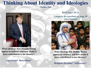
Chapter One THINKING GEOGRAPHICALLY
Chapter One THINKING GEOGRAPHICALLY. By: Mary Helen, Charles, Claire. History of Geography. The word geography was invented by the Greek scholar Eratosthenes- He built off the work of Aristotle and Plato “Geo” means Earth and “Graphy” mean to write Roman geographers: Strabo & Ptolemy

Chapter One THINKING GEOGRAPHICALLY
E N D
Presentation Transcript
Chapter OneTHINKING GEOGRAPHICALLY By: Mary Helen, Charles, Claire
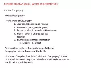
History of Geography • The word geography was invented by the Greek scholar Eratosthenes- He built off the work of Aristotle and Plato • “Geo” means Earth and “Graphy” mean to write • Roman geographers: Strabo & Ptolemy • Father of cartography: art and science of map-making • 18th century, environmental determinism was founded: the belief that the environment causes human development • Later, possibilism was created: landscapes are the products of complex human and environmental relationships
Location and Place • Place: Description of a specific point on the Earth’s surface / human and physical features that make it unique • All inhabited places on Earth have been given place names (toponyms)
Two types of Location • Two Types of Location: • Absolute: Location on the global grid / mathematical • Lines of latitude (parallels) North & South of Equator • Longitude (meridians) East and West of Prime Meridian • Note: Prime Meridian runs through Greenwich, England (Basis of Greenwich Time) • Relative: Relationship to places around it
Site and Situation • Site: Specific physical and cultural characteristics of a place such as terrain and dominant religions • Situation: Location of a place relative to physical and cultural characteristics around it.
Regions • Region: Spatial unit or group of places that share similar and unifying characteristics • 3 Types: • Formal (Uniform) • Area that has a common cultural or physical feature • Example: Marion County- shares a county government Functional Region (Nodal) • Area organized around a node or focal point defined by social or economic function • Example: Circulation of Lebanon Enterprise Vernacular Region (Perceptual) • A place that people believe exist because of their cultural identity • Example: The American South
Map-Making • Distortion: Errors resulting from flattening or projecting the Earth onto a flat surface • 4 Properties of Maps: • Shape • Size • Distance • Direction • (Cardinal and Intermediate)
Projections • Mercator Robinson
Projections • Goode Lambert
(Lambert) • Azimuthal (Polar)
Density • The frequency with which something occurs in space • 3 Types • Arithmetic • Total number of object sin an area Physiological • Number of people per unit of area suitable for agriculture Agricultural • Number of farmers per unit area of farmland • 2 Types of Concentration: • How the features are spread over space • Dispersed and Clustered
Diffusion • Process by which a characteristic spreads across space from one place to another over time • The place where it originates is called the HEARTH • 5 Types of Diffusion • Relocation • EXPANISION • Hierarchical • Contagious • Stimulus
Geographic Technology and Data • A. Geographic Information System (GIS): A computer program that stores data and produces maps through layering data patterns over each other • B. Remote Sensing: The collection of info from satellites • C. Global Positioning System (GPS): Satellite Driven remote sensing to determine exact location on the global grid
Random Things You Should Probably Know For BINGO • Distance Decay: The diminishing importance and eventual disappearance of a phenomenon with increasing distance from its origin • Globalization: Actions or processes that involve the entire world • International Date Line: 180 Longitude. -When heading East the clock moves back 24 hours -When going west the calendar moves ahead one day • Space Time Compression: Reduction in time it takes to diffuse something to a distant place because of improved communication in transportation • Transnational Corporation: A company that conducts research, operates factories, and sells products in many countries