Download
1 / 20
200 likes | 481 Vues
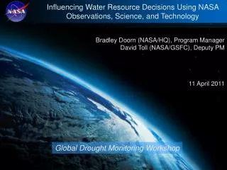
Influencing Water Resource Decisions Using NASA Observations, Science, and Technology. Bradley Doorn (NASA/HQ), Program Manager David Toll (NASA/GSFC), Deputy PM 11 April 2011. Global Drought Monitoring Workshop. NASA Applied Sciences Program A Pathway Between Earth Science & Society.

E N D
Influencing Water Resource Decisions Using NASA Observations, Science, and Technology Bradley Doorn (NASA/HQ), Program Manager David Toll (NASA/GSFC), Deputy PM 11 April 2011 Global Drought Monitoring Workshop
NASA Applied Sciences ProgramA Pathway Between Earth Science & Society Natural Disasters Water Resources Ecosystems Agriculture Air Quality Weather Public Health Climate Results of NASA Earth Science Research Uses by Partners and Stakeholder Communities GEOSS Societal Benefit Areas NASA Applied Sciences Program
Applied Sciences ProgramUSGEO Societal Benefit Areas Agriculture Climate Disasters Ecosystems Energy Health (incl. Air Quality) Oceans Water Resources Weather | 3
NASA Water Resources –Themes • Streamflow(Includes Snowpack) • Drought Monitoring & Prediction • Irrigation and Water Delivery • Water Quality • Climate Change and Water Resources • Programmatic Activities (Partnering, Leveraging, Outreach etc.)
NASA Water Resources – Partnerships • Key Partnerships • Federal: EPA, NOAA-NCEP, NOAA-NOHRSC, NOAA-OHD, USGS, USAID, DoS, USDA, AFWA, USBR • State: California DWR, USDM • NGO: GEO, UNESCO-IHP, ACE-ICIWaRM, World Bank, UNESCO HELP • Interagency Organizations • USGS Water Census Ad Hoc Team, Western US Federal Agency Support Team (WestFAST), Climate Change Analysis Water Working Group (C-CAWWG), Department of State Internal Water Working Group (DoI-IWG), Advisory Committee on Water Information – Subcommittee on Hydrology (ACWI-SOH), & US Army Corp ICIWaRM
GPM SMAP Missions in Formulation and Implementation NPP AQUARIUS LDCM ICESat-II
Upcoming NASA Water Resources Workshops • Global Drought Monitoring, Hilton Washington DC/Silver Spring MD on April 11-12, 2011. • In coordination with the U.S. Drought Monitor and NIDIS meetings • http://www.watercycleforum.com • The 2nd SMAP Applications Workshop, Washington, DC on October 12-14, 2011. • http://smap.jpl.nasa.gov/applications/ • 2011 Remote Sensing Applications for U.S. - Mexico Border Water Management, San Diego, CA on Jun 8-9, 2011. • http://www.watereduction.org, Click on Event > Conferences
A.34 EARTH SCIENCE APPLICATIONS:WATER RESOURCES NOTICE: NASA plans to solicit for this program element in ROSES-2011 NASA will issue an amendment to ROSES-2011 to provide specific information about the element The proposal due date will be at least 90 days following the announcement of the amendment 1. Program Objectives (…) 2. Scope of Program Element ……… In this solicitation, the program will request applications of Earth science research results to improve decision-making activities on topics related to drought, drought policy and management decision making. The program will initially support one-year feasibility studies of possible applications. The program will then down-select and continue support for a subset of innovative, impactful applications for a three-year effort to develop and transition the application. The amendment to this program element will describe this feasibility-to-decision support project arrangement more fully. The Water Resources program website is available through the website listed above.
Global Drought Monitoring Workshop • To review the information requirements for global-scale, drought monitoring products for global and regional applications. • To evaluate the information value of NASA capabilities and explore ways in which these capabilities can be used more effectively to inform water security/management concerns at global to sub-continent scales. • To assess the specific requirements for monitoring agricultural and hydrological droughts and the capabilities of the current suite of NASA data products to provide that information. • To develop a set of actions that would enable NASA, either separately or in collaboration with other organizations, to more effectively impact drought information for decision making. Overarching Program Goal Develop the most effective strategy to affect global drought information from NASA capabilities with the ability to measure success from the impacts on U.S. and international
GRACE Reveals Massive Depletion of Groundwater in NW India The water table is declining at an average rate of 33 cm/yr GRACE is unique among Earth observing missions in its ability to monitor variations in all water stored on land, down to the deepest aquifers. Rodell, Velicogna, and Famiglietti, Nature, 2009 Trends in groundwater storage during 2002-08, with increases in blue and decreases in red. The study region is outlined. Time series of total water from GRACE, simulated soil water, and estimated groundwater, as equivalent layers of water (cm) averaged over the region. The mean rate of groundwater depletion is 4 cm/yr. Inset: Seasonal cycle. During the study period, 2002-08, 109 km3 of groundwater was lost from the states of Rajasthan, Punjab, and Haryana; triple the capacity of Lake Mead Matthew.Rodell@nasa.gov
Near Real Time Global Monitoring of Lakes and Reservoirs Phase IV http://www.pecad.fas.usda.gov/cropexplorer/global_reservoir Lake Urmia/Iran Lake Buhayrat/Iraq
Using NASA Evapotranspiration (ET) for Agriculture Water Consumptive Use
U.S. Drought Monitor (NOAA-USDA-USGS) Soil Moisture and Vegetation Health • Prototype of Soil Moisture Change (SMC) with Drought D-Level Overlay: JPL automated system produces data; weekly automatic uploaded to NOAA PSD, who creates multiple SMC products and derivatives with D-level overlay. • Expedited MODIS Vegetation Drought Response Index (VegDRI) : USGS/EROS and NDMC have integrated MODIS NDVI 7-day composites into the national VegDRI model on a rapid, weekly schedule to meet requirements of US Drought Monitor authors. • Resolution Benchmark: NASA results have excellent resolutions to resolve the county-level goal of NIDIS. This is evident in the comparison of SMC and VegDRI products versus USDM drought maps at the lower resolution. • Improvements of USDM are Important for Users:NOAA NWS uses D2 to trigger drought information statements, IRS for tax deferrals, USDA programmatic usage, among others. User community interactions: Drought Forum 2009 Nghiem/JPL & Verdin/USGS