Section 2-5
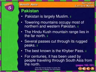
Pakistan. Pakistan is largely Muslim. . Towering mountains occupy most of northern and western Pakistan. The Hindu Kush mountain range lies in the far north. Several passes cut through its rugged peaks. The best known is the Khyber Pass.

Section 2-5
E N D
Presentation Transcript
Pakistan • Pakistan is largely Muslim. • Towering mountains occupy most of northern and western Pakistan. • The Hindu Kush mountain range lies in the far north. • Several passes cut through its rugged peaks. • The best known is the Khyber Pass. • For centuries, it has been used by people traveling through South Asia from the north. Section 2-5 (pages 150–151) Click the mouse button or press the Space Bar to display the information.
Pakistan (cont.) • Kashmir is a mostly Muslim territory on the northern border of India and Pakistan. Section 2-6 • Kashmir is currently divided between the two countries. • Both nations want to control the entire region, mainly for its vast water resources. • This dispute over Kashmir has sparked three wars between Pakistan and India. (pages 150–151) Click the mouse button or press the Space Bar to display the information.
Pakistan (cont.) • Pakistan has had many changes of government since independence–some were elected, others seized power. Section 2-7 • The official language, Urdu, is the first language of only 9 percent of the people. • English is widely spoken in government. (pages 150–151) Click the mouse button or press the Space Bar to display the information.
Pakistan (cont.) • In the far north lies Islamabad, the capital. Section 2-8 • The government built this well-planned, modern city to draw people inland from crowded coastal areas. (pages 150–151) Click the mouse button or press the Space Bar to display the information.
Who are the most recent leaders of Pakistan’s government? Section 2-9 In 1999, the army seized power from the elected government and military leaders are still in control. (pages 150–151) Click the mouse button or press the Space Bar to display the answer.
Bangladesh • Bangladesh is nearly surrounded by India and shares many cultural features with India. Section 2-10 • Two major rivers–the Brahmaputra River and the Ganges River–flow through the lush, low plains that cover most of Bangladesh. (pages 151–152) Click the mouse button or press the Space Bar to display the information.
Bangladesh (cont.) • The monsoons affect Bangladesh. • When the monsoons end, cyclones may strike. • A cyclone is an intense tropical storm system with high winds and heavy rains. • Cyclones, in turn, may be followed by deadly tidal waves that surge up from the Bay of Bengal. Section 2-11 (pages 151–152) Click the mouse button or press the Space Bar to display the information.
Bangladesh (cont.) • Most people farm. Rice is the most important crop. Section 2-12 • The fertile soil and plentiful water make it possible for rice to be grown and harvested three times a year. • Still, Bangladesh cannot grow enough food for its people. • Bangladesh is one of the most densely populated and poorest countries in the world. (pages 151–152) Click the mouse button or press the Space Bar to display the information.
Although cyclones may cause flooding, what might happen if the rains come late? Section 2-13 Crops could fail, causing widespread hunger. (pages 151–152) Click the mouse button or press the Space Bar to display the answer.
Nepal • Nepal’s land forms a stairway to the world’s highest mountain range–the Himalaya. Section 2-14 • Nepal is home to Mount Everest. • Nepal’s economy depends on farming. • Farmers grow rice, sugarcane, wheat, corn, and potatoes. (pages 152–153) Click the mouse button or press the Space Bar to display the information.
Nepal (cont.) • Nepal is a parliamentary democracy ruled by a prime minister. Section 2-15 • The capital and largest city is Kathmandu. (pages 152–153) Click the mouse button or press the Space Bar to display the information.
What environmental problems are caused by Nepal’s farmers? Section 2-16 They clear the forests for new land and fuel, causing mountain slopes to be stripped of trees, which leads to erosion and flooding. (pages 152–153) Click the mouse button or press the Space Bar to display the answer.
Bhutan • The Himalaya are the major landform of the country. Section 2-17 • More than 90 percent of Bhutan’s people are subsistence farmers. • They live in the fertile mountain valleys and grow cardamom, oranges, rice, corn, and potatoes. • People also herd cattle and yaks, which are a type of oxen. (pages 153–154) Click the mouse button or press the Space Bar to display the information.
Bhutan (cont.) • Most people remain deeply loyal to Buddhism. Section 2-18 • In Bhutan, Buddhist centers of prayer and study are called dzongs. • They have shaped the country’s art and culture. • In 1998 Bhutan began to move toward democracy. (pages 153–154) Click the mouse button or press the Space Bar to display the information.
What is a hindrance to developing Bhutan’s economy? Section 2-19 The mountains slow progress, building roads is difficult, and there are no railroads. (pages 153–154) Click the mouse button or press the Space Bar to display the answer.
Sri Lanka • Sri Lanka is one of the world’s leading producers of tea and rubber. Section 2-21 • It is also famous for its sapphires, rubies, and other gemstones. (pages 154–155) Click the mouse button or press the Space Bar to display the information.
Sri Lanka (cont.) • The British ruled Sri Lanka–then called Ceylon–from 1802 to 1948, when it became independent. Section 2-22 • Today Sri Lanka is a republic. (pages 154–155) Click the mouse button or press the Space Bar to display the information.
Sri Lanka (cont.) • Sri Lanka’s people belong to two major ethnic groups, the Sinhalese and the Tamils. Section 2-23 • The Sinhalese live in the southern and western parts of the island. • The Tamils live mostly in the north and east. • Since 1983 the Tamils and Sinhalese have fought a violent civil war. (pages 154–155) Click the mouse button or press the Space Bar to display the information.
How has Sri Lanka benefited from its location? Section 2-24 Sri Lanka has prospered because of its location on an important ocean route between Africa and Asia. (pages 154–155) Click the mouse button or press the Space Bar to display the answer.