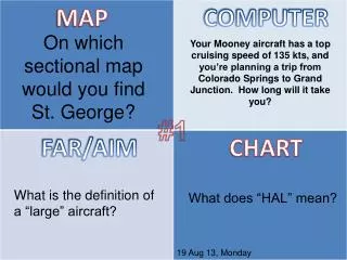
Flight Planning: St. George Map and Travel Time Calculation
Discover the sectional map section for St. George relevant to your flight planning. Your Mooney aircraft, with a cruising speed of 135 knots, is being prepared for a journey from Colorado Springs to Grand Junction. In this guide, we’ll calculate the estimated travel time for your trip. Additionally, learn about the FAR/AIM definition of a “large” aircraft and the meaning of the acronym “HAL.” Stay informed and safe as you take to the skies on August 19, 2013.

Flight Planning: St. George Map and Travel Time Calculation
E N D
Presentation Transcript
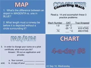
MAP COMPUTER On which sectional map would you find St. George? Your Mooney aircraft has a top cruising speed of 135 kts, and you’re planning a trip from Colorado Springs to Grand Junction. How long will it take you? #1 FAR/AIM CHART What is the definition of a “large” aircraft? What does “HAL” mean? 19 Aug 13, Monday