Download
1 / 22
220 likes | 334 Vues
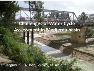
Challenges of Water Cycle Assessment in Medjerda basin. Z. Bargaoui (1) , A. Ben Gsim (2) , N. Abid (1). 1: Université Tunis El Manar, 2: Ministère de l’Agriculture. Problematic (1). (i) Flood risk

E N D
Challenges of Water Cycle Assessment in Medjerda basin Z. Bargaoui(1), A. Ben Gsim(2), N. Abid(1) 1: Université Tunis El Manar, 2: Ministère de l’Agriculture
Problematic (1) • (i) Flood risk • Generalized flodds in the past (1969 et 1973) as well as in recent years (2000, 2003, 2004, 2005, 2009, et 2012), • Generation process: heavy rainfall with long durations and great spatial extent(monthly rainfall occurrence in only few days 2 to 3 days). • The resulting soil saturation favores the occurrence of surface floods and enhance the flooding process
Problematic (2) • Downstream Sidi Salem dam (750 Mm3) is a flood plain (nearly 2 millions of people) with urbanization, agricultural and industrial activities • Upstream dams are inter connected (5 great dams) • Multi objectives dams and confliction objectives : flood protection, domestic water furniture, irrigation with all maxima in summer season
Problematic (3) • (ii) Drought risk • Dry land agriculture (wheat, olives, parcours) and forest under the risk of pluriannual drought. • Despite the dams and water transportation infrastructures the risk of water deficit for irrigation exists enhanced by the small incomes of farmers and their vulnerability to face investments in supplementary investments as result of drought • Domestic water demand in rural area (MDG goals) (many conflits on safe access to water and with durability)
Drought risk in Tunisia(annual precipitation in the period 1991- 2000, 4 Tunisia regions, Medjerda belons to North) In bold years with < 75% of regional average hydrological years (1/9 to 31/8) - Over 1991-92 à 2000-2001, all regions experienced 2 to 4 annual deficits. - Le North Wuest , North East et Suth East 4 dry years out of 10 - 1994-95 (75% of spatial extension ) and 1996-97 (66 % of spatial extension). - 2000-2001 Center and South représenting 82% of Tunisia.
Problematic (4) • (iii) Climate risk • The IPCC Fourth Assessment Report collected global data for the past 50 years, and showed that heavy rainfall has increased over the decades since the 1990s. • the IPCC Fourth Assessment Report analyzed global 100-year data to assess drought risk, showing that drought-affected areas haveincreased over the past 20 years. In simulation with multiple models, more than two-thirds of the models also suggested an increase in drought-affected areas. • along the Mediterranean Sea in northern Africa (where the Tunisia is located), it is predicted that the Hadley Circulation will be intensified by global warming, and that rainfall amounts will decrease on average.
Challenges (1) • Share information on water stocks (soils, dam, groundwater and rivers) • Enhance short term forecasts for precipitations river discharges for flood risk mitigation • Enhance seasonal forecasts for drought and flood mitigation (dry farming; irrigation vulnerability) • Develop studies of climate change impacts at local scale in order to give operational adaptation measures
Challenges (2) • Develop Regional climate model evaluation integrating precipitation and temperature data • Downscaling of models outputs for local impact studies • Adaptation strategies at local scales and with multidisciplinary and multisector approaches
Situation • No basin authority (6 regional authorities under national authority) • Availability of observation networks (to strengthen) • Availability of databases (to strengthen) • Availability of information systems (to strengthen) • Human Ressources (capacity building) • Mécanismes de concertation multisectoriels • Législation et Société civile • Etudes sur la gestion du risque de crue, de sécheresse et l’évaluation des modèles climatiques régionaux. • Studies • Piseau I 2001-2007 328 MDT BIRD, AFD, AfDB) – IRR- Dwat- GW /SINEAU • Piseau II 2009-2014 216 MDT BIRD, AFD, AfDB) – IRR- Dwat- WRM
Moyennes mensuelles observées et prédites par les RCM (période de contrôle 1961- 2000) Six modèles RCM runs (CNR-A, DMI-A, DMI-B, ICT-E, SMH-B, SMH-E) Bargaoui Z, Tramblay Y., Lawin E., Servat E. (2013) Seasonal precipitation variability in regional climate simulations over Northern basins of Tunisia. Int. J. Climatol., in press
Résultats de l’étude • Les modèles sous estiment les précipitations saisonnières de 20% en moyenne (nécessité de correction de biai). • Le modèle qui décrit le mieux les précipitations observées et leur variabilité spatiale est ICT-E (coefficient de corrélation r=0.87 entre simulations et observations, 25 km de résolution) • Pour le futur, en été et automner les différents modèles ne projettent pas de changements majeurs dans les distributions saisonnières des précipitations. • Mais, pour l’hiver et le printemps, tous les modèles projettent une décroissance significative des précipitations. Bargaoui Z, Tramblay Y., Lawin E., Servat E. (2013) Seasonal precipitation variability in regional climate simulations over Northern basins of Tunisia. Int. J. Climatol., in press
Groundwater Observations • Drilling (560) • wells (3500) • Piézomètres (250) • Exploitation (surface and groundwater) 1200 Mm3/year • Dams: Sidi Salem; Siliana; Mellègue; Bouheurtma; Kasseb • Canal Medjerdha Cap Bon (120 km) • Reduction of drought risk
ETa Estimation • University Tunis El Manar - First prospective Master of Sciences of Nesrine Abid w ith ITC collaboration (Chris Mannaerts) North Tunisia Case study • Période: March 2010 to September 2010 • 1ere decade of each month • Meteorological stations : Institut national de la Météorologie (9 stations) • Satellite data : SAF products and SPOT vegetation, MNT (STRM) • Tools: GeonetCast et ILWIS • Two approches: Modèle SEBS - ETa SAF
Température de la surface terrestre [K] Les données satellitaires Carte de la température moyenne [°C] Carte de la pression de l’air [°C] Les données d’entrées L’émissivité dérivé par FVC LST FVC ALBEDO lAI NDVI DSSF Angle zénithale On utilise GEONETCasttoolbox DSSF NDVI Prétraitement Température de l’air Émissivité Modèle Numérique de Terrain MNT Fraction de la couverture végétale FVC Angle zénithale solaire Albédo Vitesse de vent Le modèle SEBS Carte de la vitesse de vent [m/s] Indice foliaire LAI Les données météorologiques Pression de l’air SAF_ET Humidité spécifique Évapotranspiration estimé pour un jour
Résultats d’évapotranspiration réelle (mm/jour) Distribution spatiale 01/03/2010 01/05/2010 01/09/2010
MARS 01-10/2010 MAI 01-10/2010 SEPTEMBRE 01-10/2010 Eta_SEBS Eta_SAF
Structures de gestion et mécanismes de concertation • Echelle centrale (Cabinet du Ministre, DGEGTH +DGRE) : état des ressources • Echelle centrale multisecteurs: Ministère de l’équipement (DHU), Protection civile, Ministère de l’environnement, Institut de la Météo • Echelle régionale: CRDA, Divisions Eau, sol, etc.. • Loi des catastrophes naturelles (crues) concertation • Le comité de concertation sur la sécheresse • Tissu de gestionnaires locaux (problèmes de représentativité et de solvabilité financière, coûts énergétiques très importants)
ConclusionsObjectifs d’un projet dans le cadre de AfWCCI • Améliorer les bases de données et les systèmes d’information sur le climat et l’hydrologie • Développer les capacités des acteurs de l’eau (associations et services publics) pour l’utilisation de ces systèmes d’information • Développer des centres (ou task forces) pour l’alerte contre les crues et les sécheresses dans un cadre multisectoriel • Promouvoir l’approche de gestion intégrée et durable dans le cadre de l’adaptation au changement climatique et de la réduction des risques hydrologiques