Passage Two
Passage Two. AIS ECDIS. Learning Objectives:. basic characteristics of AIS and ECDIS used on board (e.g. working modes of AIS) characteristics of AIS and ECDIS and their functions (e.g. differ ECS from ECDIS) Technical terms and phrases relevant knowledge on AIS and ECDIS. Vocabulary:.

Passage Two
E N D
Presentation Transcript
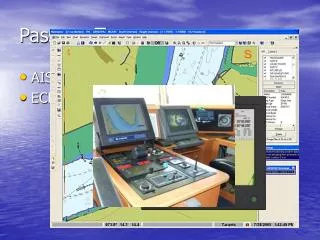
Passage Two • AIS • ECDIS
Learning Objectives: • basic characteristics of AIS and ECDIS used on board (e.g. working modes of AIS) • characteristics of AIS and ECDIS and their functions (e.g. differ ECS from ECDIS) • Technical terms and phrases • relevant knowledge on AIS and ECDIS
Vocabulary: spontaneous combustion自燃; Be spontaneous.不矫揉造作; Natural, spontaneous verbal utterance. 自然的、朴素的语言发声 The masterless communicationmeans that even if a connected device (station) goes into power off, operations to automatically switch the master station continue. • AIS (Automatic Identification System) 船舶自动识别系统 • derive /di'raiv/ vt. 起源,由来(from) • ingenious /in'dʒi:njəs/ adj. 精巧的,巧妙的 • spontaneous /spɔn'teiniəs/ adj. 自发的,自动的,自然的 • masterless adj. 无主的 masterless communication • collision n. 碰撞 • autonomous /ɔ:'tɔnəməs/ adj. 自主的 • burst /bə:st/ n. 无线电脉冲 • decode vt. 译(电报),解码 • graphic adj. 图解的,图示的 • integrate /'intiɡreit/ vt. 使结合,使一体化 • playback n. (录音等)播放,放音,放像 • laptop adj./n.便携式的 (电脑) make into a whole or make part of a whole; incorporate e.g. integrate theory with practice 把理论同实践统一起来 Some countries want to integrate into this organization. 一些国家想加入这个组织。
get the opinions (of people) by asking specific questions;e.g. These stations may poll vessels via the AIS channels. 这些台站可以通过船舶自动识别系统对船舶进行调查。 • automated adj. 自动化的 • poll /pəul/ vt. 对…进行调查; 投票;民意测验 • augment /ɔ: ɡ'ment/ vt./ n. 扩大,增加,增长 • overlay /,əuvə‘lei/ n. 覆盖物,透明图 radar overlay • cost-effective adj. 经济的,实惠的 • feasible /'fi:zəbl/ adj. 可行的,可实行的 • degrade vt. 使降级 degraded adj. 降了级的,退化了的 • timeslot n. 时段,一种时间单位 • comply vt. 照做,符合(with) • sophisticated /sə'fistikeitid/adj. 复杂的 • cross track error航迹偏差 • raster /'ræstə/n. 光栅 • digitize /'didʒitaiz/ vt. 使数字化 • envision /in'viʒən/ vt. 想象,预想 imagine; picture to oneself e.g. I cannot envision him as President. The sooner you envision your dreams and develop a plan to turn them into reality, the faster you will accomplish your goals. 越早预制梦想并制定计划去实现它,你就会越快实现自己的目标。
这种设计理念源自瑞士发明家的创造性工作。20世纪80年代中期他开发的这种精妙的无人操控的自动通讯技术可以按照非常准确的计时标准发射大量信息。这种设计理念源自瑞士发明家的创造性工作。20世纪80年代中期他开发的这种精妙的无人操控的自动通讯技术可以按照非常准确的计时标准发射大量信息。 • AIS • AIS is a shipboard broadcast transponder system in which ships continually transmit their ID position, course, speed and other data to all other nearby ships and shoreside authorities on a common VHF radio channel. The concept is derived from the pioneering work of a Swedish inventor, who developed in the mid 1980s an ingenious technique for spontaneous, masterless communication, which permits a large number of transmissions to a very precise timing standard. • AIS is designed to operate in one of the following modes:
Masterless transmissions • 1. In a ship-to-ship mode for collision avoidance: • The primary operating mode for AIS will be autonomous ship-to-ship reporting. In this mode, each ship transmits its data to all other AIS-equipped ships within VHF range. The unique communications scheme permits these data transmissions to take place independently without the need for a master control station. • Position and other data are fed automatically from the ship's sensors into the AIS system, where the data is formatted and transmitted in a short data burst on a dedicated VHF channel. When received on the other ships, the data is decoded and displayed for the officer of the watch, who can view AIS reports from all other AIS-equipped ships within range in graphic and text format.The AIS data may optionally be fed to the ship’s integrated navigation systems and radar plotting system to provide AIS “tags” for radar targets. The AIS data can also be logged to the ship's voyage data recorder (VDR) for playback and future analysis. • Updated AIS messages are transmitted every few seconds to keep the information up-to-date. Note that the ship-to-ship data exchange takes place automatically without any action required by the watch officer on either ship. In pilotage waters, a pilot can plug a laptop computer, loaded with his own navigation program, directly into the ship’s AIS system. In this way, the pilot can monitor the position and movement of all other vessels in the area independent of the ship’s installed navigation systems. Radio pulse 数据被其他船只接收后,可以被解译并显示出来,值班驾驶员就能看到量程内来自其他所有配备了AIS的船舶所发送来的AIS图文报告。 within range:在量程范围内 in graphic and text format:以图表和文字的形式 AIS数据可被选择性地输入到船舶综合导航系统以及雷达标绘系统中,从而给雷达目标提供AIS“标签”。 be fed to:供给,注入
2. In a ship-to-shore mode as a means for coastal states to monitor and obtain information about a ship and its cargo: • In coastal waters, shoreside authorities may establish automated AIS stations to monitor the movement of vessels through the area. These stations may simply monitor AIS transmissions from passing ships, or may actively pollvessels via the AIS channels, requesting data such as identification, destination, ETA, type of cargo and other information. Coast stations can also use the AIS channels for shore-to-ship transmissions, to send information on tides, notices to mariners and local weather forecasts. Multiple AIS coast stations and repeaters may be tied together into Wide Area Networks (WAN) for extended coverage. • Coastal nations may use AIS to monitor the movement of hazardous cargoes and control commercial fishing operations in their territorial waters. AIS data can be logged automatically for playback in investigating an accident, oil spill or other event. AIS will also be a useful tool in search and rescue operations, allowing SAR coordinators to monitor the movements of all surface ships, aircraft and helicopters involved in the rescue effort. 这些站台可以单纯地监控往来船只发送的AIS数据,或者通过AIS频道主动要求船只提供有关船舶身份、目的地、ETA、货物类型及其他信息。 广域网LAN(LocalAreaNetworks局域网
3. As a traffic management tool when integrated with a vessel traffic system (VTS) • When integrated with shore-based vessel traffic systems (VTS), AIS provides a powerful tool for monitoring and controlling the movement of vessels through restricted harbors and waterways. The AIS can augment traditional radar-based VTS installations providing an AIS “overlay” on the radar picture, or can provide a cost-effective alternative in areas when it is not feasible to establish radar-based system.When integrated with radar, the AIS can ensure continuous coverage, even when the radar picture is degraded by heavy precipitation or other interference. The AIS channels can be used to transmit port data, pilotage, berth assignments, shipping agency information, tides and currents, notices to mariners and other information from shore to ship, as well as ship-to-ship and ship-to-shore AIS reports. It is also possible for the VTS to broadcast the complete harbor picture to all ships in the area. So the masters and pilots all share the same “big picture”. The VTS center can assume control over the assignment of timeslots for AIS messages to ensure optimum data exchange within the coverage area. Special dedicated channels may be designated for local-area AIS operations. The shipboard AIS equipment will have the ability to shift to different channels automatically when directed by the shoreside VTS controller. AIS能在雷达图像上提供一种“透明图”,从而增强传统的基于雷达的VTS设施。AIS还是一种经济实惠的替代选择,供不适合建立雷达系统的地区使用。 VTS中心可以对该区域内的AIS信息进行时段分配控制,以确保数据最佳交换。
ECDIS • The IMO has defined theElectronic Chart Display and Information System (ECDIS) as the integrated bridge system that complies withthe up-to-date chart carrying requirements of international law. At the heart of any integrated bridge system lies an electronic chart. An electronic chart system meeting IMO specifications for complying with chart carrying requirements is an Electronic Chart Display and Information System. All other electronic charts are known as Electronic Chart Systems (ECS). • Electronic Chart Systems (ECS) are those digital chart display systems that do not meet the IMO requirements for ECDIS. Until an ECDIS standard is approved and a particular ECS meets that standard, no ECS can be classified as an ECDIS. The practical consequence of this distinction is that an ECS cannot be used to replace a paper chart. Several companies are producing very sophisticated integrated bridge systems based on electronic chart systems. These integrated bridges combine accurate electronic positioning sensors with electronic chart presentations to produce a video representation of a chart which displays and updates the ship’s charted position at frequent intervals. 这些综合驾驶台系统将精确的电子定位传感器与电子海图显示屏相连接,从而产生一种海图的视频图像,频繁显示并更新船舶在海图上的位置。 integrated bridge = integrated bridge system 综合驾驶台系统 at frequent intervals 频繁地
Tendency; possibility ECDIS最终标准的不确定性并没有使得海运界减小对开发这项创新技术的潜力的要求。 lessen the demand to do…减少或减轻做某事的要求 exploit the potential of …开发的……潜能 • Electronic charts can also display tracklines, cross-track error, and other operational data. These systems have the potential to integrate radar systems and control systems to create a fully integrated bridge. The uncertainty surrounding the final ECDIS standard has not lessened the marine community’s demand to exploit the potential of this revolutionary technology. One consequence of this demand has been that some national hydrographic offices are producing official digital raster charts for use in electronic charting systems. In addition, a number of commercial companies have been licensed to digitize the paper charts of various national hydrographic offices. However, these are not the data bases envisioned by the IMO standard. Remember that ECDIS is a system. The electronic chart data base is only a subset of this system. Therefore, even though electronic charts come from a national hydrographic office or from official charts, the integrated bridge system in which the chart is used may not meet the ECDIS system requirements. • The emergence of extremely accurate electronic positioning systems coupled with the technology to produce an electronic chart is effecting a revolution in navigation. When fully mature, this technology will replace the paper charts and plotting instruments used by navigators since the beginning of sea exploration. • 高精电子定位系统的出现加上电子海图生产技术给航行带来一场变革。 • couple with 与…连接在一起 • The strike couple with the flood,was expected to reduce supplies of food drastically. 罢工加洪水,预计会大量减少食品供应。 • effect vt. 使…发生;引起;实现 • The temperature often effects a change of the state of matter. 温度常常引起物态的变化。 These dada bases do not satisfy the IMO standard.
Exercises: Exercises I. Multiple Choices: 1. ______ the repeater compass with the master compass, please. • A. Similize B. Clock • C. Synchronize • D. Position 2. My gyro-compass error is ______. • A. east two degrees • B. two degrees east • C. two east degrees D. two-degrees east 3. A stabilogauge is a calculator used to ______. 1) measure GM 2) measure initial stability. • A. 1) only B. 2) only • C. Both 1) and 2) • D. Neither 1) nor 2) 4. Deviation of the magnetic compass can be obtained by means of ______. • A. taking bearings of the sun B. comparison with the gyro-compass • C. reciprocal bearings • D. A+B+C
5. The principal purpose of adjustment of the magnetic compass is to eliminate ______ as far as possible. • A. variation B. compass error • C. deviation • D. earth’s magnetic force 6. If the compass heading and the magnetic heading are the same then ______. • A. the deviation has been offset by the variation • B. there is something wrong with the compass • C. the compass is being influenced by nearby metals • D. there is no deviation on that heading 7. If a magnetic compass is not affected by any magnetic field other than the earth’s, which statement is true? • A. Compass error and variation are equal. • B. Compass north will be true north. • C. Variation will equal deviation. • D. There will be no compass error. 8. Deviation is caused by ______. • A. changes in the earth’s magnetic field • B. nearby magnetic land masses or mineral deposits • C. magnetic influence inherent to that particular vessel • D. the magnetic lines of force not coinciding with the lines of longitude
9. Deviation is the angle between the ______. • A. true meridian and the axis of the compass card • B. true meridian and the magnetic meridian • C. magnetic meridian and the axis of the compass card • D. axis of the compass card and the degaussing meridian 10. At the master gyrocompass, the compass card is attached to the ______. • A. spider element • B. sensitive element • C. link arm D. pickup transformer 11. As a vessel changes course to starboard, the compass card in a magnetic compass ______. • A. remains aligned with compass north • B. also turns to starboard • C. first turns to starboard then counterclockwise to port • D. turns counterclockwise to port
Related exercises: 12. Radar is not only to obtain ______, but also to measure their distance away from you. • A. brightness of objects • B. color of targets • C. shape of targets • D. bearing of objects
13. When your vessel is proceeding to the area of traffic density, ______ is used to determine the exact ranges of other ships or objects in the vicinity. • A. radar • B. GPS • C. DF D. satellite navigator 14. The fitting of an efficient radar reflector is likely to considerably increase the ship’s probability of ______. • A. detection • B. being detected • C. the detective D. the detected 15. The abbreviation PPI in the Sperry collision avoidance system means ______. • A. plan position indicator • B. plain position indicator • C. plane position indication D. policy proof of interest 16. It may be found that, in certain circumstances, radar beacon emissions can cause ______ with the normal radar display, particularly at close range. • A. unwanted interference • B. unexpected figures • C. abnormal data D. unwanted information
17. If there is any doubt as to the proper operation of a radar, which statement is true? • A. Only a radar expert can determine if the radar is operating. • B. All radars have indicator lights and alarms to signal improper operation. • C. A radar range compared to the actual range of a known object can be used to check the operation of the radar. • D. The radar resolution detector must be energized to check the radar. 18. An indirect radar echo is caused by a reflection of the main lobe of the radar beam off the observer’s vessel. Which of the following is not a characteristic of indirect echoes? • A. Their bearing is almost constant, even when the true bearing of the contact changes appreciably. • B. They always appear on a bearing of 90 degrees from the true bearing of the contact. • C. The indirect echoes usually appear in shadow sectors. • D. When plotted, their movements are usually abnormal. 19. A radar display in which north is always at the top of the screen is a(n)______. • A. unstabilized display • B. stabilized display • C. composition display D. relative display 20. A radar contact will remain stationary on a relative motion radar display only when it is ______. • A. on the same course as your vessel • B. at the same speed as your vessel • C. on the same course and speed as your vessel • D. on a reciprocal course at the same speed as your vessel
inherent inaccuracy radar plotting pulse length/pulse width/pulse duration compass card/ compass bowl/ binnacle pulse repetion rate • II. Translate the following phrases into English: • 1. 固有的不精确性 • 2. 雷达标绘 • 3. 脉冲长度 • 4. 罗经碗 • 5. 脉冲重复率 • 6. 平面位置指示器 • 7. 倾斜误差 • 8. 永久磁场/感应磁场 • 9. 首/北向上显示模式 • 10. 分罗经调谐 • 11. 陀螺罗经的例行检查 • 12. 间接回波 • 13. 盲区 • 14. 主瓣/旁瓣 • 15. 差分全球定位系统 • 16. 航程数据记录仪 • 17. 船舶自动识别系统 • 18. 电子海图与信息系统 • 19. 综合驾驶台系统 • 20.电子定位传感器 PPI: Plan Position Indicator heeling error permanent/induced magnetism heading-upward/north-upward presentation repeater synchronization routine inspection of the gyro-compass false/indirect echo blind/shadow sector main/side lobe DGPS: Differential Global Positioning System VDR: Voyage Data Recorder AIS: Automatic Identification System ECDIS: Electronic Chart Display and Information System integrated bridge system electronic positioning sensor
III. Translate the following English into Chinese: • 1. The VHF channel System uses a limited number of frequencies called channels. The public system has 57 channels, numbered CH1 to 28 and 60 to 88, each of which has a certain purpose: intership, ship-to-port, or ship-to-shore (public). Four channels have special purpose: CH16: to be used for verbal distress calls and for calling “all stations” only. All large ships are obliged to monitor it constantly. Never to be used for chatting, etc; CH70: the DSC channel; CHs75-76: Used as Guard Band for distress channel 16. • 2. The GPS receiver calculates the range, bearing and cross track error to next waypoint when you select a destination. The calculation of that data is called navigation calculation. The calculation itself is done using one of two methods (selectable): Great circle (straight line between two points) or Rhumb line (straight line between two points on nautical chart). • 3. When navigating in restricted waters, a mariner most often relies on visual piloting to provide the accuracy required to ensure ship safety. Visual piloting, however, requires clear weather; often, mariners must navigate through fog. When conditions render visual piloting impossible and a vessel is not equipped with DGPS, radar navigation provides a method of fixing a vessel’s position with sufficient accuracy to allow safe passage • 4. The following units of measure will appear on the ECDIS chart display: 1) Position: Latitude and Longitude will be shown in degrees, minutes, and decimal minutes, normally based on WGS-84 datum; 2) Depth: Depth will be indicated in meters and decimeters. Fathoms and feet may be used as an interim (临时的) measure; 3) Height: Meters (preferred) or feet; 4) Distance: Nautical miles and decimal miles, or meters; 5) Speed: Knots and decimal knots. • 5. Updated AIS messages are transmitted every few seconds to keep the information up-to-date. Note that the ship-to-ship data exchange takes place automatically without any action required by the watch officer on either ship. In pilotage waters, a pilot can plug a laptop computer, loaded with his own navigation program, directly into the ship's AIS system. In this way, the pilot can monitor the position and movement of all other vessels in the area independent of the ship's installed navigation systems.
Exercises from the test bank 把发射机经波导馈线送来的发射脉冲送来的能量集成一串朝一个方向发射出去,同时接收该方向回波送给接收机。 1. ______ is not a job of the radar antenna. A.To receive the high-frequency pulses from the transmitter B.To focus the pulses into a beam,and send them into space C.To pick up reflected pulses coming from objects that have been struck by the beam D.To reflect microwaves 2. Radar reflectors are required for ______. A.all fishing vessels over 39 feet in length B.sail-propelled fishing vessels C.all fishing vessels of less than 200 GT D.wooden hull fishing vessels with a poor radar echo 3. The shoreline along Rocky Point should give a good radar return because ______. A.The shore is bluff and rocky B.Of offshore exposed rocks C.Submerged reefs cause prominent breakers D.The lookout tower is marked with radar reflectors A steep headland, promontory, riverbank, or cliff. 悬崖,峭壁,陡岸,绝壁 adj.(形容词) Having a broad, steep front. 宽而垂直的
The correct method of switching off a marine radar is to turn power switch to ______ position first,then to ______ position. A.Off/standby B.Standby/off C.Standby/close D.Close/standby The radio waves used for radar are very short,only ______ long. A.A few centimeters B.A few fathoms C.A few meters D.A few feet To determine if risk of collision exists,a vessel which is fitted with radar must use ______. A.Radar scanning B.Radar plotting C.Compass bearings D.All of the above
Which condition indicates that your radar needs maintenance ________. A.Serrated range rings B.Indirect echoes C.Multiple echoes D.Blind sector In more recent years,______ has been used by civilians in many new ways to determine positions,such as in automobile and boat navigation,hiking,emergency rescue,and precision agriculture and mining. A.GPS B.GMDSS C.AIS D.Navtex The angular difference between the true meridian(great circle connecting the geographic poles)and the magnetic meridian(direction of the lines of magnetic flux)is called ______. A.deviation B.variation C.error D.difference
The compass error of a magnetic compass that has no deviation is ______. A.Zero B.Equal to variation C.Eliminated by adjusting the compass D.Constant at any geographical location The difference between magnetic heading and compass heading is called ______. A.Variation B.Deviation C.Compass error D.Drift The error in a magnetic compass caused by the vessel's magnetism is called ______. A.Variation B.Deviation C.Compass error 没有自差的磁罗差等于磁差。 罗经差=磁差+自差, 即:⊿c=var+dev
The MOST important feature of the material used for making the binnacle of a standard magnetic compass is that it is ______. A.nonmagnetic B.weatherproof C.corrosion resistant D.capable of being permanently affixed to the vessel Variation in a compass is caused by ______. A.Worn gears in the compass housing B.Magnetism from the earth's magnetic field C.Magnetism within the vessel D.Lack of oil in the compass bearings What is an advantage of the magnetic compass aboard vessels ________. A.Compass error is negligible at or near the earth's magnetic poles B.It does not have to be checked as often C.It is reliable due to it's essential simplicity D.All points on the compass rose are readily visible
Automatic identification systems(AIS)are required to ______. A.provide safety-related information automatically to shore stations,other vessels and aircraft B.receive safety-related information automatically from similarly equipped vessels C.exchange safety-related information with shore-based facilities D.All of the above It is dangerous for vessels without the use of radar ______ the estuary. A.To get B.To approach C.To proceed D.To close It may be found that,in certain circumstances,Radar Beacon can cause unwanted interference particularly ______. A.At close range B.At end on situation C.At head on situation D.At crossing situation
The ______ transmits own ship data cyclically via two defined VHF channels and receives the same data of the other ships and objects that are equipped with AIS systems. A.AIS B.ECDIS C.GPS D.VDR The GPS system was designed for ______ satellites. A.3 B.12 C.18 D.24
When your vessel is proceeding to the area of traffic density,______ is used to determine the exact ranges of other ships or objects in the vicinity. A.Radar B.GPS C.DF. D.Satellite Navigator Which one of the followings does not limit the effective range of radar ________. A.Pulse width B.Pulse repetition frequency C.Peak power D.Target brightness Which statement concerning GPS is TRUE ________. A.It cannot be used in all parts of the world B.There are 12 functioning GPS satellites at present C.It may be suspended without warning D.Two position lines are used to give a 2D fix
Which of the following statements is TRUE regarding automatic identification systems(AIS)________. A.AIS is a global tracking system that relies upon INMARSAT C service to communicate vessel position and other safety related information to similarly equipped vessels,aircraft and shore stations within the area B.AIS is a short-range 3 cm X-band radar system that automatically sends a vessel's position and other safety related information to similarly equipped vessels,aircraft and shore stations within the area C.AIS is a short-range VHF-FM system that automatically broadcasts a vessel's position and other safety related information frequently to similarly equipped vessels,aircraft and shore stations within the area D.AIS is a one-way centrally managed system that requires the local VTS to send commands to instruct each vessel to broadcast position and other safety related information to similarly equipped vessels,aircraft and shore stations within the area