Download
1 / 17
170 likes | 329 Vues
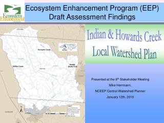
Project Status & Phase I Results. Presented at the Stakeholder Meeting Mike Herrmann, NCEEP Central Watershed Planner January 27 th , 2009. Phase I Activities & Products. Objective: Begin Characterizing Watershed Conditions Process:. Field and GIS inventory

E N D
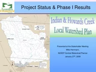
Project Status & Phase I Results Presented at the Stakeholder Meeting Mike Herrmann, NCEEP Central Watershed Planner January 27th, 2009
Phase I Activities & Products Objective: Begin Characterizing Watershed Conditions Process: • Field and GIS inventory • Delineate and characterize drainages • Assess Functions • Form stakeholder group • Review existing Monitoring data Products: • Critical data gaps identified • Goals for the LWP • Potential hotspots & projects • Monitoring & fieldwork plans • Preliminary Assessment Report
Phase I Assessment Functional Assessment
Phase I Assessment Habitat Function Assessment Factors • Diverse aquatic & terrestrial communities • Abundant and diverse microhabitat (sticks, leaf packs, logs, and root masses) • Limited embeddedness (covering of channel by fine sediment) • Stable streambanks • A variety of bottom substrate (sand, gravel, cobbles and boulders) • Stream canopy cover • Terrestrial habitat is abundant and provides adequate food and shelter • Promotes propagation of native and/or threatened species • Minimally fragmented forests • Forested wetlands and corridors *Bold specifies that the factor was part of the Phase I Assessment Hexastylis naniflora (Dwarf flowered Heartleaf).
Phase I Assessment Water Quality Function Assessment Factors • Chemical, pathogens, and sediments are not excessive • Riparian zones and wetlands and promote nutrient & sediment uptake • Stream maintains a hospitable environment for aquatic life • Attaining its designated use (e.g., biological integrity, recreation, or water supply) *Bold specifies that the factor was part of the Phase I Assessment
Phase I Assessment Hydrology Function Assessment Factors • Effective transport of water and sediment • Low bank-height ratios (vertical stability) • Reasonably stable streambanks (lateral stability) • Higher base flows, and lower peak flows • Promote groundwater recharge while storing floodwater flows and deposited sediment • Wooded floodplains to slow flood flows, reducing stress on streams • Upland areas also have higher amounts of forests, wetlands, or other permeable land cover that encourage infiltration *Bold specifies that the factor was part of the Phase I Assessment
Phase I Assessment Hydrology – Draft Results Forested floodplain & riparian area 100-year floodplain Floodplain Conditions, Middle Indian Creek
Phase I Assessment Subwatersheds
Phase I Assessment Watershed Functions Ratings • High-functioning: Watershed is functioning efficiently and is resilient to changes in the natural environment. • Functioning – at risk: Watershed functions are minimally achieved but have been diminished and are at risk to both natural and man-made alterations. • Low-functioning: existing conditions indicate that function is not being achieved.
Phase I Assessment Watershed FunctionsHydrology
Phase I Assessment Watershed FunctionsResults
Phase I Assessment Phase I Gaps Monitoring • How do streams compare to regional reference conditions? • How has drought affected aquatic biology? • Are water quality conditions in streams draining urban subwatersheds comparable to rural subwatersheds? • Are water quality conditions healthy upstream of Cherryville’s drinking water intake? • What are the stressors for the lower Indian Creek Impairment?
Phase I Assessment Phase I Gaps Stream and Wetland Conditions • Streambank Stability • Low bank-height ratios (vertical stability) • Microhabitat Condition (sticks, leaf packs, logs, and root masses) • Limited embeddedness (covering of channel by fine sediment) • A variety of bottom substrate (sand, gravel, cobbles and boulders) • Identification of Stream and Wetland Stressors • Identification of Natural Resource Assets • Assess Stormwater BMP opportunities in watersheds draining Cherryville.
Phase II – Detailed Watershed Assessment Phase II Objective: Complete assessments to characterize watershed and act on project goals. Activities • Instream Monitoring • Physical/chemical • Biological communities • Channel and riparian zone assessment • Stormwater BMP Investigation • Wetland Functional Assessments • Modeling the benefits of Restoration Practices/BMPs • Characterization of watershed condition and function • Phase II Detailed Assessment Report • DWQ Monitoring Reports (Water Chemistry, Biology, Wetlands) • Source Water Protection (SWP) Program activities • Activities to meet the Project Goals Products
Phase II Assessment Project Goals
Phase II Assessment Phase II Fieldwork Planning • Developing Fieldwork Plan • Entrix under contract to complete the following assessments
- - - - - - - - - - Project Timeline Winter 2008 Planning Process Begins Form Stakeholder Group Monitoring Begins Summer 2008 Develop Preliminary Findings Phase 1 Activities End Fieldwork (Stream, Wetland, Stormwater, Ag BMPs) Data Analysis/Summaries Winter 08/09 Water Quality, Biologic Monitoring Monitoring Summary Report Watershed Finding Reports Phase 2 Activities End Summer 2009 Final Reports • Atlas of Project Sites • Final Assessment and Recommendations Final Public Meetings Phase 3 Activities End Winter 09/10 Plan Implementation