Session II Nautical Charts
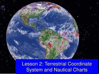
Session II Nautical Charts. Objectives. To become familiar with: data found on Nautical Chart and how it relates to GPS and the AtoN Program. the compass rose and variation error. The General Information Block how depths are depicted on a chart. the symbols and abbreviations on a chart.


Session II Nautical Charts
E N D
Presentation Transcript
Objectives • To become familiar with: • data found on Nautical Chart and how it relates to GPS and the AtoN Program. • the compass rose and variation error. • The General Information Block • how depths are depicted on a chart. • the symbols and abbreviations on a chart. • the scale of a nautical chart. • the horizontal and vertical datum on chart
One Minute of Latitude equals One Nautical Mile
SMALL SCALE CHART EVERYTHING APPEARS SMALL – less detail. 1:100,000 MEANS 1 INCH ON THE CHART IS 100,000 INCHES ON THE EARTH’S SURFACE. LARGE SCALE CHART EVERYTHING APPEARS LARGE – more details. 1:1,000 MEANS 1 INCH ON THE CHART IS 1,000 INCHES ON THE EARTH’S SURFACE.
A Large Scale Charts provides a smaller area and more details.
1:80,000 Small Scale 1:25,000 Large Scale
Harbor Chart 1:2,000 1:40,000
Chart Orientation • TRUE NORTH is at the top of the chart. • EASTis at the right-hand side of the chart. • WEST is at the left-hand side of the chart. • SOUTH is at the bottom of the chart.
SC - Small Craft Chart • The Small Craft Chart is the exception to the rule. • True North orientation is not at the top of this chart. • Use the Compass Rose to orient True North on a SC Chart.
The Compass Rose • Every chart has a least one Compass Rose. • The star on the Compass Rose points to True North. • The outer circle projects True North, • The inner circle projects Magnetic North.
Magnetic North is 013 degrees to the West in the New York area. • The difference between True and Magnetic North is called Variation Error. Variation changes yearly. • Variation Erroris printed in the center of the Compass Rose. • Many newer GPS units automatically adjust for Variation Error. Check your GPS manual!
Chart Number • Located at the bottom left-hand corner of a nautical chart. • Chart Number is the official document number for the chart. • Edition Number is also shown. • Date of last Update indicates the last time that the chart was updated.
General Information Block 1. TheName reflects the body of water covered by the chart. 2. Vertical Datum - definition of how depths are measured on the chart. • Feet, Meters, or Fathoms (6 feet). Calibrate your depth sounder to this Datum.
Horizontal Datum Refer to the General Information Block on your Nautical Chart for the horizontal datum.
MLW - Mean Low Water - is the mean or average of the all of the low tide projections for the area. • MLLW - Mean Lower Low Water is the mean or average of the lower tide projections for the area. • The lowest of the lows per day. • All US charts are being changed to this datum.
Cautionary Notes • A“Mean”is an average. Therefore, depths can be higher or lower than the printed depth shown on a nautical chart. • Depths are also affected by storms, the moon, and shoaling in the area. • Onshore winds can increase the depth of water. • Offshore winds can decrease the depth of water and/or delay its predicted depth time.
Depths found on nautical charts are best professional guesses. • Always usetwo methods for determining water depth. • A charted depth and a depth sounder are acceptable as long as the depth sounder is set to the vertical datum from the chart that you are using. • Before you start out on a trip, always calibrate (verify) the accuracy of your depth sounder.
Scale of the Chart-a ratio of inches on the chart to inches on the earth’s surface. • 1:40,000 means that 1 inch on the chart represents 40,000 inches on the earth’s surface. Heights of Objectsare measured in vertical datum above Mean High Water. • Clearance under bridges are measured up from the MHW projection. • Heights of lights are measured up from the MHW projection to the focal plane of the light.
Special Abbreviations and Notesare shown that are peculiar to the area. • Cautionary Notes-special notes of uncharted dangers in the area. • Special Tide and Current Information -any unique tide or current phenomena in the area is noted. • Magnetic Interferencein the area. • LORAN Interferencein the area. • Anchorage Areasin the area.
Soundings and Water Depth • Depth designations are shown with: • Numbers which reflect the vertical sounding datum. • Colors - shallow water is tinted a darker blue and deeper water is a lighter blue and white. • Contour Lines - a system of standardized symbols and abbreviations - dots and dashes.
Depths are expressed in: • Feet. • Meters. • Fathoms [Six Feet per Fathom] • All depths refer to the vertical datum of the chart.
Aids to Navigation • Symbols for floating buoys. • Diamond with a small circle. • Lighted ATONs show a magenta circle and a small circle. • Abbreviationsfor shape of buoys. • N - designates a nun or conical shaped buoy. • C- designates a can shaped buoy.
Abbreviations that indicate colorof the AtoN. • R= Red- Diamond symbol will be printed red. • G=Green- Diamond symbol will be printed green. • RW=Redand White.. • GR=Greenbuoy withRedband. • RG=Redbuoy withGreenband. • Y=Yellow - When AtoN is painted white or yellow, the diamond chart symbol is left white or blank.
Abbreviations for Lightcoloron Buoys: • R- Light isRed. • G- Light isGreen. • Y- Light isYellow. • When no color symbol is shown with a buoy, the light color is assumed to be white. • Other Features on Buoys: • Sound Signals - Horns, whistles, bells, and gongs. • RADAR Reflectors - reference is found only in the Light List.
Numbers -Nuns are even numbered and cans are odd numbered. • Letters -Used on non-lateral buoys. • Light Flash Characteristics - how the light flashes. Note: The numbers or letters, and the flashing characteristics on the Aid are printed on thenautical chart beside the chart symbol.
Chart Symbols CAN - Green Diamond with small watch circle
Symbols - Daymarks and Minor Lights Minor Light - Magenta exclamation mark (teardrop) with black dot Vertical letters used for fixed marks
Symbols for Light Houses and Other Fixed Aids. • Major Lights - Light Houses. • Black Dot with a Flare - looks like an exclamation point. • Name of Light appears on the Chart. • Shows height and range of light. • Small Lights - Fixed Lights. • Black Dot with a Flare - looks like an exclamation point. • Not named on the chart. • Will show height and range.
Fixed Aids Small Light Major Light
Ranges: • Consist of two daymarks or beacons. • Shows a dashed line in the direction of the range or safe water. • If not lighted, shows daymark symbols as squares or triangles. • Interpretation of panel colors is found in the front of the Light List. • If lighted, light symbols and flash characteristic appears on the chart. CAUTIONARY NOTE: Ranges are usually fixed on land, rocks, or shoals. Always use a nautical chart when transiting a range.
Isolated Danger Marks • Erected on or moored over a danger. • Horizontal bands of red and black. • White light. • Top mark of two black spheres. • Chart symbol has two black dots over the diamond symbol.
Daymarks - Day Beacons • Permanently fixed structures. • Uses square, octagonal or triangle panels to designate their use. • TRand small triangle. • Red - Even numbered -Redlight if lighted. • Treat as if a nun buoy • SQand small square. • Green- Odd numbered - Greenlight if lighted. CAUTIONARY NOTE: Do not pass close aboard (near) daymarks due to the danger of striking their foundation.
Other Charted Features • Prominent Landmarks • Water towers, smoke stacks, church spires, flag poles, public buildings. • Symbol is a circle with a dot indicating a highly surveyed position. • Great for taking bearings. • Circle symbol without a center dot is an approximate position. • Landmarks on private property are not plotted on nautical charts.
Wrecks, Rocks and Reefs. • May be shown as: • Symbol • Abbreviation plus a number. • Dashed or dotted line around a symbol. • Bottom characteristics • Symbol or abbreviation used alone or in combination. • Structures • Jetties, docks drawbridges, and ramps. • Some docks do not appear on a chart depending on the scale of the chart.
Coastlines • Identified at both high and low water. • Any prominent landmarks that may help you get a fix on your position may be shown. • Any details located a short distance from the shore line may not be shown. • Lettering on a Nautical Chart. • Vertical lettering indicates fixed objects. • Slanted lettering indicates floating objects.
Horizontal Datum • Accuracy and location is based on the survey that was made to generate the chart. • NAD27 • NAD83 • WGS-84 The datum has a major accuracy impact between your GPS Set and the nautical chart.. Your GPS set must be adjusted to reflect the datum of the Nautical Chart that you are using.
Criteria used to determine theaccuracy of a nautical chart.. • Source and date of the survey – and technology used at that time. • Amount of detail of the soundings in an area. • Blank spaces should be regarded with suspicion. • The term, “Dumping Ground”, indicates that material was dumped in the area and that soundings in this area have not been verified.
Chart Corrections • Local Notice to Mariners found on internethttp://www.navcen.uscg.gov/LNM/default.htm • Always start with the most recent LNM and work backwards • Temporary corrections are made in pencil • Permanent corrects are done in ink
Electronic Equipment Notes • Set your Depth Sounder to the vertical datum from your chart—feet, meters, or fathoms. • Set your GPS to the horizontal datum from your chart– usually WGS 84 in the US. • If your GPS does not have an automatic variation adjustment, set it for the Variation Error found in the nearest Compass Rose.
End of Session II