Three Norths for Nautical Navigation
Learn about Grid North, True North, and Magnetic North in nautical navigation. Understand variation and its importance in chart reading and compass steering. Practice using magnetic bearings for accurate navigation.

Three Norths for Nautical Navigation
E N D
Presentation Transcript
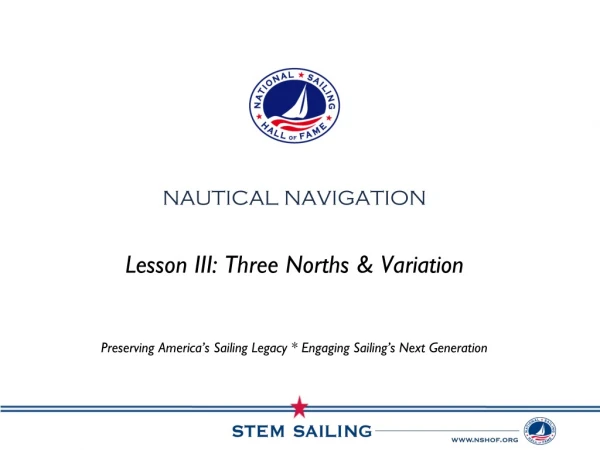
Lesson III: Three Norths & Variation Preserving America’s Sailing Legacy * Engaging Sailing’s Next Generation Nautical Navigation
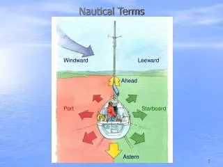
Three Norths • Grid North • True North • Magnetic North
Grid North • Refers to the direction northwards along the grid lines • The difference between grid north and true north is very small and can be ignored for most navigational purposes
True North • The north pole around which the world rotates • Where the lines of Longitude intersect • Also known as “geographic north”
Magnetic North • Where the needle on a magnetic compass points Why is it different than true north?
Magnetic North • Magnetic North is different than True North because of the magnetic field generated by the earth’s molten core • Magnetic field created by the constantly moving nickel iron fluid in the earth’s outer core • Does Magnetic North stay the same? NO! Moves ~ 25 miles/year
Variation • Also known as “magnetic declination” • The difference between True North and Magnetic North • Variation
Variation • A compass rose on a chart or map is used to measure the difference in variation • Look at your charts and find the compass rose Why does this matter to you as a navigator? • Outer Ring = True North • Inner Ring = Magnetic North
Variation • When converting True degrees => Magnetic degrees • “West is Best” (+) “East is Least” (-) • Example: • You are sailing offshore. You look at your chart and see that you want to steer 015o T • The Variation on the chart is 10o W • What course would you steer using a Magnetic Compass? • 025o M
exercise • Complete the following worksheet on variation calculations • Remember… • [Magnetic Bearing] = [True Bearing] + [Variation] • If the variation is East, subtract (-) • If the variation is West, add (+)