Download
1 / 26
260 likes | 357 Vues
Discover the diverse landscape of Costa Rica, from tropical rainforests to active volcanoes. Learn about the country's climate, wildlife, and geological wonders, including Arenal and Irazu volcanoes. Witness the impact of deforestation and the importance of conservation efforts in this rich ecosystem. Get ready for an immersive journey into the heart of Costa Rica's Earth Science!

E N D
Would you ever do this? II did!!!
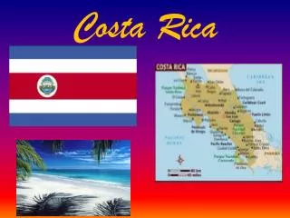
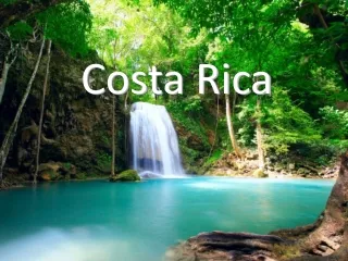
Costa Rica Background Costa Rica covers 19,730 square miles (51,100 km), which is smaller than West Virginia. About 60 % of Costa Rica is covered by different types of forests. Over 11 % of the land is reserved as national parks. This small nation has a diverse landscape of tropical rain forests, mountain cloud forests, volcanoes, green pastures, and beautiful rivers and beaches. Although the country lies entirely in the tropical climate zone, elevation changes allow for cooler temperatures in the central highlands. The coastal lowlands are hot and humid with temperatures averaging 81*F (27*C) throughout the year. Most people live at elevations where the climate is generally mild. In San Jose and other parts of the central valley highlands temperatures average 67*F (20*C) year round. Rainfall varies between the dry season (December-April) and the wet season (May-November). Costa Rica is also subject to earthquakes, hurricanes and volcanic eruptions.
Costa Rica Capital: San Jose
Before we get to Earth Science, how about a little Costa Rican bio…..
This plant thrives in excessive moisture and minimal sunlight. The floor of a rainforest does not receive much sunlight due to the canopy of trees hanging above.
This is another plant that does not require too many sun rays.
Walking Palm Tree Walking Palm Tree This tree will move a few centimeters in order to have access to a little insolation. Yes, it really walks!!!!!
Deforestation in action Deforestation involves the cutting down, burning, and damaging of forests. The loss of tropical rain forest is more profound than merely destruction of beautiful areas. If the current rate of deforestation continues, the world's rain forests will vanish within 100 years-causing unknown effects on global climate and eliminating the majority of plant and animal species on the planet.
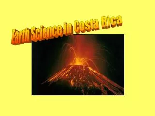
Onto the Geology ...
The Arenal Volcano Volcán Arenal is a stratovolcano which rises 1,657 meters above sea level and is situated in north-western Costa Rica (10.463N, 84.703W), 90 km north-west of San José. Less than 3,000 years old, this andesite-basalt volcano is Costa Rica's most active. On July 29th, 1968, after approximately 500 years quiescence, Arenal erupted explosively killing 78 people, and has since been continuously active. Arenal is one of seven historically active Costa Rican volcanoes.
After Arenal’s lava cools (solidifies) it turns into solid basalt rock. Massive amounts of basalt can be found miles away from the volcano. Lava is about 1000*C when it comes out of a crater.
Arenal has a volume of only 15 km3 and is the smallest but most active of seven historically active Costa Rican volcanoes. The tectonic setting of the volcano is disputed, with some authors suggesting that Arenal overlies a tear in the subducting Cocos plate and others believing there is a smooth transition in the orientation of the Wadati-Benioff zone, thought to lie 150 km below Arenal. The small truncated and dormant volcano, Cerro Chato, lies approximately three kilometres southeast of Arenal. Arenal is most likely directly tapping a lower to mid-crustal magma chamber, possibly located at a discontinuity which lies at a depth of 22 km.
This is Arenal Volcano viewed towards the northwest from a small town, by tourists and school kids. Arenal usually produces a small explosion every few minutes; larger eruptions occasionally occur. Most of the recent activity has occurred on the north side, away from this particular view, so the flanks visible here are mostly vegetated. If you look closely, however, you can see where both lava flows and pyroclastic flows have burned their way down the flanks.
Arenal was a dormant stratovolcano. Young deposits were of the slopes of the volcano but it had not erupted in historic time. Arenal's status changed dramatically in July of 1968. An explosive eruption produced hot avalanches and ejected blocks that devastated the west flank of the volcano. Arenal has been continuously active since 1968. This photo shows a slow moving lava flow on the west flank of Arenal.
Irazu Volcano The centerpiece of this national park is the highest active volcano in Costa Rica, Irazu, at 2,432 meters. It is because eruptions of this and other volcanoes that the soil of the Central Valley is so fertile. The Irazu National Park is remarkable because of its surreal lunar landscape.
The Irazu Volcano has three craters. The Principal Crater is 1050 meters in diameter and 300 meters deep. The Diego de a Haya Crater is 690 meters in diameter and 100 meters deep. It contains a small lime-green lake. Diego de a Haya Crater Crater # 1 Why is the crater lake green?
Irazu, the name of this subconical volcano, derives from an indigenous word meaning “thunder and earthquake mountain”. The Principal Crater Crater # 2
IRAZU Crater # 3 Irazu is a strato-volcano that towers 3,432 metres above sea level.
Volcanic Ash When volcanoes erupt finer material is convected upwards in an eruption column before settling out downwind to form volcanic ash fall deposits. Ash fall deposits are composed of various proportions of volcanic glass, crystal or rock particles. Volcanic glass can be glass shards or pumice derived from magma, while crystals are minerals developed in the magma. Different minerals reflect the composition of different magmas. The years following eruptions are bountiful, in large part due to the fresh load of minerals and trace metals delivered by the ash to the soil. In moderation, volcanic ash can be very beneficial, rejuvenating soils long exploited for crops.
EROSION DEPOSITION Remember this? Just some good old earth science review!!!
Sometimes the soil is too moist (saturated) and cannot support tree roots The waterfall is created by a very resistant rock surrounded by less resistant rock. Boring...
High Elevations Clouds forming all around .
Apparently in Costa Rica, wearing volcanic ash on your face is just like putting on insect repellant. Now for the fun stuff…
VOLCANO ASSIGNMENT Objective: Students will gain a better understanding of the United States geologic history. Your mission is to find information and report on a volcano that has erupted in the last 100 years.
Volcano name Type of volcano Location (city and state) Latitude and Longitude Name of nearest city Distance to nearest city Population of the city Other disasters caused by the eruption (earthquake, flood, mudslide, tsunami) The last page should be a speculation of what you would do if you were to be in charge of minimizing the risk to the public. Your Report Must Include: