Download
1 / 44
440 likes | 672 Vues
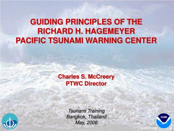
Richard H. Hagemeyer Pacific Tsunami Warning Center Regional/National Level of TARNS System CONOPS in the United States Charles S. McCreery, PTWC Director TSUNAMI ALERT RAPID NOTIFICATION SYSTEM (TARNS) FIRST WORKSHOP: SYSTEM DESIGN AND PLAN

E N D
Richard H. Hagemeyer Pacific Tsunami Warning Center Regional/National Level of TARNS System CONOPS in the United States Charles S. McCreery, PTWC Director TSUNAMI ALERT RAPID NOTIFICATION SYSTEM (TARNS) FIRST WORKSHOP: SYSTEM DESIGN AND PLAN 24-27 May, 2006, Sailom Hotel in Hua Hin, Thailand
JMA: NWPTAC & Indian Ocean (Interim) WC/ATWC AOR U.S./Canada Atlantic and Gulf Coasts HAWAII: Local, Regional, & Distant Tsunamis Puerto Rico & Virgin Islands & Caribbean (Interim) S. China Sea (Interim) PACIFIC BASIN: Regional and Distant Tsunamis Indian Ocean (Interim) PTWC Area of Responsibility
PTWC KEY OPERATIONAL ACTIVITIES • SEISMIC DATA COLLECTION & ANALYSES • TSUNAMI WAVE MEASUREMENTS • DECISION-MAKING PROCESSES • MESSAGE CREATION & DISSEMINATION
KEY OPERATIONAL GOALS • FASTER • MORE ACCURATE • MORE RELIABLE • MORE EFFECTIVE
DATA MESSAGE ALERT THE GENERAL CONCEPT Threat Evaluation Evacuation Decision Safety Response PTWC Designated Government Authority Public
TWO GENERAL CASES • Local Tsunami • Must Respond in Minutes from Earthquake • No Time for Official Decisions • Immediate Public Alerting Necessary • Automatic Public Evacuation Required • Regional or Teletsunami • Must Respond within a Few Hours at Most • More Time for Official Decisions • More Time to Alert and Instruct Public • Organized Evacuation Possible
PTWC OPERATIONS FOR A TELETSUNAMI
RESPONSE TIME TO ALARMS 2005: 30 SEC DURING NORMAL WORK HOURS 2 MIN DURING AFTER HOURS (FM QUARTERS) 2006: 30 SEC AT ALL TIMES (24X7 STAFFING) OPS CENTER QUARTERS 1 QUARTERS 2 QUARTERS 5 QUARTERS 3 QUARTERS 4
PACIFIC EVENT ALARMS SEISMIC SEA LEVEL * for areas with coverage
ANALYSTS REVIEW & REVISION (1-3 MIN) • VERIFY ITS A LARGE PACIFIC EARTHQUAKE. • SELECT FROM AUTOMATIC HYPOCENTERS. • REVISE HYPOCENTER WITH ADDITIONAL DATA. • INTERACTIVELY COMPUTE MAGNITUDES. • DECIDE BEST HYPOCENTER AND MAGNITUDE. • COMPARE TO CRITERIA AND ISSUE MESSAGE.
RADIO AFTN TALK RAYNET SIRENS GTS FAX EMAIL EMWIN TV ISSUE MESSAGE & ALERT PUBLIC PTWC Public Text Designated Agencies of Countries US Interests in the Pacific Hawaii Civil Defense
Designated Agencies must be prepared with an Operations Plan to respond quickly and alert the public when necessary based upon the information received from PTWC and any supplemental data or information they may receive. This could include advice from local experts.
PTWC OPERATIONS FOR A LOCAL HAWAII TSUNAMI
HAWAII LOCAL TSUNAMI THREAT REPEAT OF 1868 OR 1975 ~15 MINUTES TRAVEL TIME HILO KONA
HAWAII REGIONAL TSUNAMI THREAT SOUTHWEST COAST EVENT HONOLULU ~30 MINUTES TRAVEL TIME
HAWAII EVENT ALARMS SEISMIC SEA LEVEL
RESPONSE TIME TO ALARMS NOW: 30 SEC DURING NORMAL WORK HOURS 2 MIN DURING AFTER HOURS (FM QUARTERS) 2006: 30 SEC AT ALL TIMES (24X7 STAFFING) OPS CENTER QUARTERS 1 QUARTERS 2 QUARTERS 5 QUARTERS 3 QUARTERS 4
ANALYSTS REVIEW & REVISION (1-3 MIN) • VERIFY ITS AN ACTUAL LOCAL EARTHQUAKE. • SELECT FROM AUTOMATIC HYPOCENTERS. • REVISE HYPOCENTER WITH ADDITIONAL DATA. • INTERACTIVELY COMPUTE MAGNITUDES. • DECIDE BEST HYPOCENTER AND MAGNITUDE. • CHECK RUNUP AND SEA LEVEL DATA. • COMPARE TO CRITERIA AND ISSUE MESSAGE.
State & County Emer Ops State & County Warning Pts HAWAS EMAIL FAX NWR SIRENS EAS Honolulu Forecast Office ISSUE MESSAGE & ALERT PUBLIC PTWC Public Voice Text
The Public must be educated to respond immediately based upon having felt shaking from the earthquake and upon hearing sirens, EAS, or NWR alerts. There is no time to verify the warning or wait for instructions.
100% OPERATIONAL RELIABILITY • POWER: All operational systems on a central UPS backed up by a generator with one week of fuel. • CENTER HARDWARE: Hardware duplicated into primary and redundant systems. • DATA SOURCES: Seismic and sea level data come from multiple sources. • DATA COMMUNICATIONS: Data is sent to PTWC over multiple links whenever possible.
100% OPERATIONAL RELIABILITY • DATA PROCESSING: Multiple algorithms for EQ detection, alerting, locations, magnitudes, and model guidance. • MESSAGING: Multiple dissemination methods to reach designated contact points by multiple means. • DUTY PERSONS: Two persons always on duty on the Center compound. • BACKUP CENTER: PTWC and WC/ATWC provide backup service for each other.
LONG TERM SUSTAINABILITY • NATIONAL SUPPORT: National commitment to Center operations. As a part of the US National Weather Service, certain resources and expertise are shared with this organization that also does 24x7 monitoring of the environment and issues advisories, watches, and warnings. • ORGANIZATIONAL SUPPORT: Organizations of stakeholders such as ITSU (international), NTHMP (national), and TTRC (local) that include emergency managers, warning center operators, and scientists provide authoritative sustained focus on tsunami issues.
LONG TERM SUSTAINABILITY • MULTI-FUNCTION SEISMIC: Seismic stations operated by multiple organizations for multiple purposes including earthquake monitoring, volcano monitoring, and geophysical research. • MULTI-FUNCTION SEA LEVEL: Sea level stations operated by multiple organizations for multiple purposes including tides, storm surge, El Niño, and long-term sea level rise. • MULTI-FUNCTION COMMUNICATIONS: Data communications methods shared when possible. Message disseminations over multi-purpose circuits such as GTS, AFTN, EMWIN.
Components of a Tsunami Resilient Community RESEARCH RESEARCH HAZARD AND RISK ASSESSMENT PREPAREDNESS AND RESPONSE Historical Data x Vulnerability = Risk Government Policy Makers Emergency Managers And Scientific Advisors Tsunami Sources Numerical Models Bathymetry Topography TSUNAMI RESILIENT COMMUNITY Forecast Models Inundation and Evacuation Maps WARNING GUIDANCE Sea Level Observations: Coastal and Deep Ocean Education, Training, and Outreach Tsunami Warning Centers Forecasts And Warnings Seismic Observations Mitigation Other Observations Response Plan