Download
1 / 15
160 likes | 384 Vues
Direction and Grid Systems. Pineda. Compass Rose. What do you know about directions? N- Never (North) E – Eat (East) S – Soggy (South) W – Wieners (West)

E N D
Direction and Grid Systems Pineda
Compass Rose • What do you know about directions? • N- Never (North) • E – Eat (East) • S – Soggy (South) • W – Wieners (West) • These are the four principal or Cardinal points found on the compass rose. This might be great for travelling up to Grand Beach or out to Toronto, but what about all of those other places in between?
Compass Rose • There is a set of ordinal points found halfway between each cardinal point called the ordinal points. These indicate • NE –North-East • NW – North-West • SW – South-West • SE – South-East
Compass Rose • There is a further subdivision between the cardinal and ordinal points that indicate directions such as North-North East that can be found between North and North-East. • NNE SSW • ENE WSW • ESE WNW • SSE NNW
Compass Rose • Degrees, from 0˚-360˚, on the compass rose, called compass bearings, provide a more accurate direction than Cardinal Points because they measure the angle of the direction in relation to the North, moving in a clockwise direction.
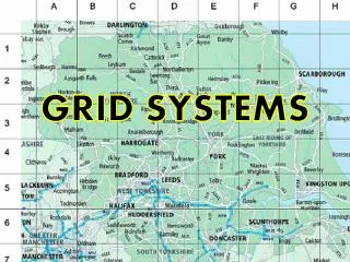
Alphanumeric Grid System • Have you ever used a Winnipeg transit map to get anywhere in the city? • Winnipeg Transit uses alphanumeric maps to show the public their routes throughout the city.
Alphanumeric Grid System • Alphanumeric grid maps are maps that use both letters and numbers to identify squares in a grid pattern. • The letters are found on one side of the map, while the numbers are found on the other side. • Alphanumeric grid maps are often used on road maps.
Alphanumeric Grid System • See figure 3-2 and answer questions 1-10 on pg. 30
Alphanumeric Grid System 1. L19 – Minor Airport, Principal use Highway, gravel use Highway 2. A) M20 B)L18 3. Whitewater Lake
Alphanumeric Grid System 4. 750m 5. A) Minnedosa B) The size of the name 6. Hwy19, Hwy 21, Hwy 1
Alphanumeric Grid System 7. Holiday Mountain M20 8. Hwy 10, M18 9. A) With 2 arrows and the number in-between B) i)100 km ii)151 km iii)209 km
Alphanumeric Grid System • Deloraine – 50km, Boissevaine – 48km Boisevaine would be closer
Map (Military) Grid System • The Map Grid, or Military Grid System was developed and used by Britain in WW1 • Vertical lines run from top of the map to the bottom of the map called easting. These vertical lines are numbered with a 2 digit number. • Eg. 81/82/83 • The number refers to the column to the right of the vertical numbered line.
Map (Military) Grid System • Horizontal lines run across the map from the left of the map to the right called northing. These horizontal lines are also numbered with a 2 digit number. • Eg. 09/10/11 • The number refers to the row above the horizontal numbered line. • To identify the square on the map, combine the easting and northing numbers.
Map (Military) Grid System • Do #1 at the top of the page on page 31 • 1. 8108 • 2. 8206 • 3. 8309 • 4. 8305 • 5. 8407 • 6. 8505