Download
1 / 43
430 likes | 786 Vues
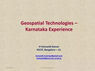
Geospatial Technologies – Karnataka Experience H Hemanth Kumar KSCST, Bangalore – 12. hemanth.h.kumar@gmail.com hemanth@kscst.iisc.ernet.in. Outline of presentation Geospatial technologies (NRDMS) in Karnataka Development of Karnataka GeoPortal Decision support system for governance.

E N D
Geospatial Technologies – Karnataka Experience H Hemanth Kumar KSCST, Bangalore – 12. hemanth.h.kumar@gmail.com hemanth@kscst.iisc.ernet.in Karnataka Geoportal
Outline of presentation • Geospatial technologies (NRDMS) in Karnataka • Development of Karnataka GeoPortal • Decision support system for governance Karnataka Geoportal
Karnataka NRDMS program Initiated : 1992-93 Funding : DST - GOI and GOK. Karnataka Geoportal
Objectives: • Demonstrate and promote the use of Spatial Data Technologies at micro level to support decentralised planning process in all the districts of the State. • Provide software support for data management, modeling and user defined applications. • Promote research, development and dissemination in spatial data technology • To develop decision support system for end users • To organise training programs and workshops to create awareness among end-users. • Provide S & T inputs for framing Policies related to spatial data technology. • Develop & Demonstrate Karnataka GeoPortal to support Karnataka NRDMS program. • Documentation and dissemination. Karnataka Geoportal
Agro-Climatic Zones Taluk/District Boundary District Head Quarters Division Boundary Division Head Quarters Geology Meteorological Station Parliamentary Constituencies Legislative Assembly Constituencies Rail network Reservoir Rain gauge Station River Drainage Basin Boundary Catchment Boundary Sub catchment Boundary Subdivision Boundary Sub watershed Boundary Tanks National Highway State Highway Major district road Other District Roads Village roads Airport etc., State Level Data Karnataka Geoportal
Non spatial Database 2001 Census Data (part I and part II) Samanya Mahiti data – 21 sectors -357 fields (Infrastructure & Developmental activities-Habitation wise) – Part of the data has been integrated. District line department data
Development of Karnataka GeoPortal • To develop a web based Geo Portal to acquire, process, store, distribute and improve the utilization of geo spatial data • Data clearing house - Gateway for spatial data generated by various agencies in the State. Karnataka Geoportal
SDI Spatial Data Infrastructure (SDI) is the collection of technologies, policies, standards, human resources, and related activities necessary to acquire, process, distribute, use, maintain, and preserve spatial data. Karnataka Geoportal
Development of KSSDI Portal • Inventory of databases • Functional requirements of website/portal • Notification of Expression of Interest (EOI) • Pre-bid meeting with Industry/agencies • Preparation of Request for proposal (RFP) • Technical bid (scope of work) • Financial bid (hardware/software/networking/development etc.) • Invitation to bidders – RFP • Evaluation of technical bids • Short listing of bidders • Evaluation of financial bids • Identification of bidder for implementation • Technical committee for monitoring project implementation • Stakeholders meeting – formulate policies/standards Karnataka Geoportal
Stages of Portal development • Requirement analysis • Real world object catalogue • Conceptual Data Model • Centralized database • Publishing metadata • Creation of Geo-portal • Customization of software for creation of Geo-portal • Security system to handle data, identity & network • Testing of the Geo-portal/ database/ services • Final deployment of the complete system • Training • User acceptance testing • System maintenance for three years Karnataka Geoportal
Karnataka GeoPortal Services: • Map viewer - Web Map Service (WMS), • Product catalogue/metadata - Catalogue Service on • Web (CS-W), • Services specific service/ feature data sets - Web Feature • Service (WFS), • Simple Applications (Query based decision support) • Coverage services/images - Web Coverage Service (WCS) • Search and Discovery • Help/support Karnataka Geoportal
Karnataka GeoPortal’s – Login Page • The Geo Portal provides the site overview and secure access through login to the geospatial content and features of the SDI.
User requirements/Applications Selective List Karnataka Geoportal
User requirements/Applications Selective List … Karnataka Geoportal
Understanding processing Karnataka Geoportal
Village with Primary Health Centres (PHC) Karnataka Geoportal
Real World Object Catalogue Layer/Dataset – Real World Object Properties KSSDI Real World Object Catalogue Comprises • Hierarchy and Classification of Datasets: • Real World Objects: Based on the hierarchy, the datasets are identified as the real world objects. Each dataset is categorized as a real world object defining its type, category, scale, definition, source and finally its attributes are designed for the future use. Layer/Dataset Real World Object - Properties Physical Data Model Karnataka Geoportal
KSSDI Data Model Karnataka Geoportal
Karnataka GeoPortal’s – Home Page • On Login into the Geo Portal, the user have access to the various modules of the SDI.
Karnataka GeoPortal’s – Map Viewer • Geo Portal Map Viewer module by default displays State Division and District Boundaries • The Layer Tab on the left pane displays the list of layers that can be made visible at various map scales. • User also have the ability to switch ON or OFF layers by using the Eye icon against each layer. • The General Map Viewing tools available are: Zoom, Pan, Full view, Previous and next view, Identify, Measure, Refresh and Load context. It also provides the scale bar, X Y coordinates, SRS (Spatial Reference System) and Over View Map display along with Google Map layer display.
Karnataka GeoPortal’s – Map Viewer • Add Layer Tab allows user to search for the available services through “Key Word Search” or “Spatial Extent ” using the Select Tool from the Toolbar. • The Resulted services will be displayed and by clicking “View on Map”, the selected layer gets displayed on the current Map Viewer. • Note: The current map displays the Division & District boundary with the State National Highway Layer resulted in the search above.
Karnataka GeoPortal’s – Map Viewer 3 • The Query Module provide option to query on attributes, spatial or combination of them to generate desired results. • The Application query sub module can be used to create and store commonly used queries that are regularly used for planning and decision making purpose. • Note: The current map viewer shows the Query on District Layer, Highlighting the districts with SC Population greater than 30%.
Karnataka GeoPortal’s – Map Viewer 25000 The Attribute Query Sub Module provides the ability to select multiple layers with or without spatial join and operators with input values to generate results and view them too on map. Note: The current map viewer shows the Query on District Layer, Highlighting the Districts with TOTAL ST POPULATION > 25000.
Karnataka GeoPortal’s – Map Viewer The Export module allows the user to select a specific layer for export to GML and SHAPE file format. Note: The above screen shot shows Export of District layer to GML.
Karnataka GeoPortal’s – Catalog Product Catalogue allows user to search the Published Web Services (WMS/WFS/WCS) in the KSSDI Data Repository. It presents the Metadata of the selected Layer (NSDI Metadata Standard 2.0). Also allows a user to all the layers to cart.
KBP – GIS Map Viewer Map Viewer showing the Legend, Overview Map and Map Navigation Tools
KBP – GIS Map Viewer • Map Viewer showing the Search which extends to District, Taluk and Village Biogas Plants Details. • Select District/ Taluk/ Village, the Map zooms to the respective area and Click on the Show Result Button to view the BGP Details of the same.
KBP – GIS Map Viewer • Similar Example of UDUPI District • Map Viewer showing the Selection UDUPI District and Map on the fly zooming to UDUPI District.
Education Information System Karnataka Geoportal
2nd phase planned activities • Development of web based real-time geospatial applications/decision support system for selected departments to support informed decision-making. • To standardize storing and sharing the data/metadata through the Karnataka Geo-portal to facilitate data access and discovery on Survey of India framework data. • Development of multi-lingual search facility
Acknowledgement KSSDI Technical Committee Prof. K.N. Ganeshaiah –Professor, UAS, GKVK – Chairman Dr. R. Krishnamurthy – PRS, SERC, IISc - Member Mr. S.N. Sondur - Fellow, KSCST - Member Mr. U.T. Vijay - Project Engineer, KSCST - Member Mr. H. Hemanth Kumar - Fellow, KSCST - Member Secretary Special Invitees Prof. M.S. Mohan Kumar, Secretary, KSCST Prof. M.K. Surappa – Former Secretary, KSCST Prof. Y. Narahari - Computer Sc. & Automation Dept. IISc Mr. P.S. Acharya - Director – NRDMS, DST, GOI Mr. A.R.Shivakumar, Former Executive Secretary i/c, KSCST Dr. M.Prithviraj - Executive Secretary , KSCST Karnataka Geoportal