Download

1 / 14
150 likes | 402 Vues
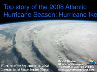
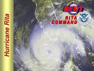
ORLEANS parish: Rebuilding a community Post hurricane Katrina . By: Vernessa Shih Fall 2012 Midterm. PP M224A GIS Professor Kawano. Hurricane Katrina August 23, 2005 to August 31, 2005 FEMA Locations ORLEANS PARISH POPULATION DENSITY Lower Ninth Ward

E N D
ORLEANS parish: Rebuilding a community Post hurricane Katrina By: Vernessa Shih Fall 2012 Midterm PP M224A GIS Professor Kawano
Hurricane Katrina • August 23, 2005 to August 31, 2005 • FEMA Locations • ORLEANS PARISH • POPULATION DENSITY • Lower Ninth Ward • Comparing Neighborhoods How has the rebuilding/repopulating of Orleans Parish changed from Pre-Katrina conditions?
FEMA Regions 4, 5, 6 Federal Emergency Management Agency, FEMA REGIONS, HEADQUARTERS, and HURRICANE KATRINA EFFECTED STATES
Focus Area: Lower Ninth Ward Source: ESRI, Google Earth
Comparing Neighborhoods - 2000 Source: ESRI, CENSUS
Comparing Neighborhoods - 2010 Source: ESRI, CENSUS
Hypothesis/Discussion • Lower Ninth Ward • Insurance values of home • Local discrimination • Effects of insurance pay out discrimination on the population of returning Black/African American Residents • Commission on Discrimination in Federal Funding is halting all pay outs • Studying Levees, FEMA reactions • New investments in green building technology
THANK YOU! Interested in finding out more? Check out Rebuilding Together and the Make it Right Foundation
Final Proposals Racial Discrimination in Insurance Pay outs Potential parallels with Hurricane Sandy? New Jersey Cabs “Famous” Jersey Shore 86th Street Station
Mad Skillz Sources: ESRI/Social Explorer NASA CENSUS.gov/American Fact Finder National Oceanic and Atmospheric Administration FEMA GOOGLE EARTH US Geological Survey Greater New Orleans Community Data Center Regional Planning Commission for New Orleans City of New Orleans • Inset map – US, Louisiana, Orleans • Point or line graduated symbol – graduated colored symbols, Hurricane Katrina Categories • Geoprocessing – Clipping • Geoprocessing – Joining • Geocoding – FEMA Locations • Google Earth – KML/KMZ • Custom Shape files– Water boundaries for Orleans Parish • Comparison Charts/Graphs