Automated Weather Systems
170 likes | 409 Vues
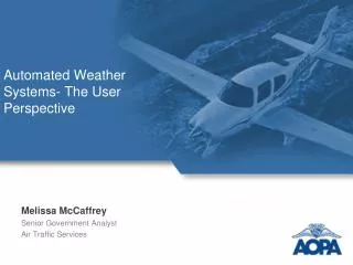
Automated Weather Systems. Presented to: Friends and Partners of Aviation Weather (FPAW) By: Paul Armbruster. Terminal Requirements, AJT-2C1 Date : 2 August 2012. ASOS/AWOS Overview. Background Automated Weather Observing Systems Fed-AWOS Non-Fed AWOS ASOS Review/Questions.

Automated Weather Systems
E N D
Presentation Transcript
Automated Weather Systems Presented to: Friends and Partners of Aviation Weather (FPAW) By: Paul Armbruster. Terminal Requirements, AJT-2C1 Date: 2 August 2012
ASOS/AWOS Overview • Background • Automated Weather Observing Systems • Fed-AWOS • Non-Fed AWOS • ASOS • Review/Questions
Automated Wx Systems • While automated observing systems have been in use since the1960s and 1970s these systems reported only elements that could be directly measured: ambient and dew point temperature, wind (speed and direction), and pressure. Sensor technology was not sufficiently developed to measure elements such as sky condition and visibility. By the early 1980s
Automated Wx Systems • Benefits: • collects, processes and displays meteorological data; • performs automated generation and transmission of meteorological reports; • supports a wide range of sensor configurations; • supports a variety of data communication options; • manages all communication protocols for the various sensors and other associated data communication equipment; • stores all relevant data for immediate or future retrieval as required; • allows manual input of additional information unable of being automatically measured; • provides the first level of quality control on both data measurement and message generation, and • allows authorized users to access data remotely;
Automated Wx Systems • Disadvantages: • Limited area representation, an area of about 3-5 km around the sensor site; • It is not possible to observe all parameters automatically, for example snow depth, snow water equivalent , volcanic ash and others;
All Weather Systems • Currently: • 537 Non-Fed AWOS Systems • 198 Fed AWOS Systems • 874 ASOS Systems • Total – 1609 Automated Weather Systems
Non-Federal AWOS • All non-Federal AWOS systems must be submitted to AJW-1444 in Oklahoma City for certification • The AWOS system must be certified prior to proposal to install/installation at any aviation location-airports, heliports, helipads (including medical) and where the system altimeter is intended for aviation. • Manufacturers may operate test facilities prior to FAA certification
Non-Federal AWOS • Certification Standards are in Advisory Circular (AC) 150/5220-16, AWOS for non-Federal Applications • All proposals to install must be coordinated with the appropriate non-Federal Program Implementation Manager (PIM) • ESA Gail Hackbart or Patricia Graham • CSA Robert Tomko • WSA Christian Yaden
Non-Federal AWOS • Ground Inspection by Technical Operations Field Personnel is Required • Operation, Maintenance and non-Federal Technician Requirements are also in AC 150/5220-16 • Sponsor of the non-Federal AWOS must sign a Memorandum of Agreement (MOA) and Operations and Maintenance Manual (OMM) with FAA
Non-Federal AWOS • non-Federal Technicians Maintaining the non-Federal AWOS Must Have Verification Authority Issued by the FAA • non-Federal Technicians Must Have or Obtain a Federal Communications Commission (FCC) General Radiotelephone Operator License
AWOS • AWOS System Definitions1 • AWOS A Altimeter setting • AWOS A / V Altimeter setting, visibility • AWOS I Wind speed, wind direction, wind gust, variable wind direction, temperature, dew point, altimeter setting, and density altitude • AWOS II Same as AWOS I plus visibility, and variable visibility • AWOS III3Same as AWOS I plus visibility, variable visibility, cloud height, and sky condition • AWOS IIIP3 Same as AWOS III plus present weather identification • AWOS IIIT3 Same as AWOS III plus thunderstorm/lightning reporting • AWOS III P/T3: Same as AWOS III plus present weather identification and thunderstorm/lightning reporting • AWOS III P/T/Z: Same as AWOS III plus present weather identification, thunderstorm/lightning reporting, and freezing rain detection • AWOS IV3: Same as AWOS III plus present weather identification, thunderstorm/lightning reporting, freezing rain detection, and runway condition detection
AWOS • AWOS System Definitions1 • Notes: • These system definitions are based on information found in FAA Advisory Circular (AC) 150/5220-16C, • In addition to providing the identified certified information, AWOS systems may also provide additional, uncertified ("Advisory") information. • Advisory weather parameters are not verified or certified by the FAA. • Any uncertified weather information (measured or calculated), e.g. density altitude or wind speed and direction on an AWOS A system, is advisory and must be preceded by the word, "Advisory" in all automated verbal transmissions (radio or phone line). • Advisory sensors may or may not be located in accordance with the siting criteria, Order 6560.20. • Advisory parameters may or may not adhere to the criteria (definitions, accuracy, reliability, etc.) identified in FAA Advisory Circular 150/5220-16C.
AWOS • AWOS System Definitions1 • Notes: • In accordance with FAA Advisory Circular 150/5220-16C, non-Fed AWOS systems meeting the AWOS III (or better) criteria may be eligible for dissemination of certified weather information nationally via the ADAS. Please refer to the advisory circular as additional criteria do apply. • A waiver to Buy American Preference Requirements on AIP projects through December, 2012 was issued to Vaisala for AWOS I, II, III and above on December 27, 2007. All Vaisala AWOS III or above may include runway condition sensors. (The waiver excludes the Vaisala AWOS A and A/V, which are certified.) • The AWOS-II is certified to provide AWOS-A/V information (altimeter setting and visibility).
Automated Surface Observing System (ASOS) • The ASOS program began in the early 1980’s with the procurement starting in 1990. • The ASOS program implemented a flexible and modular unit to monitor the weather automatically. Using up-to-date technology, these systems, deployed across the country in the early to mid1990's, automatically acquire, process, store, format, and distribute weather observations like atmospheric pressure, temperature, visibility and precipitation.
Automated Surface Observing System (ASOS) • Criteria for ASOS establishment at an airport: • Only airports with hard surface runway(s) (Except Alaska) • Air Traffic Counts: GA, AT, AC, MIL • Airport Special Usage: Military, Medical Evacuation (only where traffic count is available) • Airport characteristics – towered/non-towered, CWO, FSS/AFSS… • Remoteness • Presence of Hazardous Weather Conditions • Availability of non-precision and/or precision approach • NEXRAD coverage – points given for non-coverage • Proximity to other weather reporting stations – higher points for reduced density of stations • Whether the airport meets National Plan of Integrated Airport Systems (NPIAS) criteria that allows them to qualify for AIP funding.
Automated Surface Observing System (ASOS) • ASOS Service Standards • The ASOS Airports were ranked by using a composite score based upon weighted objective criteria: • Bad Weather Score (∑ of % of time Thunderstorms, freezing/frozen precip, visibility ≤0.5nm impact airport multiplied by total operations at the airport) - Score range: 0-18. • Distance to nearest alternate airport - Score range: 0-5. • Airport characteristics score - Score range: 0-13. • Grand Total Score - Score range: 0-36. • Service Levels: (simplified) • A - Composite Scores 9 and above • B - 8 • C – 7 • D – 6 and below
Automated Surface Observing System (ASOS) • Currently 874 ASOS commissioned: • Service Level A – 72 • Service Level B – 60 • Service Level C – 302 • Service Level D - 440