Download
1 / 58
580 likes | 739 Vues
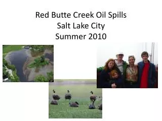
SALT LAKE CITY DEPARTMENT OF PUBLIC UTILITIES Red Butte Creek Riparian Corridor Study Public Workshop 3 May 14, 2009 Facilitated by BIO-WEST, Inc. Workshop Presentation Outline. Review of Workshops 1 and 2 Purpose/Need of Study Study Plan and Schedule Riparian Area Definition

E N D
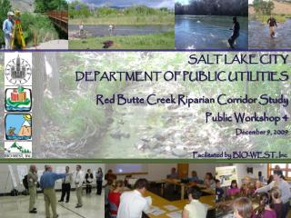
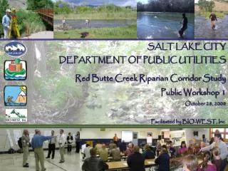
SALT LAKE CITY DEPARTMENT OF PUBLIC UTILITIES Red Butte Creek Riparian Corridor Study Public Workshop 3 May 14, 2009 Facilitated by BIO-WEST, Inc.
Workshop Presentation Outline • Review of Workshops 1 and 2 • Purpose/Need of Study • Study Plan and Schedule • Riparian Area Definition • Riparian Corridor Functions • Baseline Assessment • Recommended Types of Improvement Projects • What is our collective vision for the Red Butte Riparian Corridor
Why is SLC Conducting This Study? • To assess current conditions • To determine desired future conditions • To identify opportunities for restoration and remediation of Red Butte Creek
Why is SLC Conducting This Study? • To use the information, data, and maps developed during the study to inform planning, permitting, and administrative processes of the Riparian Corridor Overlay District Ordinance (RCO)
What Will the Riparian Corridor Study Management Plan Include? • Statement(s) of desired future conditions • Identification of restoration and remediation projects • Cost analysis and ranking of projects • Identification of project funding mechanisms • Presentation of best management practices • Inventory of GIS-based information • Continuation of public outreach
What Does a Riparian Corridor Study Involve? Salt Lake City Public Utilities BIO-WEST • Baseline Condition Assessment • vegetation • stream condition • Historical and Current Trend Assessment Planning & Public Outreach public workshops (four) subcommittee/stakeholder meetings (quarterly) web site comment form Management Plan / Desired Future Conditions
Timeline and Milestones Identify Improvement Projects High Flow Field Evaluation Historical Trend Assessment Draft and Final Mgt. Plans Field Evaluation Fall 2008 Winter 2009 Spring 2009 Summer 2009 Public Workshop 1 Public Workshop 2 Public Workshop 3 Public Workshop 4
Riparian Area Definition: (Illustration by G. Zaimes; based on BLM 1991). • Zone of influence between aquatic and upland areas • Sometimes defined as including channel, floodplain, and transition zone
Riparian Corridor Functions: • Wildlife and Aquatic Habitat • 60% of vertebrate species in arid Southwest rely on riparian areas (Ohmart and Anderson 1982) • Shading and Water-Temperature Control • Aesthetics • Recreation and Open Space • Floodplain Storage and Flood Damage Reduction
Riparian Corridor Functions: • Wildlife Travel Corridors/Connectivity • Organic Matter Inputs • Stream Stability/Safety • Pollution and Nutrient Filtration • Storm Water and Irrigation Water Conveyance
Baseline Assessment Results Review • Aesthetics Function – Litter • Wildlife Habitat Function – Invasive Plants • Filtration Function – Lack of shrub and understory cover • Stability Function • Erosion from storm runoff and drain outfalls • Scour around concrete • Culverts narrower than channel width • On-going stream channel adjustments • Altered hydrology
Improvement Projects: Working Toward Solutions • Riparian Corridor Projects • General Projects • Appropriate at any scale • Local-scale Projects • Relevant to specific individual locations or features (storm drain, culvert, etc.) • Reach-scale Projects • Stream bed and bank stability should be addressed at this scale • Watershed-scale Projects Figure from SLCO 2009
General Projects : Stream Cleanup • Volunteer stream cleanup • Organize a group to pick up trash along specific portions of the riparian corridor • Mechanized trash cleanup • Heavy, over-sized items requiring mechanical equipment to remove • Stream adoption • http://www.adoptawaterbody.utah.gov/ • Continued public outreach From adoptawaterbody website
General Projects: Weed Management • Weed Management and Revegetation • Improve Habitat and Filtration Functions • Weed-Management Techniques • Physical • Cultural – replant with desirable species • Biological • Chemical (herbicides) • Salt Lake County Natural Areas Plan • Includes detailed information sheets by species http://www.recreation.slco.org/planning/natural.html
General Projects : Weed Management • Non-native invasive species common in riparian corridor but not on State or County “noxious weed” lists • English ivy and periwinkle • Shallow root systems = poor stabilization • Low stem density = poor filtration • Exclude other plants • Habitat for rodents • Siberian elm • Russian olive • Tamarisk • Tree of heaven
General Projects: Revegetation • SLC Riparian Corridor Recommended Plant List • Four lists according to mapped vegetation community type • Canopy, shrub, understory species • Species appropriate for sun, shade, part sun/shade • Planting Techniques • Site and seedbed preparation • Seeding/planting guidelines • Protection from herbivory • “Fire-wise” plants – http://www.utahfireinfo.gov/prevention/firewiseplants.pdf
General Projects: Revegetation • SLC Riparian Corridor Recommended Plant List
General Projects: Revegetation • General techniques appropriate for slopes 3:1 and flatter • Use geotextile for 3:1 to 2:1 • Steeper than 2:1 requires structural/ engineered techniques
General Projects: Revegetation • These general revegetation techniques are recommended for: • Areas where invasive species have been removed • Areas disturbed by construction activities or utility installation • Areas impacted by foot traffic, where future traffic has been redirected or otherwise addressed • NOT adequate for: • Slopes steeper than 2:1 • Areas that are unstable due to stream erosion processes • Areas that are unstable due to poorly controlled runoff • Need to understand why an area is not well vegetated
General Projects: Bioengineered Slope Stabilization • Use on slopes 2:1 or steeper • Can be applied at various scales when slopes to be treated are above the AHWL • When slopes extend to the AHWL and below, treatments should be applied at the reach scale and incorporate toe protection and grade control!
General Projects: Bioengineered Slope Stabilization • Tiered vegetated cellular grids Photos from NCHRP 544
Local-scale Projects: Outlet Protection • Recommend rock and vegetation rather than concrete • Stabilize conveyance channel as well as outlet
Local-scale Projects: Outlet Protection • Provide a stable path over entire distance from pipe outlet to creek • Vegetated rock-lined swale is recommended to provide some water quality treatment • Where possible, avoid locating outlets within the active channel where they are subject to scour and channel change
Local-scale Projects: Outlet Protection • Techniques appropriate for: • new storm drain outfalls • retrofits of existing outfalls that are in poor condition • high-priority locations for retrofits are identified on project maps
Local–scale Projects: Stream Crossings • These recommendations are applicable to new crossings and crossing replacements • Bridge spanning full width of channel and active floodplain
Local-scale Projects: Stream Crossings • Box, arch, or large-diameter culvert with natural substrate bottom • Open-bottom or bottom “fitted” with rock substrate • Improved stability, conveyance, connectivity, and habitat functions relative to small-diameter culverts • Reduced risk of clogging Deer Creek Highway 189 crossing
Reach-scale Projects: Bed and Bank Stabilization • Use in areas within the AHWL, where conditions are affected by stream- channel adjustments • streambed lowering • bank scour • channel migration
Reach Projects: Bed and Bank Stabilization • Should implement comprehensively through reach from “hard point” to “hard point” • “Local” scale approaches in adjusting reaches are unlikely to be long lasting • “Local” scale stabilization often just sends the problem elsewhere
Reach Projects: Bed and Bank Stabilization • Things to avoid: • Treatments that protrude into the active channel and reduce width between banks • Concrete or other smooth, impervious treatments • Use of “hard” (nondeformable) bank treatments within acceptable meander zone • Use of “hard” bank treatments above toe and lower bank zones
Reach Projects: Bed and Bank Stabilization • DO: • Give the stream as much width to adjust as possible • Incorporate vegetation to the greatest extent possible • Aesthetics • Habitat • Filtration/Water Quality • Protect toe of bank to expected scour depth • Incorporate grade control with bank stabilization
Reach Projects: Toe Protection • Subexcavate to maximum depth of scour • Install rock sized to be immobile during flood flows
Watershed-Scale Projects • Applicable within and beyond riparian area • Attempt to halt or reverse some of root causes of riparian corridor degradation • Alterations to hydrology • Alterations to sediment regime • Point and non-point source pollution Figure from FISRWG (1998) Figure from SLCO (2009)
Watershed-Scale Projects • Lower Red Butte Creek watershed is 32% impervious
Watershed-Scale Projects • Manage and reduce impervious surfaces • County WaQSP document includes recommendations • Green roofs • Bioretention swales • Oil/water separators at gas stations • Porous pavement • Infiltration practices • New development • U of U Research Park area • VA Hospital area Figures from SLCO (2009)
Watershed-Scale Projects • Retrofit existing development • Seattle Public Utilities “natural drainage system” program • Convert curb and gutter systems to bioretention swales, etc. • Opportunities in your own yard • Infiltrate driveway and rooftop runoff
Watershed-Scale Projects • Improve instream flows • Investigate opportunities to secure and manage water rights for instream flows • Improve groundwater recharge • Increase construction inspections and enforcement of existing stormwater regulations • Reduce sediment/pollutant inputs • Emphasize revegetation
Watershed-Scale Projects • Conduct public awareness campaign • Coordinate with U of U, City Parks, etc. to show creeks on maps and web sites • Neighborhood signs (e.g., “Yalecrest – Red Butte Creek Watershed”) • Road signs – “crossing Red Butte Creek” etc. • Storm drain stenciling • Sidewalk imprints
Improvement Projects - Ranking • Identify high- vs. low-priority locations for each type of “local-scale” project (e.g., storm drains, culverts) • Identify appropriate suite of projects for each reach • Provide your input to determine which types of projects are highest priority
Summary of Workshop Series 1: • Workshop Dates: October/November 2008 • Red Butte attendees: 16 • Red Butte comments: 2 • Emigration attendees: 27 • Emigration comments: 9
Summary of Workshop Series 2: Workshop Date: February 2009 • Red Butte Attendees: 24 • Red Butte Comments: 5 • Emigration Attendees: 42 • Emigration Comments: 3
What Is A Vision Statement? • Defines desired or intended future condition • Acts as a source of inspiration • Provides clear decision-making criteria • Describes what will be achieved
Features Of An Effective Vision Statement: • Is clear and unambiguous • Creates a vivid picture • Describes a bright future • Uses memorable and engaging wording • Embodies realistic aspirations • Aligns with values and culture