Download
1 / 42
430 likes | 673 Vues
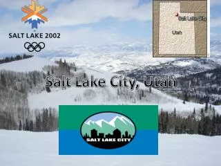
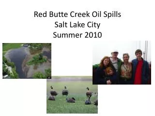
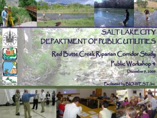
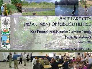
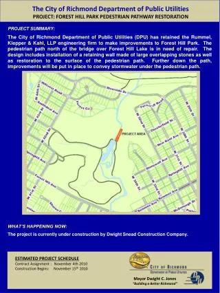
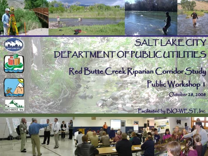
SALT LAKE CITY DEPARTMENT OF PUBLIC UTILITIES Red Butte Creek Riparian Corridor Study Public Workshop 1 October 28, 2008 Facilitated by BIO-WEST, Inc. Workshop Presentation Outline. Purpose and goals of the study Riparian corridor definitions and functions Red Butte Creek facts

E N D
SALT LAKE CITY DEPARTMENT OF PUBLIC UTILITIES Red Butte Creek Riparian Corridor Study Public Workshop 1 October 28, 2008 Facilitated by BIO-WEST, Inc.
Workshop Presentation Outline • Purpose and goals of the study • Riparian corridor definitions and functions • Red Butte Creek facts • Public outreach and input • Baseline condition assessments • Project timeline and milestones
Why is SLC Conducting This Study? • To assess current conditions • To determine desired future conditions • To identify opportunities for restoration and remediation of Red Butte Creek
Why is SLC Conducting This Study? • To use the information, data, and maps developed during the study to inform planning, permitting, and administrative processes of the Riparian Corridor Overlay District Ordinance (RCO).
What Will the Riparian Corridor Study Management Plan Include? • Statement(s) of desired future conditions • Identification of restoration and remediation projects • Cost analysis and ranking of projects • Identification of project funding mechanisms • Presentation of best management practices • Inventory of GIS-based information • Continuation of public outreach
Why Are Riparian Corridors Important? • They provide significant habitat • 60% of vertebrate species in the arid Southwest rely on riparian areas (Ohmart and Anderson 1982) • They serve as our “green infrastructure” • They are rare • Occupy very small portion of land area • In Salt Lake City, less than 1.2% (includes Jordan River plus four creeks)
Red Butte Creek – A Limited Resource • Open channel length in city ~3.6 miles • Lower 3.4 miles in culvert pipe
Red Butte Creek – Historic Importance • Source of fresh water • City’s streams developed for water supply soon after settlement • Fort Douglas (est. 1862) relied on Red Butte Creek for irrigation and drinking water • Court battles between U.S. Army and Salt Lake City over this limited resource
Riparian Area Definition (Illustration by G. Zaimes; based on BLM 1991). • Zone of influence between aquatic and upland areas • Sometimes defined as including channel, floodplain, and transition zone
Riparian Corridor – Legal Definition • City’s Riparian Corridor Overlay Zone Ordinance (RCO) applies to the area within 100 feet of the annual high water line (AHWL) of above-ground streams. • “Stream corridor” definition: the stream plus the 100-foot riparian corridor on each side. • Our study involves assessing these stream corridors.
Riparian Corridor Functions: • Recreation and aesthetics Red Butte Garden
Riparian Corridor Functions: • Open space and public lands access Miller Park
Riparian Corridor Functions: • Shading and water temperature control Miller Park
Riparian Corridor Functions: • Floodplain storage and flood-damage reduction University of Utah
Riparian Corridor Functions: • Wildlife and aquatic habitat VA/ Sunnyside
Riparian Corridor Functions: • Wildlife travel corridors/connectivity Red Butte Garden
Riparian Corridor Functions: • Provision of organic matter to stream ecosystem • habitat complexity • nutrient cycling
Riparian Corridor Functions: • Stream bank stability and safety Parleys Ck – Sugarhouse Pk
Riparian Corridor Functions: • Pollution and nutrient filtration and sediment trapping
Riparian Corridor Functions: • Storm water and irrigation water conveyance
Effects of Urbanization • Vegetated areas have been converted to impervious pavement, rooftops, etc. • Rain water that used to infiltrate now runs off illustrations from "Stream Corridor Restoration: Principles, Processes, and Practices, 10/98, by the Federal Interagency Stream Restoration Working Group
Effects of Urbanization • Storm runoff flows have higher peaks • Peaks occur more rapidly • “Flashier” hydrology illustration from "Stream Corridor Restoration: Principles, Processes, and Practices, 10/98, by the Federal Interagency Stream Restoration Working Group
Effects of Urbanization Rain Runoff Storm Drains Creeks • Red Butte Creek is an essential part of the city’s storm water conveyance system.
Red Butte Creek - Facts • Smallest of four Salt Lake City creeks • average flow 3.2 cfs • drainage area 11 sq. mi. • Water quality meets Utah State standards • Red Butte Reservoir (above Red Butte Garden) contains a refuge population of endangered June sucker • Upper watershed relatively pristine • Upper watershed managed by U.S. Forest Service as the Red Butte Research Natural Area • No fish in Red Butte Creek below Reservoir (?) reference: Salt Lake County Water Quality Stewardship Plan 2008
What Does a Riparian Corridor Study Involve? Salt Lake City Public Utilities BIO-WEST • Baseline Condition Assessment • vegetation • stream condition • Historical and Current Trend Assessment Planning & Public Outreach public workshops (four) subcommittee/stakeholder meetings (quarterly) web site comment form Management Plan / Desired Future Conditions
How Will Community InvolvementAffect the Study? • Mayor Becker’s goal: “Our goal is that this study will use a collaborative approach to information exchange, joint information gathering, consultation, and consensus in a way that will promote legitimacy and transparency, encourage creative problem-solving, and support a timely implementation.”
Purposes and Goals of the Public Outreach Process • Elicit community and stakeholder participation. • Identify public values and concerns. • Communicate results of the study for public awareness, education, and support.
Public Outreach Activities: • Public workshops (series of four) • Stakeholder and interagency meetings (quarterly) • Web-based information exchange (www.slch20.com) • Draft study comments and responses • Final study adoption meetings
Public Outreach Workshops Overview: • Workshop 1: Visioning and Issue Identification • Workshop 2: Baseline Stream and Riparian Conditions • Workshop 3: Proposed Improvement Project Costs and Ranking • Workshop 4: Draft Document Presentation
Baseline Condition Assessment • Compile/summarize existing available information: • water quality • wetlands • stream stability (county field assessments) • hydrology • land use/watershed condition • habitat • 2008 Salt Lake County Water Quality Stewardship Plan (WaQSP)
Baseline Condition Assessment • Field assessments – low flow and high flow: • survey cross sections • measure size of stream bed material • assess condition of culverts • note problem areas (severe bank erosion, eroding access trails, etc.) • note areas and types of bank hardening • general habitat/ stability
Baseline Condition Assessment • Historical and Current Trend Assessment: • are channels actively widening? • are the banks moving? • are channels actively incising? (drop in stream bed elevation) • We need your help! • old photographs • changes you’ve observed on Red Butte Creek
Baseline Condition Assessment • Field assessments – vegetation: • map riparian vegetation communities • canopy, understory (shrub), ground cover • percent cover, species • note invasive species (Russian olive, tamarisk, Siberian elm, etc.)
Timeline and Milestones Identify Improvement Projects High Flow Field Evaluation Historical Trend Assessment Draft and Final Mgt. Plans Field Evaluation Fall 2008 Winter 2009 Spring 2009 Summer 2009 Public Workshop 1 Public Workshop 2 Public Workshop 3 Public Workshop 4
Riparian Corridor Concerns: • Trespass “corridors,” signage • Flooding • Bank erosion/property loss • Debris blockages/damage to infrastructure • General safety concerns
YOUR INPUT IS IMPORTANT! • Identify issues and concerns that are important to you. • What riparian functions are the highest priority to you? • What changes have you observed on the creek? • Suggest goals, objectives, and actions that should be implemented. • Ask project staff questions.
Ways to Comment and Participate • Workshop Response Form • SLC DPU Website (www.slch20.com) • Access Permission Form • Contact SLC DPU: Florence Reynolds 801-483-6864 florence.reynolds @slcgov.com
Limited Access Permission • We need your help! • Fill out a limited access permission form. • BIO-WEST personnel will contact you. • Your help enables us to more thoroughly assess the riparian corridors.
THANK YOU FOR PARTICIPATING! BIO-WEST Contacts: Melissa Stamp 435.881.1549 mstamp@bio-west.com Christopher Sands 435.752.4202 csands@bio-west.com