GOES DCS Status and Information
150 likes | 325 Vues
GOES DCS Status and Information. Dan Schwitalla – ddschwit@usgs.gov 2009 111 th Meeting of the STIWG– 18 – 20 May 2009. Agenda. Background and status of the EDDN New GOES Data Tools Future products and enhancements. EDDN Project GOALS.

GOES DCS Status and Information
E N D
Presentation Transcript
GOES DCS Status and Information Dan Schwitalla – ddschwit@usgs.gov 2009 111th Meeting of the STIWG– 18 – 20 May 2009
Agenda • Background and status of the EDDN • New GOES Data Tools • Future products and enhancements
EDDN Project GOALS • Receive data from all DCPs transmitting in the GOES DCS independently of Wallops Island. • Locate satellite downlink at a receive site(s) sufficiently distant from Wallops Island to achieve event independence. • Distribute data independently of Wallops Island.
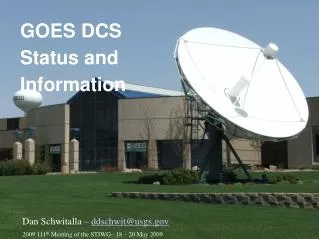
Basic EDDN System • Satellite downlink system with 2 antennas for GOES East and West ( at least 7M ) and one backup antenna • DOMSAT receive system for data from Wallops Island • LRGS systems for acquiring and distributing data. • Web Server for reporting system status.
Three New Antennas(3.8M backup, 2.4M DOMSAT, 7.5M GOES West)
EDDN System Status • EDDN was handed to the USGS in Spring 2008 • Issues in the first year of operation: • Minor wind damage to the 7.5m antenna (Did not affect the operation of the antenna) • Loss of azimuth control of the 7.5m antenna (GOES West reception was moved to the backup antenna) • Successfully negotiated two blackout periods • Maintenance option picked up for the next year
EDDN System Status • USGS EROS LRGSs • lrgseros1.cr.usgs.gov • lrgseros2.cr.usgs.gov • Public EROS LRGSs • lrgseddn1.cr.usgs.gov • lrgseddn2.cr.usgs.gov
More Information about EDDN at EROS • The EDDN has a public Web page that provides: • Status of the public Data servers • Access to a system monitoring page • Web pages that • describe the EDDN, • describe message format of DCP data, • provide message access services, • and make available relevant Documentation. • URL is http://eddn.usgs.gov
New EDDN Web Services • http://eddn.usgs.gov/msgaccess.html Provides a web service similar to msgaccess from the DECODES installation. User can access DCP messages based upon time, address, and channel criteria. (Does not decode the data) • http://eddn.usgs.gov/fieldtest.html Provides a low-bandwidth means of publicly accessing messages from a specific DCP. Designed for the access from a cell phone or PDA.
EDDN Field Test Page Criteria Page Page Source <html><head><title>FIELD MESSAGE RETRIEVAL</title><body> <form action="http://lrgseddn1.cr.usgs.gov/cgi-bin/fieldtest.pl" method="POST"> <p><font size="+1">DCP ADDRESS (required):</font><br> <input type="text" name="DCPID" size="8"></p> <p><font size="+1">Back </font><br> <input type="text" name="SINCE" size="3"> hours</p> <p><input type="submit" value="Retrieve" name="B1"></p> </form> </body></html> Result Page EDDN Field Retrieval DCP: DD29E3F0 From now minus 8 hours until now. DD29E3F009082065534G42-4NN130WXW000243J@@l@GA@@l@F?@@l@F?zWJ DD29E3F009082053520G42-4NN130WXW000242E@@l@Fz@@l@Fy@@l@FyzVJ
EDDN Enhancements • Adding demods this summer to accommodate the freed up international channels. (Stimulus money) • Starting a project to make available all the USGS and Corps DECODES platform configurations to the public. • LRGS software upgrade (in coordination with Wallops Island)