
SlideServe
Menu
Préférences
© SlideServe · v2026

RULES of Contour Mapping

ayoka avatar
14 diapositives · 2K Views · Jul 21, 2014

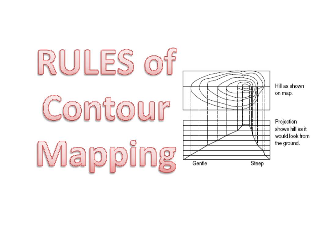
RULES of Contour Mapping. TOPOGRAPHY. The study of the shapes and features of the Earth’s surface. TOPOGRAPHIC MAPS. Map showing 3-dimensional shape and elevation of land in 2-dimensions. ELEVATION. Height above sea level. #1. A contour line represents a single equal elevation.
RULES of Contour Mapping - slide 1
01 / 14RULES of Contour Mapping
1 / 17

Télécharger la présentation

RULES of Contour Mapping
Une image / un lien ci-dessous est fourni (tel quel) pour télécharger la présentation

Politique de téléchargement : le contenu du site vous est fourni TEL QUEL pour votre information et votre usage personnel ; il ne peut être vendu, concédé sous licence ni partagé sur d’autres sites sans l’accord de son auteur.Le contenu vous est fourni TEL QUEL, pour votre information et votre usage personnel uniquement. Téléchargez la présentation en cliquant sur ce lien. Lors du téléchargement, si vous ne parvenez pas à télécharger une présentation, l’éditeur a peut-être supprimé le fichier de son serveur.Pendant le téléchargement, si vous ne parvenez pas à obtenir une présentation, le fichier a peut-être été supprimé par l’éditeur.

F I N

Plus de contenu associé

Transcription de la présentation
  1. RULES of Contour Mapping

  2. TOPOGRAPHY • The study of the shapes and features of the Earth’s surface. TOPOGRAPHIC MAPS • Map showing 3-dimensional shape and elevation of land in 2-dimensions ELEVATION • Height above sea level

  3. #1. A contour line represents a single equal elevation. • All points on the same contour line have the same elevation. C D A B

  4. Commonly, every 5th line is darker and the elevation shown. This is the index contour.

  5. #2. Where one closed contour line surrounds another, the inner contour line represents the higher elevation.

  6. This is a contour map of a mountain.

  7. #3. Elevation is determined by the contour line interval. Question: What is the contour line interval here?

  8. #4.Closely spaced contour lines =steep slope.Widely spaced contour lines =gentleslope.

  9. #5. Where a contour line crosses a stream or river, the contour line bends to form a “V” that points upstream.This is called the Rule of V’s

  10. In what direction is the river flowing?

  11. #6. Depressions are shown using hachure contour lines

  12. The hachures point into the depression. (Hachures = short dashes)

  13. Contour Elevation Repeats A hachured contour line, lying between two different contour lines, is the same elevation as the lower contour line. Count up Count down