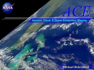
ACE Operational Overview
ACE Operational Overview. Steve Spehn , ACE Operational Manager. ACE Operational Overview. Background Vision Objectives User Requirements Desired Capabilities. Background.

ACE Operational Overview
E N D
Presentation Transcript
ACE Operational Overview Steve Spehn, ACE Operational Manager
ACE Operational Overview • Background • Vision • Objectives • User Requirements • Desired Capabilities
Background • Approved as a Joint Capability Technology Demonstration (JCTD) under the Assistant Secretary of Defense for Research & Engineering ((ASD(R&E)) • Funded largely through DoD, with contributions from: NASA MSFC, UAHuntsville, VCSI, and DRDC • Began execution in FY11, but delayed by Continuing Resolutions in FY11 and FY13 • Conducted Technical Demonstration (TD) and Operational Demonstration (OD) in March 2013 • Transitioned to University of Alaska Fairbanks (UAF) in April 2013 • U.S. National Ice Center (U.S. NIC) will be Federal lead for operational applications
Background: Capability Gaps • No overarching operational architecture or universal core system for data & tool integration • No common integrator of varied data sources • Inadequate environmental visualization to support development of cooperative Arctic policies • Inadequate access to models to support planning • Insufficient integration of operational and environmental data to support ongoing and future operations (e.g., SAR, Humanitarian Response, Recovery Operations, Strategic Movement, Training, & Research)
Vision: What ACE Does • Provides an open source, web-based, open-access, Arctic-focused, environmental research and decision-support system that integrates data from existing remote sensing assets and in situ observations to provide monitoring, analysis, and visualization based on earth observation data and modeling. • Enables local, regional, and international cooperation and coordination on long-term environmental planning and near-term actions in response to climatic and environmental changes occurring in the Arctic Region. • Leverages prior earth science applications work done at NASA MSFC: RTMM, SPoRT, SERVIR, AMSR-E, etc. • Capitalizes on the IPY, enabling and promoting the exchange of data and models for use in the Arctic Region, and providing a collaborative environment for common areas of interest for the Arctic Nations. • Identifies and define new data sets, instruments and infrastructure for situational awareness and missions that will be provide enhanced societal benefits within the arctic. • Is directly applicable to other regions and other purposes.
Vision: Unique Aspects of ACE • Free to end users and openly accessible by all through the public Internet • Open source for community development and special purpose replication • Designed for immediate extension to other regions of the world • Provides general capabilities that end users can customize for various purposes • Users can Share their own data files and share this information to a specific group of people (researchers, rescuers, educators, etc) or share with the general public • Users can share uniquely tailored workspaces (maps and data views) within their own group • Group collaboration and support for areas/topics of interest • Rich catalog of data sources, including searchable metadata • Access to multiple data sources, including complex forecast data such as NetCDF • (Easily) extensible to include additional data sets – e.g. just integrated database of Russian Arctic surface air temps and plan to integrate NIMBUS satellite images, sea ice forecast model, HDF, GRIB2 & ShapeFiles • Multiple simultaneous 2D Map and 3D Globe map views with persistence, including differing layers, geographic regions, and zoom levels. • Sustained through future collaborative research proposals and workshops
Objectives • Provide a framework for shared Arctic awareness and understanding • Enable international cooperation and collaboration on activities in the Arctic Region • Encourage the sharing of Arctic environmental information and research data • Identify other opportunities to work with the international Arctic community on the development and demonstration of technology to support Arctic activities
User Requirements:Working Group Members • AMRDEC • Bundeswehr Geoinformation Service • CANEUS International • Cold Regions Research & Engineering Lab • District 17, USCG • MDA Geospatial Services • NASA Marshall Space Flight Center • Naval Research Laboratory • NOAA • NORAD-USNORTHCOM • University of Alabama in Huntsville • USEUCOM • U.S. Department of Defense • Von Braun Center for Science & Innovation • USCG
User Requirements:Prioritized Missions / Functions • High • Maritime SAR • On-Ice SAR • Maritime Safety • Humanitarian Response • Environmental Response • In-Situ Mobility • Scientific Research • Infrastructure Design & Development • Inter-Agency/International Cooperation • Inter-Agency/International Training • Medium • Coastal Zone Mapping • Freedom of Navigation • Strategic Movement • Recovery Operations • Subsistence Fishing • Subsistence Hunting • Low • EEZ Management • Hydrographic Surveys • Environmental Management • Commercial Fishing
User Requirements:Prioritized Tasks / Activities / Capabilities • High • Plan and Execute Maritime Navigation • Data & Voice Communications • Avoid Superstructure Icing • Share Arctic Data • Locate and Assess Surface Ships • Assess Snow & Ice Coverage • Assess Tides & Currents • Mitigate Infrastructure Icing • Develop & Share Constructed Data • Assess Permafrost Conditions • Avoid Airfoil and Structural Icing • Medium • Plan and Execute On-Ice Navigation • Locate Coastlines & Territorial Waters • Locate, Identify, & Track Food Fish • Locate, Identify, & Track Game Animals • Chart Ocean Floor & Obstructions • Low • Plan and Execute Air Navigation • Plan and Execute Land Navigation • Identify Coastal Baselines
User Requirements:Prioritized Data Requirements • High • Sea Ice • Location: Area, Onset, Growth, Drift, and Decay • Characterization: % Coverage, Thickness, and Type • Sea Surface • Temperature • Movement: Sea State, Tides, Currents, and Swells • Surface Weather • Visibility • Air Temperature • Winds: Speed, Direction, and Gusts • Relative Humidity & Dew Point • Forecast • Icing • Propensity for Superstructure Icing • Propensity for Infrastructure Icing • Snow cover • Depth • Drift • AIS • Vessel Location • Vessel Characterization • Special • Buoy data • Integrated active and passive data • Other • Volcanic activity • Fires • Medium • Sea-Ice Characterization • Concentration • Snow Cover • Fractures, Ridging, & Rafting • Melt Ponds • Leads &Polynyas • Water Temperature Profile • Water Salinity Profile • Marine Life Location, Concentration, and Movement • Game Animal Location, Concentration, and Movement • Soil • Moisture • Temperature • Vegetation • Surface Roughness • Permafrost Conditions • Low • Coastline Identification • Ocean Floor & Obstruction Mapping • Seismic & Volcanic Activity • Ice Scour • Space Weather
User Requirements:Functional Requirements (1 of 3) • Accessibility • Accessible over the public Internet • No user system requirements beyond a KML-compliant browser • No client-side code requirements beyond • Code to execute the KML browser • JavaScript (specify version) • No onerous licensing requirements (for system replication) • Comply with NIC policies for access and user registration • Products provided in bandwidth-appropriate resolutions • Interoperability • Compliant with appropriate international standards • KML/KMZ 2.2 or other Google Earth compliant standards for product streams • GEO Data Standards for data streams • XHTML 1.0 and CSS 2.0 for web pages • Provide full functionality within Google Earth & the Google Earth plugin • Ingestible by DoD data systems • Ingests non-ACE products complying with international standards • Customization • Persistence of customized products and User Interface • User addition of “non-ACE” products for layering • Users can define and control tailored Communities of Interest
User Requirements:Functional Requirements (2 of 3) • Extensibility • Access to restricted products available based on user credentials • Standard interface for new data sources • Implement standard modeling interface and publish API • Scalability • Handle a specified minimum number of simultaneous users • Provide licensing for minimum number of simultaneous users • Cultural & Environmental Factors • Multi-lingual chat • Spatial • Provide for selection of any contiguous region of the Earth’s surface • Provide for smooth movement between regional selections
User Requirements:Functional Requirements (3 of 3) • Temporal • Provide user selection of both time scale and range by dataset • Provide access to products for the past, present, and future • Usability • Provide mechanism for user feedback and comments • Help system: FAQ, Online Help, and Quick-Start Videos • Data Ingest • Provide capability for remote users to provide in-situ data • Support blogs • Accuracy • Provide detailed and nominal information on expected accuracy • Provide access to raw data with pedigree • Socialization • Integrate social networking capabilities: Chat, Video, Blog, etc.