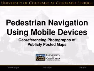
Adaptive mobile navigation
Jaromír Škorpil (skorpj1@fel.cvut.cz) . Adaptive mobile navigation. Goals. Mobile navigation in maps generated from GPS records New algorithm for map construction Java application for mobile phones. Data transfer. Data logging. GPS tracks.

Adaptive mobile navigation
E N D
Presentation Transcript
Jaromír Škorpil (skorpj1@fel.cvut.cz) IBM - CVUT Student Research Projects Adaptive mobile navigation
IBM - CVUT Student Research Projects 2 Goals Mobile navigation in maps generated from GPS records New algorithm for map construction Java application for mobile phones
IBM - CVUT Student Research Projects 3 Data transfer
IBM - CVUT Student Research Projects 4 Data logging
GPS tracks Google Earth screenshot (source: Google, Tele Atlas, TerraMetrics, Europa Technologies)
Track detail (GPS position drift) Google Earth screenshot (source: Google, Tele Atlas, TerraMetrics)
Data clustering (k-means++) Google Earth screenshot (source: Google, Tele Atlas, TerraMetrics)
Connected clusters Google Earth screenshot (source: Google, Tele Atlas, TerraMetrics)
Road segments Google Earth screenshot (source: Google, Tele Atlas, TerraMetrics)
Route planning Google Maps API (source: Google, Data map, PPWK, Tele Atlas)
Mobile phone navigator SMTK emulator S65 (Siemens AG IC Mobile) (map source: Mapy.cz, PlanStudio s.r.o.) WTK 2.2 DefaultColorPhone (Sun Microsystems, Inc.) (map source: Mapy.cz, PlanStudio s.r.o.)
IBM - CVUT Student Research Projects 12 Conclusion Project's results Automated extraction of routable maps from GPS data recorded in vehicles. Java navigation application in the maps tested on phones: Siemens SK65, S65, S68, S75 and Sony Ericsson P910i Future improvements Thank you for your attention