Download
1 / 33
360 likes | 602 Vues
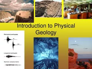
From Geology to Biology. Geologic process create the habitats and climatic differences that lead to biological diversity Uplifting, Faulting, Erosion, Volcanic events, glaciation temperature gradients water gradients/rainshadows varying slope aspects different soil/mineral types types.

E N D
From Geology to Biology • Geologic process create the habitats and climatic differences that lead to biological diversity • Uplifting, Faulting, Erosion, Volcanic events, glaciation • temperature gradients • water gradients/rainshadows • varying slope aspects • different soil/mineral types types
Recap: • Tolerance – to physical environment • Competition – other organisms • Predation – from other organisms
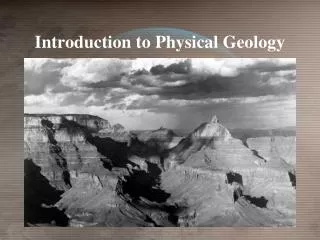
Course Area: Owens Valley & Eastern Sierra Nevada
The Physical Environment Will Change With: • Changes in Latitude • Changes in Elevation • Rainshadow Effect
Latitudinal Influences C • Increases in Latitude: • decreasing temperature • increasing water B A
Rainshadow • decreased water east of Sierras is dry • breaks in mountains = increased water Wind direction East Pacific Ocean Sierra Nevada Coast Range
COOLER AND WETTER WETTER DRYER HOTTER AND DRYER
Increasing Altitude = • Decreasing Temperature (~3 deg. F per 1000’) • More rain/water (precipitation, but….) • Shorter growing seasons Colder Hotter
THE CENTRAL IMPORTANCE OF PLANTS (and many producers) • They form the base of the food chain • Plants cannot move (animals can). • they are reflect of the physical conditions at a particular area. • The type of plants in a location influences the type of animals at that same location • Via habitat structure and food availability (type and amount) • Terrestrial ecosystems/communities are usually identified by the plants groups they posses.
Physical factors affecting the large scale distribution of organisms • Temperature • Water • Sunlight • Wind • Rocks, soil pH
HOW PLANTS WORK • Use Water (from ground), CO2, and sunlight energy to make food • WATER + CO2 SUGARS (this is photosynthesis) • Needs the right temperature to happen • This happens mostly in leaves (which also lose water)
Water Availability Productive Temperature Photosynthesis and Growth Right temp and water amount photosynthesis food growth and reproduction “productivity”
B A
Abiotic (non-living) factors affecting the distribution of organisms • Temperature • Water • Sunlight • Wind • Soil Conditions • pH • salt content/salinity • sandy • tightly packed • organic content Large Scale Small Scale
Within a zone, there is further fine scale variation based on: • small scale differences in water • (creeks, ponds, slope aspect, etc…) • create Riparian zones • temperature • (depressions, slope aspect) • sunlight • (clearings, slope aspect, canopy shading) • soil • (pH, sandy, gravelly, salinity, mineral, organic, nutrient levels, etc..) • wind • (exposed or protected)
What is a community • A group of species that grow together in sites that are environmentally similar • They exist together because: • they have similar tolerance ranges • They inhabit different niches • Don’t compete too directly
Common Plant Communities of course area High Elevation less water (mostly frozen, little soil) alpine Cold constrained (short growing season) subalpine upper montane lower montane intermediate temps/seasons more water pinyon pine-Juniper Sagebrush or Joshua Tree Woodland Creosote, shadscale, or alkali scrub Heat Constrained (short growing season) Little rainfall (little waterconstraint) Low Elevation High evaporation rates
Dichotomous Key 1a. Organism is square…………………go to 3 1b. Organism is not square……………. Go to 2 2a. Organism has stripes……………….. go to 4 2b. Organism has no stripes……………. Go to 5 3a. Organism has legs ………………… Right walky 3b. Organism has no legs……………... Right sitty 4a. Organism has antennae…………….. Roundy feely 4b. Organism has no antennae………….go to 6 5a. Organism is happy …………………. Go to 7 5b. Organism is not happy……………… Plain grumpy 6a. Organism has arms………………….Touchy feely 6b. Organism has no arm ………………. Roundy touchy 7a. Organism has 2 or less toes…………. Plain footys 7b. Organism has 3 or more toes ………..Plain touchy
The areas we use and the governmental agencies the administrate and manage them
National Parks (NPS) • Part of the Department of Interior • It was created on August 25, 1916 by Congress through the National Park Service Organic Act (16 United States Code, sections 1,2,3 and 4) in order to "conserve the scenery and the natural and historic objects and the wild life therein and to provide for the enjoyment of the same in such manner and by such means as will leave them unimpaired for the enjoyment of future generations." • Also includes national monuments, recreation areas, memorials, seashores, etc… • Although all units of the National Park System in the United States, including National Parks, are the responsibility of a single agency, they are all managed under individual pieces of authorizing legislation or, in the case of national monuments created under the Antiquities Act, presidential proclamation. For example, Congaree National Park is almost entirely wilderness area, yet Yosemite has the Badger Pass Ski Area and the O'Shaughnessy Dam within its boundaries. Death Valley National Park actually has an active mine within its boundaries. • Private Inholdings exist where individuals or companies can maintain their pre-exisiting claims and rights.
National Forests (NFS) • Part of the departmental of Agriculture • U.S. National Forests are protected forests and woodland areas in the United States. The management of these lands focuses on timber harvesting, livestock grazing, water, wildlife, and recreation. Commercial use of national forests is permitted and in many cases encouraged, unlike national parks. • In the USA there are 155 national forests containing almost 190,000,000 acres (297,000 mi² - 769 000 km²) of land. These lands comprise 8.5% of the total land area of the United States, an area about the size of Texas. Only 13% of National Forest land lies east of the Mississippi River. Alaska alone accounts for 12% of all National Forest land • There are two distinctly different types of national forests. Those east of the Great Plains are primarily re-acquired or replanted forests. That is, the land had long been in the private domain but was purchased by the United States government in order to create new national forests. In these cases, the areas of national forest noted on most maps do not actually represent the extent of the national forest, but only the extent of the authorized purchase zone. The actual amount of land acquired in most cases is much smaller. • Those national forests west of the Great Plains are originally-owned forests. These are mostly lands reserved from the public domain by the US government, and were never in private hands. In these cases, the areas of national forests noted on maps are generally the true areas of the forest. • Many ski resorts operate in national forests. • In 1876, Congress created the office of Special Agent in the Department of Agriculture to assess the state of the forests in the United States. Franklin B. Hough was appointed. In 1881, the office was expanded into the newly-formed Division of Forestry. The Forest Reserve Act of 1891 authorized withdrawing land from the public domain as "forest reserves," managed by the Department of the Interior. In 1901, the Division of Forestry was renamed the Bureau of Forestry. The Transfer Act of 1905 transferred the management of forest reserves from the General Land Office of the Interior Department to the Bureau of Forestry, henceforth known as the USDA Forest Service. • The National Wilderness Preservation System protects federally managed land areas that are of a pristine condition. It was established by the Wilderness Act (Public Law 88-577) upon the signature of PresidentLyndon B. Johnson on September 3, 1964. The National Wilderness Preservation System originally created hundreds of wilderness zones within already protected federally administered property, consisting of over 9 million acres (36,000 km²). As of 2005, a total of 680 separate wilderness areas, encompassing 105,695,176 acres (427,733 km²) had been set aside. • This is approximately 5% of the entire United States, though only about 2.5% of the 48 contiguous states. Wilderness areas exist in 44 of the 50 states.
Wilderness Areas • The Wilderness Act of 1964 (Pub.L. 88-577) was written by Howard Zahniser of The Wilderness Society. It created the legal definition of wilderness in the United States, and protected some 9 million acres (36,000 km²) of federal land. The result of a long effort to protect federal wilderness, the Wilderness Act was signed into law by PresidentLyndon B. Johnson on September 3, 1964. • The Wilderness Act is well known for its succinct and poetic definition of wilderness: • ...an area where the earth and its community of life are untrammeled by man, where man himself is a visitor who does not remain. • ”—untrammeled meaning the forces of nature operate unrestrained and unaltered. • When Congress passed and President Lyndon Johnson signed the Wilderness Act on September 3, 1964, it created the National Wilderness Preservation System. The initial statutory wilderness areas, designated in the Act, comprised 9.1 million acres (37,000 km²) of national forest wilderness areas in the United States of America previously protected by administrative orders.
Bureau of Land Management (BLM) • The Bureau of Land Management (BLM) is an agency within the United States Department of the Interior which administers America's public lands, totaling approximately 258 million acres (1,060,000 km²) or one-eighth of the landmass of the country. Most public lands are located in western states. • BLM figures for total land under their management range as high as 264 million acres (1,070,000 km²). Its budget is about 1 billion dollars for 2007 ($3.5 per person • The Bureau of Land Management states that it is their mission to sustain the health, diversity and productivity of the public lands for the use and enjoyment of present and future generations. • The BLM offers visitors opportunities in the following areas: hunting, fishing, camping, hiking, boating, hang gliding, shooting, off-highway vehicle driving, mountain biking, birding, and visiting natural and cultural heritage sites. The BLM administers 205,498 miles of fishable streams, 2.2 million acres (8,900 km²) of lakes and reservoirs, 6,600 miles of floatable rivers, over 500 boating access points, 69 National Back Country Byways, and 300 Watchable Wildlife sites. The BLM also manages 4,500 miles of National Scenic, Historic, and Recreational Trails, as well as thousands of miles of multiple use trails used by motorcyclists, hikers, equestrians, and mountain bikers. • Of BLM’s 261 million acres (1,060,000 km²), the Bureau manages 55 million acres (220,000 km²) of forests and woodlands, including 11 million acres (45,000 km²) of commercial forest and 44 million acres (180,000 km²) of woodlands within 11 western States and Alaska. Fifty-three million acres (210,000 km²) are productive forests and woodlands on Public Domain lands and 2.4 million acres (9,700 km²) are on Oregon and California Grant lands in western Oregon. Additionally, as part of its trust responsibility, the BLM oversees minerals operations on 56 million acres (230,000 km²) of Indian lands. The BLM also has a National Wild Horse and Burro Program in which it manages animals on public rangelands. • One of the BLM's goals is to recognize the demands of public land users while addressing the needs of traditional user groups and working within smaller budgets. Perhaps one of the Bureau's greatest challenges is to develop more effective land management practices, while becoming more efficient at the same time. • The BLM has a wide range of responsibilities, including collecting geographic information, maintaining records of land ownership and mineral rights, conserving wilderness areas while allocating other areas for grazing and agriculture, and protecting cultural heritage sites on public land.