Download

1 / 30
310 likes | 405 Vues
Delve into the fascinating world of plate tectonics, geological forces, rock deformation, folding, faulting, and how Earth's crust shapes our planet. Learn about major plates, types of plate boundaries, earthquakes, mountain formation, volcanoes, and more.

E N D
Geology An overview of plate tectonics
Disturbing Forces Deformation of rock involves changes in the shape and/or volume of these substances. Changes in shape and volume occur when stress and strain causes rock to • Fold • Fault
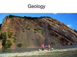
Folding A fold can be defined as a bend in rock that is the response to compression forces. Folds are most visible in rocks that contain layering.
Before the fold Remember, first the layers must be DEPOSITED before they can be FOLDED.
Faults Faults form in rocks when the stresses overcome the internal strength of the rock resulting in a fracture. A fault can be defined as the displacement of once connected blocks of rock along a fault plane. This can occur in any direction with the blocks moving away from each other.
Faults The location of some of the major faults located on the Earth
Faulting examples • http://www.physicalgeography.net/fundamentals/images/normal.gif • http://www.physicalgeography.net/fundamentals/images/rerversed.gif • http://www.physicalgeography.net/fundamentals/images/graben.gif • http://www.physicalgeography.net/fundamentals/images/horst.gif
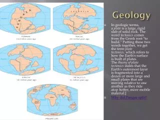
Pangaea Alfred Wegener first proposes Continental Drift in his book published in 1915. Suggests that 200 million years ago there existed one large supercontinent which he called Pangaea (All Land)
Theory of Plate Tectonics is born Plate - is a rigid piece of lithosphere floating on a partially plastic substrate (asthenosphere). Seven Major Plates Pacific • North American • South American • African • Eurasian • Antarctic • Indo-Australian
Driving Force Heat rises from the core. The gooey, gooey asthenosphere begins to “roll”, causing the plates to move
The results • Trenches • Earthquakes • Volcanoes, oh my…
Plates smashing into each other One of the plates is subducted under the other creating a deep oceanic trench. The Marianas trench in the Pacific ocean is created by the collision of the fast-moving Pacific Plate against the slower moving Philippine Plate.
More smashing Convergence of two oceanic plates also creates chains of volcanic islands called island arcs. Island arcs are created by the friction of subduction which creates hot plumes of magma at the interface of the two plates. These hot plumes of magma then rise to the Earth's surface to form volcanoes.
Bashing can make earthquakes Another phenomena associated with collision and subduction of the plates is earthquakes. The gliding of one plate under the other is not smooth but jerky producing seismic waves.
Earthquakes Earthquakes are a form of wave energy that is transferred through bedrock. Motion is transmitted from the point of sudden energy release, the earthquake focus, as spherical seismic waves that travel in all directions outward. The point on the Earth's surface directly above the focus is termed the epicenter.
Where are the earthquakes This image shows the most recent seismic activity across the globe. Each circle represents an earthquake, with larger circles indicating stronger quakes. The color signifies how long ago the earthquake occurred, from red (less than one day old) to yellow (two weeks old). Also represented on the image are the sites of Near the plate boundaries. earthquakes that occurred more than two weeks ago (the black diamonds and purple dots) and the seismic stations (the triangles).
Mountain Making and More The collision of an oceanic and a continental plate: the oceanic plate subducts under the lighter continental plate. Once again we get the formation of a trench, volcanoes, and earthquakes. Collision causes sediment deposited on the ocean floor to be piled up at the continental plate boundary. The creation of hot magma plumes also causes the continental crust to deform producing mountains.
Two plates a’smashing Once again one of the crustal plates is subducted under the other producing earthquakes. A mountain range is produced at the plate boundaries because of the deformation of rocks. Some of the rocks in the mountain range may be sedimentary and may have been set down in an ocean environment that existed between the two continental crusts prior to collision.
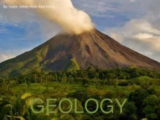
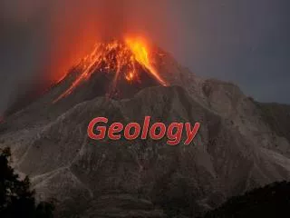
Volcano A volcano is generally a conical shaped hill or mountain built by accumulations of lava flows, tephra, and volcanic ash. About 95% of active volcanoes occur at the plate subduction zones and at the mid-oceanic ridges . tephra : Material (such as rock fragments) that are sometimes ejected into the atmosphere when a volcano erupts mid-oceanic ridges : an underwater mountain range
Cool…. Check out this lava flow
In a nut shell The crust of the earth is moving and grooving on the squishy, mushy asthenosphere. When the plates smash, bash, and rub into, passed, or under one another, we can sometimes feel it (earthquakes) or see it (mountains, volcanoes, rifts)