Download

1 / 40
410 likes | 590 Vues
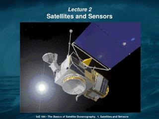
Lecture 2 Satellites and Sensors. IoE 184 - The Basics of Satellite Oceanography. 1. Satellites and Sensors. 1957 – Soviet Union launches first satellite Sputnik 1978 – NASA launches three ocean-observing satellites:. TIROS-N with AVHRR radiometer measuring sea surface temperature;

E N D
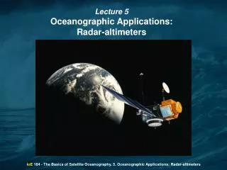
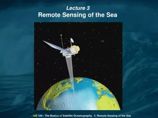
Lecture 2 Satellites and Sensors IoE 184 - The Basics of Satellite Oceanography. 1. Satellites and Sensors
1957 – Soviet Union launches first satellite Sputnik 1978 – NASA launches three ocean-observing satellites: TIROS-N with AVHRR radiometer measuring sea surface temperature; Seasat with radar-altimeter measuring sea surface height; microwave scatterometer and synthetic aperture radar (SAR). both measuring ocean roughness; Nimbus-7 with ocean color sensor. IoE 184 - The Basics of Satellite Oceanography. 1. Satellites and Sensors
The basic principles of space technology; 1. The basic elements and sampling characteristics of satellite orbits; 2. Electromagnetic spectrum and satellite sensors; 3. Active and passive sensors; 4. Data transmission to the Earth; 5. Orbit determination techniques. IoE 184 - The Basics of Satellite Oceanography. 1. Satellites and Sensors
The basic elements and sampling characteristics of satellite orbits - Satellite orbital dynamics All Earth-orbiting satellites have elliptical orbit, or the special case of a circular orbit. IoE 184 - The Basics of Satellite Oceanography. 1. Satellites and Sensors
The basic elements and sampling characteristics of satellite orbits - Satellite orbital dynamics ais the semi-major axis of the ellipse; e is the eccentricity of the ellipse; a*eis the displacement of the ellipse center from the center of the Earth; θis the angle between the satellite's present radius vector and that at perigee (the orbit's closest point to the Earth). For the elliptical orbit the distance rof the satellite from the center of the Earth is given by the equation: IoE 184 - The Basics of Satellite Oceanography. 1. Satellites and Sensors
The basic elements and sampling characteristics of satellite orbits - Satellite orbital dynamics From Newtonian dynamics, the period T for the satellite to travel round the orbit is T = 2π (a3 /GM)1/2 whereGis the constant of gravitation andMthe mass of the Earth, and G * M= 3.98603 * 1014 m3 s-2 . The instantaneous rate at which the satellite describes its orbit is d θ / dt = [G * M * a ( 1 - e2 ) ]1/2 * r-2. IoE 184 - The Basics of Satellite Oceanography. 1. Satellites and Sensors
The basic elements and sampling characteristics of satellite orbits - Satellite orbital dynamics When e is small, a = a * (1-e) and the orbit is called “circular orbit”. In this case the horizontal speed of the satellite is V0 = ( G * M / a) 1/2. Taking into account:R = 6378 km - Earth's mean equatorial radius;g = G * M / R2- the acceleration due to gravity. Hence, V0 = R * [ g / (R+ h)]1/2. IoE 184 - The Basics of Satellite Oceanography. 1. Satellites and Sensors
The basic elements and sampling characteristics of satellite orbits - Satellite orbital dynamics The instantaneous orbital rate of the satellite V0 and the period it travels round the orbit T (i. e., the spatial and temporal resolution of satellite observations) directly depend on its orbital axis a (i. e., the height above the Earth h). Higher orbit has longer period and lower orbit has shorter period. IoE 184 - The Basics of Satellite Oceanography. 1. Satellites and Sensors
The basic elements and sampling characteristics of satellite orbits - Satellite orbital dynamics During launch the rocket must be fired to obtain a trajectory such that at the desired heighthof the satellite, its speed is V0 , assuming that a circular orbit is required. • If when the satellite reacheshit is traveling horizontally at speedV, then ifV<V0the satellite will fall into an elliptical orbit for whicha<(h+R). • Alternatively ifV>V0, the satellite moves out into a higher ellipse and a>(h+R). • IfV>2 * V0then the elliptical orbit becomes parabolic and the satellite reaches escape velocity and never returns. IoE 184 - The Basics of Satellite Oceanography. 1. Satellites and Sensors
The basic elements and sampling characteristics of satellite orbits - Satellite orbital dynamics Satellite orbital elements on the celestial shell IoE 184 - The Basics of Satellite Oceanography. 1. Satellites and Sensors
The basic elements and sampling characteristics of satellite orbits - Satellite orbital dynamics So far we have identified six orbital elements which characterize a satellite's position: θ - the angular position of the satellite in its orbit, a - the semi-major axis of the ellipse, e - the eccentricity of the ellipse, i - the inclination of the orbital plane to the Earth equatorial plane, Ω - the right ascension of the ascending node N, measured eastward from the point of Aries which is a fixed point in the heavens, w - the angular distance of perigee around the orbit, measured from the ascending node. In fact d Ω/dt -(G*M) 1/2 R2 * a -7/2 (1-e2) -2*cos(i). IoE 184 - The Basics of Satellite Oceanography. 1. Satellites and Sensors
The basic elements and sampling characteristics of satellite orbits - Satellite orbital dynamics For Earth observation, three types of orbit are most useful: 1. Geostationary orbit The satellite orbits in the same direction as the Earth with a period of one day. It is positioned in a circular orbit above the equator. Therefore, it becomes stationary relative to the Earth and always views the same area of the Earth's surface. From equation T = 2π (a3 /GM)1/2:T = 1 day = 86400 seconds => a = 42,290 km => h = a - R = 35,910 km. IoE 184 - The Basics of Satellite Oceanography. 1. Satellites and Sensors
The basic elements and sampling characteristics of satellite orbits - Satellite orbital dynamics For Earth observation, three types of orbit are most useful: 2. Polar orbit i (inclination) ~ 90o. Usually these satellites have height between 500 and 2,000 km and a period of about1 to 2 hours. As the Earth rotates under this orbit the satellite effectively scans from north to south over one face and south to north across other face of the Earth, several times each day, achieving much greater surface coverage than if it were in a non-polar orbit. IoE 184 - The Basics of Satellite Oceanography. 1. Satellites and Sensors
The basic elements and sampling characteristics of satellite orbits - Satellite orbital dynamics For Earth observation, three types of orbit are most useful: 3. Nearly polar sun-synchronous orbit From equation for d Ω/dtit is possible for a given orbit height by a suitable selection of the inclination ito achieve d Ω/dt= 0.986 per day, which is equivalent to one rotation of the orbit plane per year. In this way the orbit plane is not fixed relative to stars, but fixed relative to the sun. The result is sun-synchronous orbit, in which the satellite crosses the equator at the same local solar time on each pass throughout the year. In practice i is about 100, i. e., the orbit is not polar, but nearly polar. IoE 184 - The Basics of Satellite Oceanography. 1. Satellites and Sensors
The basic elements and sampling characteristics of satellite orbits - Satellite orbital dynamics Orbit characteristics of oceanographic near-polar sun-synchronous satellites IoE 184 - The Basics of Satellite Oceanography. 1. Satellites and Sensors
The basic elements and sampling characteristics of satellite orbits Spatial and temporal sampling characteristics of orbits From the orbital period of sun-synchronous satellite we can estimate the distance between successive ground tracks. For example, for Landsat 1 the period is 103.2 min, and the distance is 25.8 degrees, which corresponds to a spacing at the equator of about 2,865 km. The distance between tracks decreases with latitude. Another important characteristic of remotely sensed data is the swath-width of the sensor. Typical swath-width is 1,500-2,000 km. IoE 184 - The Basics of Satellite Oceanography. 1. Satellites and Sensors
2. Sensors on satellites All sensors employed on ocean-observing satellites use electromagnetic radiation to view the sea. This radiation travels through free space at the speed of lightc ~ 3*108m s-1 . The frequencyfand wave lengthλare related by f λ = c. So, the electromagnetic spectrum used in the sensor can be characterized by wavelength λand/or frequency f. IoE 184 - The Basics of Satellite Oceanography. 1. Satellites and Sensors
2. Sensors on satellites The electromagnetic spectrum, showing some bands definitions and typical remote-sensing applications. IoE 184 - The Basics of Satellite Oceanography. 1. Satellites and Sensors
2. Sensors on satellites Emission spectra at different temperatures. IoE 184 - The Basics of Satellite Oceanography. 1. Satellites and Sensors
2. Sensors on satellites Approximate transmittance of electromagnetic waves through the atmosphere. IoE 184 - The Basics of Satellite Oceanography. 1. Satellites and Sensors
2. Sensors on satellites The choice of bands for remote-sensing application is governed by both the application and the atmospheric transmission spectrum. Hence, if features of the land and sea are to be observed by the reflection of incident solar radiation in the same way as the human eye observes, then the frequency range 100 nm - 100 m should be used. Alternatively, if the self-emission of radiation by the sea is to be means of remote sensing, sensors should be used for the 3 to 40 m wavelength range. However, not all the parts of these ranges are useful, since the atmosphere will not transmit them, as illustrated by the typical transmission spectrum of the atmosphere. IoE 184 - The Basics of Satellite Oceanography. 1. Satellites and Sensors
2. Sensors on satellites Usually the range 400 nm - 1 m is used to measure visible waves and about 10 m for infrared measurements. Above 10 mm there is very little absorption. These radar bands are exploited by active microwave sensors which create their own radiation with which to illuminate the target, and then observe the nature of the reflected signal, in contrast to passive IR and visible wavelength sensors which rely on naturally occurring radiation. IoE 184 - The Basics of Satellite Oceanography. 1. Satellites and Sensors
2. Sensors on satellites IoE 184 - The Basics of Satellite Oceanography. 1. Satellites and Sensors
Active sensors illuminate the target (the sea) with their own pulse of electromagnetic radiation; hence, they measure not only the amplitude but also the phase of the reflected signal and the travel time of the pulse. 2. Sensors on satellites Passive sensors measure incoherent electromagnetic radiation. IoE 184 - The Basics of Satellite Oceanography. 1. Satellites and Sensors
2. Sensors on satellites Sampling capabilities of sensors The basic sensor is a radiometer, which measures the flux of electromagnetic energy reaching the sensor from a given small cone of directions (analogy with the human eye). As in the human eye, the sensors measure not only intensity but "color" of radiation (analogy with the human eye measuring the relative magnitude of radiation in three overlapping wavebands). IoE 184 - The Basics of Satellite Oceanography. 1. Satellites and Sensors
2. Sensors on satellites Sampling capabilities of sensors One way to measure different wavelengths is to split the electromagnetic signal using a prism. Another way is to use optical filters, which are transparent for some wavelengths and opaque for others. IoE 184 - The Basics of Satellite Oceanography. 1. Satellites and Sensors
2. Sensors on satellites Spatial resolution IFOV(Instantaneous Field of View or Instrument Field of View) is the angle of view from which a signal is received by the sensor at any one instant. This angleΔΩ = ΔA/r2, whereΔAis the surface area observed at nadir andris the distance between the instrument and the surface. Typical IFOV of optical and IR sensors is about 1 km. It is limited by the size of telescope a satellite can afford. IoE 184 - The Basics of Satellite Oceanography. 1. Satellites and Sensors
2. Sensors on satellites Spectral resolution Amultispectralsensor collects data at select wavebands or channels (e.g., AVHRR – 5; SeaWiFS – 8; MODIS – 36). When a sensor provides a continuous spectral coverage, it is calledhyperspectral. In practice, it means that its spectral resolution is better than 10 nm or 0.01 µm and the number of channels >100. IoE 184 - The Basics of Satellite Oceanography. 1. Satellites and Sensors
2. Sensors on satellites To produce areal coverage greater than a single swath of 1 IFOV width, the sensors are made to scan across the satellite tracking directions. Swath-filling geometry of scanner ground track IoE 184 - The Basics of Satellite Oceanography. 1. Satellites and Sensors
2. Sensors on satellites The scan timing is arranged so, that subsequent scans occur after the satellite has traveled a distance approximately equal to the IFOV projection on the satellite subtrack. Typically there are 2,000 - 4,000 samples along a scan line. The scanning is usually performed in one direction only because it is achieved by a rotating mirror. Swath-filling geometry of scanner ground track IoE 184 - The Basics of Satellite Oceanography. 1. Satellites and Sensors
2. Sensors on satellites The metric ground resolution varies with the distance from the satellite and the look angle relative to the total vertical. Variations of IFOV (spatial resolution) with view angle IoE 184 - The Basics of Satellite Oceanography. 1. Satellites and Sensors
2. Sensors on satellites Oblique viewing of the Earth IoE 184 - The Basics of Satellite Oceanography. 1. Satellites and Sensors
2. Sensors on satellites Spatial vs. spectral vs. temporal resolution To increase spatial resolution we either increase the length of the telescope or decrease its diameter. The length of telescope is limited by the size of the satellite. Decreasing the diameter of the telescope we make the electromagnetic signal weaker. When the total electromagnetic signal is split into several channels, the resulting signals at each channel are weaker than the total signal. As a result, to achieve a maximum of sensor sensitivity, we have to decrease a number of channels. Panchromatic sensors (i.e., the sensors measuring total electromagnetic signal) are most sensitive. IoE 184 - The Basics of Satellite Oceanography. 1. Satellites and Sensors
2. Sensors on satellites Spatial vs. spectral vs. temporal resolution If we need more channels, we have to increase the time during which each pixel is taken. For this, we have to make the satellite swath more narrow. Landsat: 30 m resolution and 183 km swath; AVHRR, SeaWiFS and MODIS: 1 km resolution and >2000 km swath. Another solution is to use a geostationary satellite, because the signal at each channel can be accumulated during much longer time period. IoE 184 - The Basics of Satellite Oceanography. 1. Satellites and Sensors
3. Satellite-to-Earth data transmission • The information measured by sensors is • converted into digital format, • stored on magnetic media, and • transmitted to the ground receiving stations. • HRPT (High Resolution Picture Transmission) format enables transmission of raw information to the receiving stations located on the Earth's surface. • Each station includes receiving antenna and computer for processing and storage of information. • HRPT format is used in IR sensors AVHRR (Advanced Very High Resolution Radiometer) and optical scanners (e.g., SeaWiFS). IoE 184 - The Basics of Satellite Oceanography. 1. Satellites and Sensors
3. Satellite-to-Earth data transmission The storage capacity of magnetic media on board the satellite is crucial if a long time period is passed between the measurements and the transmission of obtained information to Earth. For example, in the case of SeaWiFS (launched in 1997) the satellite continuously transmits information in HRPT format to ground stations located along its orbit. Besides, it accumulates information and once per day transmits it to the central receiving station at GSFC (Goddard Space Flight Center) located in Maryland. The capacity of its "memory" is insufficient to store all the data collected during one day. That is why only 16-th part of information (each 4-th pixel in each 4-th row) is stored, transmitted to GSFC, processed there and disseminated to users. In more recently launched satellites (e.g., MODIS-Terra and MODIS-Aqua) the onboard storage capacity is much better. IoE 184 - The Basics of Satellite Oceanography. 1. Satellites and Sensors
4. Data dissemination The method of data dissemination depends on for what purpose (commercial or research) they will be used. In the first case (commercial use) the data are transmitted directly to ships and coastal receiving stations and then processed and analyzed there. In the second case (scientific use) the data are processed in the large scientific centers of and disseminated via Internet. The processing requires sophisticated procedures of atmospheric correction, calibration and interpolation. IoE 184 - The Basics of Satellite Oceanography. 1. Satellites and Sensors
5. Orbit determination techniques The principles of determination of orbits of satellites are similar to the ones used in GPS (Global Positioning System). The most sophisticated system (DORIS) is used on the TOPEX/POSEIDON altimetric satellite. DORIS' operating principle is based on the Doppler effect. About fifty beacons around the world transmit on a given frequency. The receiver carried on the satellite registers a different frequency due to the motion of the satellite in relation to the beacons. The same principle is involved when the noise made by a car, when it passes in front of you at high speed, appears to shift from a high tone to a lower tone. The two frequencies are then compared to calculate the satellite's velocity. IoE 184 - The Basics of Satellite Oceanography. 1. Satellites and Sensors
The basic principles of remote sensing are described in the tutorial Fundamentals of Remote Sensing published by the Canadian Centre for Remote Sensing you can get this tutorial at the web-site http://www.ccrs.nrcan.gc.ca/resource/tutor/fundam/index_e.php IoE 184 - The Basics of Satellite Oceanography. 1. Satellites and Sensors
IoE 184 - The Basics of Satellite Oceanography. 1. Satellites and Sensors