Download
1 / 33
330 likes | 482 Vues
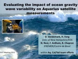
Evaluating the impact of ocean gravity wave variability on Aquarius satellite measurements. D. Vandemark, H. Feng Univ. of New Hampshire/EOS N. Reul , F . Ardhuin , B. Chapron IFREMER/Centre de Brest within Aq. Cal/Val team efforts. OSST Meeting 2012. Overview. Goal

E N D
Evaluating the impact of ocean gravity wave variability on Aquarius satellite measurements D. Vandemark, H. Feng Univ. of New Hampshire/EOS N. Reul, F. Ardhuin, B. Chapron IFREMER/Centre de Brest within Aq. Cal/Val team efforts OSST Meeting 2012 OSST 2012
Overview • Goal • Develop and refine an empirical satellite salinity correction for long wave impacts that augments the 1st order roughness corrections made using NCEP winds, Aquarius scatterometer, or other ocean roughness information • Approach • Geolocate ancillary ocean wave data with each satellite data point • Detect, characterize, and quantify long-wave impacts seen in the scatterometer, radiometer, and ultimately salinity • Help implement a point-by-point correction using operational wave model data OSST 2012
The general geophysical problem To obtain accurate salinity we need to accurately remove the signal due to rough surface emission Specifically for Aquarius 1) A three beam radiometer at L band - Tb_ocean (2 polarizations, 3 incidence angles, look angle) = F ( variable sea surface waves,S(k) ) ~= rms slopes = 2) A three beam radar scatterometer at L-band (Bragg waves ~ 18 cm) NRCS_ocean (2 polarizations, 3 incidence angles, look angle) = F ( variable sea surface waves ) ~= S(kBragg) + tilting effects 3) The portion of the wave spectrum and EM interaction differs for the radar and radiometer and for each beam’s incidence angle – how well correlated are 1) and 2)? 4) Usual surrogate for sea surface wave information is wind – unlikely to provide sufficient precision to correct for the true ocean wave field. OSST 2012
Global Wave model fields, Aquarius L2_wwav files, Day 240-271 2011 Aquarius *L2_wwav files are assembled daily at UNH for the Aq. cal/val team available at PO.DAAC OSST 2012
Aq-L2 V1.1 SCIdata(daily wget) L2V1.1_wwav* Aquarius Level 2 wave model collocation products: Processing status (March 2012) Ifremer/Previmer WW3 model product ( Partial dataset: 5 NRT variables, limited QC) * ftp access via PODAAC for Aq. Cal/Val team members Science level processing ( Latency: 50-60 days after Aq-L2data become available) Near Real Time processing ( Latency: 1 day after Aq-L2V1.1 data become available at GSFC) Aq-L2 V1.2 EVSCI data (2011) Aq-L2 V1.2.3 EVSCI data (2011, 2012) L2V1.2_wwav (2011)* L2V1.2.3_wwav (2012)* Ifremer/Previmer WW3 model product (Full wave model dataset: 14 variables with QC)
Diagnosis using Significant Wave Height (SWH) Evaluate Aquarius L2 scatterometer and SSS data Expectations: For fixed wind speed we’ll see long wave impacts in the scatterometer roughness and derived wind speeds For fixed wind speed we’ll see long wave impacts in the radiometer-derived salinity OSST 2012
Aquarius Scatterometersigma0 vs. significant wave height (17 weeks; Day 240-362) ; X-axis=NCEP wind VV POL INNER BEAM θ = 28 deg. VV POL OUTER BEAM θ = 46 deg. HH POL INNER BEAM θ = 28 deg. HH POL OUTER BEAM θ = 46 deg. LARGEST IMPACT LEAST IMPACT OSST 2012
Aquarius Scatterometer Wind vs. significant wave height (17 weeks; Day 240-362) ; X-axis=NCEP wind OUTER BEAM θ = 46 deg. INNER BEAM θ = 28 deg. LARGEST IMPACT WEAKER IMPACT • Long-waves lead to wind speed error when seas are exceedingly high • This is a good thing – indicates that the scatterometer is • sensitive to longer waves that likely impact the radiometer OSST 2012
Getting sidetracked All wind products show significant systematic differences – likely associated with ocean currents. wind waves, and atmospheric stability (SST) impacts. NCEP, ECMWF, SSM/I, Aquarius Scatterometer OSST 2012
Wind products and spatial differences Day 240-270 OSST 2012
Wind products and spatial differences Day 240-270 OSST 2012
Onto radiometer derived SSS Some substantial improvement already L2 V1.2 -> 1.3 OSST 2012
Aquarius Radiometer Salinity error vs. SWH (17 weeks; Day 240-362) ; X-axis=NCEP wind, V`1.2; DESC Residual Salinity with respect to HYCOM Residual Salinity taken with respect to HYCOM model SSS Long-waves lead to salinity anomaly – low for low seas, high for high seas OSST 2012
Aquarius Radiometer Salinity error vs. SWH (17 weeks; Day 240-362) ; X-axis=NCEP wind; Ver 1.2.3; DESC; OUTER BEAM Residual Salinity with respect to HYCOM Residual Salinity taken with respect to HYCOM model SSS Long-waves lead to salinity anomaly – low for low seas, high for high seas Aq Cal/Val, March 2012
Aquarius Scatterometer Wind vs. significant wave height (17 weeks; Day 240-362) ; X-axis=NCEP wind; V1.2 0.35 psu/ 1m sea state change OUTER BEAM θ = 46 deg. DESCENDING V1.2 0.21 psu/ 1m sea state change OUTER BEAM θ = 46 deg. Long-waves lead to wind speed error of order when seas are exceedingly high Long-waves can lead to wind speed error of order when seas are exceedingly high Desc Pass data, Galactic refl < 1 K OSST 2012
Aquarius Scatterometer Wind vs. significant wave height (17 weeks; Jan-Feb2012) ; X-axis=NCEP wind; Ver. 1.3 0.1 psu/ 1m sea state change OUTER BEAM θ = 46 deg. DESCENDING V1.3 <0.1 psu/ 1m sea state change OUTER BEAM θ = 46 deg. Substantial improvements Desc Pass data, Galactic refl < 1 K Aq Cal/Val, March 2012
Aquarius Scatterometer Wind vs. significant wave height (17 weeks; Jan-Feb2012) ; X-axis=NCEP wind; Ver. 1.3 >0.1 psu/ 1m sea state change OUTER BEAM θ = 46 deg. But not done yet ASCENDING V1.3 ~0.1 psu/ 1m sea state change OUTER BEAM θ = 46 deg. ASC Pass data, Galactic refl < 1 K Aq Cal/Val, March 2012
Some caveats and future work • Final Aquarius surface Tb_V and Tb_H are still being developed with issues such as reflected Galaxy and Faraday rotation correcting impacting these 2nd order ocean wave impact results (V1.4?) • ascending vs. descending results differ • time dependence • highest wind/wave environment are in coldest waters • SST-wave covariance • Fully exploit and document the certain benefit of using the scatterometer for SSS inversion • Further formal evaluation of the radiometer and radar data within a scattering/emission model + global wave field data • What wind model to use as a reference? SSM/I != NCEP != ECMWF OSST 2012
Analysisof Satellite SSS signatures over Hurricane IGOR 11-24 Sep 2010 using SMOS Cat 4-5
Surface salinity signal variabilityassociatedwith Hurricane-inducedmixingnear the Amazon/Orinoco plume – Igor case study– Sept 2010 Nico Reul with Chapron, Tenerelli, Vandemark, Vialard, ... • Freshwater Plume=> warmer SST & shallow • stable surface layer (barrier layer) • 65% of TC crossing the Amazon Plume evolve into cat 5 Hurricanes Ffield (J. Clim 2007) • Amazon & Orinoco plumes • =>Strong positive SST anomalies (~1°C) • Impact of plume SST on storm intensity • addressed using WRF simulation • Vizy and Cook, (JGR 2010) • Can we use SMOS retrieved SSS to study • ocean-atmosphere interactions in TCs ?
Analysis of SMOS data signature over Hurricane IGOR 11-24 Sep 2010 Cat 4-5
Coincident or causal Hurricane Igor winddropingat the plume/open ocean transition ? 09/17/2010 09/15/2010 09/13/2010 Location of the Plume (SSS<35.5) the last 10 days before Igor passage (5->13 Sep)
Thermo-haline wakesbehind Igor hurricane Salty Wake induced by Igor: SSS=SSS SMOS (CATDS/ifremer) Cool Wake induced by Igor: SST= GHRSST OSTIA (MetOffice) Strong resalinisation of the SSS after Igor passage, over the path of the storm Right-hand quadrant: ΔSSS~>+1-1.5 pss are cross-track locations from the eye at to
Erosion of the Amazon/Orinico Plume after Igor passage (Right-hand side of the TC) SSS averaged 19-24/09 (3-5 days after Igor) SSS averaged 5-11/09 (3-5 days before Igor) ARGO profiler #4900819 17/09 ARGO profiler #4900819 7/09 Apparent Erosion of the freshwater surface layer on the right-hand side quadrants of the storm
Sea surface Salinity conditions at the ARGO float location before/after IGOR (right-hand side quadrant) ΔSSS argo=+1.3 ΔSSS smos=+1.4 Enhancement of Sea Surface Salinity as seen by ARGO after IGOR passage: ΔSSSargo~+1.3 Excellent consistency with SMOS observation trend: ΔSSSsmos~+1.4 . SMOS SSS is however systematically ~0.5 pss fresher than ARGO observationsat 5 m depth Maximum surface Wind encountered at the argo float location is ~33 m/s (GFDL model) Maximum significant wave height up to 11 m (Wave Watch III, NAH)
Vertical straticationbefore/after in the right-hand side quadrant Mixing of the Warm freshwater surface layer by Hurricane Igor (ARGO#4900819) Salinity Argo #4900819 Temperature Argo #4900819 6 days Before Igor 1 day after Igor 9 days After Igor Original Plume surface freshwater layer ~20 m thick After the passage of Igor: =>Drop of sea surface temperature Δ T~2.8°C =>Enhancement of Sea Surface Salinity by ΔS=1.4 Excellent consistence with SMOS obs~1.5 Increase in sea surface density ~2 kg/m3 Density Argo #4900819 Deepening of the Mixed surface layer From 20 m down to ~90 m depth
Erosion of the Amazon/Orinico Plume after Igor passage (Left-hand side of the TC) SSS averaged 5-11/09 (3-5 days before Igor) SSS averaged 19-24/09 (3-5 days after Igor) ARGO profiler #6900590 4/09 ARGO profiler #6900590 24/09
Sea surface Salinity conditions at the ARGO float location before/after IGOR (left-hand side quadrant) ΔSSS argo=+0.3 ΔSSS smos=+0.4 Surface wind speed encountered >15 m/s up to 48 m/s from 09/15->09/17 Significant wave height >3 m up to 9 m from 09/15->09/17 SMOS SSS in general saltier than Argo SSS by ~0.05-0.1 pss However very consistent SSS temporal trend from before to after Igor between ARGO float & SMOS surface data: =>both are showing a +0.3-0.4 pss increase following the surface mixing induced by IGOR on its left hand side quadrant.
Vertical straticationbefore/after in the left-hand side quadrant 9 days Before Igor 1 day before Igor 6 days After Igor Cooling ~1°C Mixing Damped By the thicker Plume Barrier layer On the LHS ? More intense wave mixing On the RHS ?
EARLY CONCLUSIONS • SMOS SSS data able to produce before and after snapshots of plume location associated with TC passage • Satellite SSS data yielding accurate SSS perturbation due to TC as compared to two ARGO floats – 0.5 to 1.5 SSS INCREASE • New look at plume-TC interaction with SSS + SST perhaps allowing enhanced diagnosis
Surface wakes of Igor Six days of data centered on to–(+) 4 days have been averaged to construct the pre (post)-cyclonic quantities. Here acdom = ad + agag: CDOM (dissolved matter) ad: non living particulate organic material, bacteria, inorganic material and bubbles Figure 4: Surface wakes of Hurricane Igor. Post minus Pre-hurricane (a) Sea Surface Temperature (ΔSST ) (b) Sea surface Salinity (ΔSSS), (c) Sea Surface Density (Δσ o ) and (d) Sea Surface CDOM absorption coefficient .The thick and thin curves are showing the hurricane eye track and the locii of maximum winds, respectively. The dotted lines is showing the pre-hurricane plume extent. ΔSST, ΔSSS, Δσ owakes were only evaluated at spatial locations around the eye track for which the wind exceeded 34 knots during the passing of the hurricane.
Thanks! This work is supported by NASA’s Ocean Surface Salinity Science Team – Grant NNX09AU69G OSST 2012