Download
1 / 30
320 likes | 511 Vues
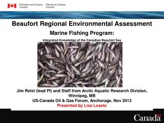
Beaufort Regional Environmental Assessment Marine Fishing Program: Integrated Knowledge of the Canadian Beaufort Sea . Jim Reist (lead PI) and Staff from Arctic Aquatic Research Division, Winnipeg, MB US-Canada Oil & Gas Forum, Anchorage, Nov 2012 Presented by Lisa Loseto.

E N D
Beaufort Regional Environmental Assessment Marine Fishing Program: Integrated Knowledge of the Canadian Beaufort Sea Jim Reist (lead PI) and Staff from Arctic Aquatic Research Division, Winnipeg, MB US-Canada Oil & Gas Forum, Anchorage, Nov 2012 Presented by Lisa Loseto
Oil and Gas Leases (Source: INAC) Beaufort Regional Environmental Assessment (BREA) • BREA announced by INAC in Aug 2010 • $21.8 Million over 5 years • Targeted research to support an efficient regulatory process • Based on the Beaufort Sea Strategic Regional Plan of Action (BSTRPA) • Supported by Inuvialuit, industry and governments
Tier 1 Gap Identified for BREA:Presence & Relevance of Fishes in Deepwater Areas? • Project Overview • Deepwater fish project proposed and approved (Sept 2011) by BREA - 5500k over 5 years (to March 2015) • BREA Proposal Leveraged: • PERD (318k to 2012) • ESRF (1154k to 2014) • DFO IGS (293k over 3 years) • ArcticNet (68k ship support) • Other PI leveraging (~1158k) • DFO in kind (~3000k) • Total ~11.5M • Participants: DFO 15 staff (~ 8 ftes) plus 6 ftes (terms); Universities (3 Canada) staff + 6 students + other collaborators • Project Linkages • Multi-disciplinary ecosystem study with two major themes: • Offshore Fishes: diversity, habitat associations & ecosystem roles • Coastal Fishes: linkages among sub-ecosystems • Develop new knowledge for ‘unknown’ offshore ecosystem, establish key baselines & understand vulnerabilities • Work complements & extends previous and ongoing DFO work - are coastal and offshore processes and outcomes coupled? • Linked with other BREA, ArcticNet projects and US (BOEM) work in Beaufort Completely New Research: Due to previous persistent ice cover, offshore deepwater fishes, their biodiversity & ecological relationships are presently unknown (isolated occurrences only), especially in deep waters – first-ever systematic sampling to 1000m.
Overview of Fishes and Their Habitats in the Canadian Beaufort Sea • 70 fish sp. in the BS, heterogeneous in distribution and association with sub ecosystems • Fishes occupy several trophic levels thus are pivotal within ecosystems – e.g., rely on zooplankton for food and in turn are food for seals, whales and sea birds • Fishes rely on key habitats at different stages of life – e.g., most larvae -pelagic near surface • Sub-ecosystems/habitats are connected abiotically (e.g., upwellings, currents) and biotically (e.g., passively by fish life stages and actively by migratory adult fishes)
BREA Marine Fishes Project Objectives • Field survey of offshore area to 1000m depths to establish: • a) fish occurrence and community diversity, • b) habitat associations, and • c) couplings (e.g., foodweb or trophic patterns) within and among components in offshore (~50-1000m) habitats • 2) Establish the functional relationships within/among offshore and slope, shelf and coastal, benthic and pelagic sub-ecosystems • 3) Summarize existing knowledge of fish occurrences and habitat associations geo-spatially • 4) Link offshore research findings with past & ongoing research in the estuary, coastal and the shelf areas in Canadian & US waters • 5) Establish regional contexts for future monitoring & assessments (e.g., hydrocarbon metabolites, Hg, species diversity and habitat use)
The Charter Vessel Name: F/V Frosti (1979) Home Port: Richmond B.C. Length: 40 m Beam: 8 m Draft: 5 m Horsepower: 1200 Gross Tonnage: 454 • Vessel retrofitted with side crane & wet/dry lab spaces • Hydroacoustics system onboard (NOAA) • Science sea trials, calibration, gear lading & shakedown late July • Frosti – two weeks transit to Canadian Beaufort Sea (arrive 31 July) • Science program: 4 August – 4 September, 4 transects each with 7 planned stations (all science components) & hydroacoustics transect with targeted trawling
2012 Field sampling- F/V Frosti 2009 CCGS Nahidik 2008 2006 & 2009
Sampling Regime Station sampling (F/V Frosti): • Oceanography and water sampling: 4 primary transects x 7 stations/transect = 28 stations; 20-1000m depths; 475 linear km; 90km transect through key transition zone – Mackenzie Trough) • Zooplankton & ichthyoplankton (larval fishes) at 28 stations • Sediments & benthic infauna at 27 stations • Benthic macrofauna at 26 stations • Fishing – benthic nets at 26 stations (Atlantic Western IIA (WIIA) benthic otter trawl & 3m beam trawl) Hydroacoustics & Water-Column (pelagic) sampling (F/V Frosti): • Re-run transect lines for spatial distribution of biomass (~475 linear km) • Identify potential aggregations of fish in water column • Mid-water and benthic fishing to ‘ground-truth’ hydroacoustics (Cosoms-Swam midwater trawl; 3m beam trawl) • Run hydroacoustics ‘section’ across area of highest biomass concentration (i.e., shelf break at ~250-400m depths – 385 linear km) Coastal Sampling (field camps & local fishers): • Sampled 3 estuarine and 3 marine sites near to traditional use areas • 6 sites for fishes, beluga, other biota; 2 also for oceanographic parameters
Deploying the small 3-meter Beam Trawl • To allow for comparison of benthic catches with previous NCMS work on Mackenzie Shelf and ongoing Alaskan work, this smaller trawl was deployed. • The main benthic trawl was a larger Otter trawl (not shown). • Diversity of catches in smaller trawls was similar to that of larger benthic trawl but abundances were less. • Larger-bodied fishes tend to avoid these smaller trawls.
Fishes Captured: 9258 individuals from 11 families Righteye flounders 113 Eelpouts 311 Snailfishes 286 Arctic Cod 7915
Preliminary Findings - Overall Fish Catch • Arctic Cod (and Polar Cod) are largest percentage of catch (85%). • Most Arctic Cod caught in pelagic (water column habitats) at ~250-400m (= halocline transition between fresher warmer Pacific and saltier colder Atlantic waters). • Halocline likely is a dynamic feature concentrating pelagic food and fishes. • Benthos in shallower depths appears to represent Pacific species (e.g., Bering Flounder, Snow Crab). • Deeper stations likely represent Atlantic water masses & associated fishes (e.g., Greenland Halibut, some of these species are new records for area). • Much greater diversity in benthic vs pelagic fishes in offshore areas.
Larger epibenthic species in the Canadian Beaufort Greenland Halibut Snow Crab & Basket Starfish Snow Crab Bering Flounder (new record?)
Lanternfishes Eelpouts Staghorn Sculpin Offshore Demersal Fishes in the Canadian Beaufort Sea • Fish community composition shifts with depth • These shifts are coincident with changes in habitat features: depth, salinity, temperature, sediment composition & prey composition • Arctic cod present across all offshore habitats but dominate the slope community Eelblennies Alligatorfish • Multi-year sea ice • Warmer, saltier Atlantic water mass • Atlantic species present • Benthic catch abundance less dominated by Arctic Cod Snailfishes BASIN (>450m) B. Sheiko • Convergence of Pacific & Atlantic water masses • Thermocline/Halocline concentrate food and fishes • Demersal fish community dominated by Arctic cod Snailfishes SLOPE (200-450m) Arctic Cod B. Sheiko < 50m > 50m • Disturbance from seasonal ice scour • Pacific Water mass with Mackenzie R. sediments & freshwater • Shift in fish community composition at 50 m depth • (Majewskiet al. submitted) SHELF (shallow) B. Sheiko Flatfishes All photos from DFO unless otherwise specified
Benthic Fish Abundance by Habitat Skates Snailfish Arctic Cod (B. Saida) Righteye Flounders
Pelagic Fish Relative Abundance by Habitat Snailfish Arctic Cod (B. saida) Lanternfish
Preliminary Findings Fishes • Oceanographic parameters, physical topography and substrate type determine fish diversity • Diversity and biomass are both relatively high in benthic areas and in key transition zones (especially on slope drop off) • Arctic/Polar Cod is most abundant and widespread fish species but others important locally • Species are associated with specific habitats (water masses) but also geographically patterned (east-west) • Fish benthic diversity much higher than pelagic diversity • Some large-bodied fishes present So What? • Benthic fishes tend to be more sedentary than pelagic species, e.g., establish local home ranges, thus are vulnerable to local impacts • Pelagic species tend to be more mobile thus are vulnerable to widespread impacts • Some species and habitats are more important than others • Fishes in their Ecosystem • Other aspects of overall study will determine food web (trophic) patterns, energetics, relevance of other key biota, and baselines for monitoring and linkages with coastal systems and higher trophic levels.
Sample Processing Identifications confirmed Biological parameters Tissues for lab analyses Diversity and abundance over space, habitat and depth Lab Analyses Fatty Acids, Hg, PAHs & stress metabolites at DFO Winnipeg Water Chemistry at DFO Winnipeg and IOS Sidney Linkages to past coastal & nearshore studies (data analysis) Linkages to coastal components (sample & data analyses) Follow-on Collaborations Stable Isotopes (C,N) – U Waterloo Benthic invertebrates – U Quebec at Rimouski Energetics & coastal work – U Manitoba Hydroacoustics Data Analysis – U Laval (ArcticNet) Linkages with BOEM & U Alaska Fairbanks – matching of outcomes Future Work Planning 2013 BREA field program Planning/linkages to ArcticNet 2013 field program (hydroacoustics) Integration of relevant data into geospatial planning tools Where to next on fishes and other biota?
BREA Frosti Offshore Fishes Crew 2012 Back – Left to Right: Wojciech Walkusz Andy Majewski Lorena Edenfield Guillaume Meisterhans Laure de Montety Front – Left to Right: Sheila Atchison Shannon MacPhee Charlie Reuben Jane Eert (Present in Spirit: Jim Reist & Rob Young – photos) Field Crew aboard F/V Frosti Other project participants at DFO: B. Cress, J. Delaronde, J. Johnson, T. Loewen, L. Loseto, B. Lynn, A. MacHutchon, C. Michel, B. Rosenberg, G. Stern & G. Tomy. Outside direct participants: B. Norcross (UAF), L. Fortier (ULaval), M. Geoffroy (ULaval), M. Power (UWaterloo), J. Treberg (UManitoba), H. Swanson (UWaterloo).
Overview of Fishes and Their Habitats in the Canadian Beaufort Sea Beaufort Sea Fishes: ~70 species Fishes Associate with Areas or Sub-ecosystems and Habitats: • Freshwater species some times in freshened nearshore areas • Sea-run species (chars, whitefishes) seasonally present (summer only) coastally and on shelf • Coastal (0- ~20+m depths) marine species tolerant of wide salinities • Nearshore/Shelf (~20-200m) species • Pelagic species (water column) • Benthic species (bottom) • Slope (~200-400+m) species • Pelagic species • Benthic species • Offshore (~400-1500m) species • Pelagic species • Benthic species • Abyssal species • Ice – if present acts as focal point for biota (e.g., feeding area) and also as predatory refuge for some fishes • Some Overall Considerations • Fishes occupy several trophic levels thus are pivotal within ecosystems – e.g., rely on zooplankton for food and in turn are food for seals, whales and sea birds • Fishes rely on key habitats at different stages of life – e.g., most larvae are pelagic near surface • Sub-ecosystems/habitats are connected abiotically (e.g., upwellings, currents) and biotically (e.g., passively by fish life stages and actively by migratory adult fishes)
Hydroacoustics – Midwater Trawl Sampling • Detect pelagic organisms and document their assemblage and biomass within surface and bottom aggregations, with particular focus on Arctic Cod • “Truth” targets identified on acoustic echogram with fishing nets • Work linked with Laval University (ArcticNet program – Geoffroy & Fortier) 200 m 400 m • After all stations on a transect were sampled, the transect was re-run using the hydroacoustic system to estimate pelagic biomass. • Preliminary results suggest a near-bottom aggregation of Arctic Cod between approximately 200 – 400 m depth spanning the Canadian Beaufort Shelf. • Arctic/Polar Cod relatively abundant in pelagic habitats also, but less so in deeper water further offshore. Adult Arctic Cod
Pelagic Sampling & Hydroacoustics Groundtruthing Arctic Cod = typical midwater catch. Glacier Lanternfish (Benthosema glaciale) – new Beaufort Sea record (?); Baffin Bay, North Atlantic, pelagic to 1250m.
Development Activity Seismic Exploration Ship-based Drilling Pelagic ecosystem Benthic ecosystem – habitat loss Land-based Drilling Habitat alteration (borrow pits, islands) Support Activities (ice-breaking, marine traffic) Discharges & minor spills Catastrophic incidents Cumulative Effects (O&G Activity) Temporal cumulation over life time of population Spatial cumulation over life history Cumulative Effects (many stressors) Temporal cumulation Spatial cumulation Activity Consequences Noise (pelagic & benthic habitats): episodic high dB outputs have uncertain effects on fish hearing and sound communications (e.g., ?fatal close to source; cods attracted to air guns); effects on Arctic Cod a key pelagic species are unknown. Small footprints relative to area and general habitat types suggest limited benthic effects. Chronic noisy sources (e.g., ship operation) at lower dB are unknown but could include exclusion from pelagic habitats. Light effects: unknown/uncertain summer relevance. Ice-breaking and Ice loss/alteration: Habitat or refugium loss (e.g., Arctic Cod) Benthic Habitat loss/alteration: Hard substrate (rocks, gravel fields, etc.) limited in location and extent – removal may affect ‘naturally rare’ species requiring these habitats Creation of artificial islands would result in small losses of local habitat, but diversity of habitats likely increased (?positive effect) Toxic or Contaminant Effect (episodic release): Localized (spatial & temporal) habitat exclusion of organisms Short-term productivity effects Limited entrainment and bioaccumulation in ecosystem Chronic Toxic or Contaminant Effect (catastrophic release): Extensive (spatial & temporal) habitat exclusion Long-term productivity effects Significant entrainment and bioaccumulation in ecosystem Possible Points of Intersection of O&G Development with Marine Fishes
Overview Other Components: Oceanography (Eert) Conductivity, Temperature & Depth and Water Sampling Rosette Temperature – Dalhousie 12 Salinity – Dalhousie 12
Zooplankton and fish larvae sampling - MultiNet & Bongos (Walkusz) • 200 zooplankton samples • Copepods, Euphausids and Amphipods mainly • 320 fish larvae collected (1/3 Arctic cod) • Spatial & depth analyses for taxonomy, diversity & relative abundance ongoing • 21 taxa chosen for analysis of foodweb patterns, energetics and baseline contaminant markers (Hg, PAHs)
Sediments& Benthic Invertebrates – MacPhee, de Montety & Archambault Bottom Trawling for Epifauna Box Coring for Sediments & Infauna No. Stations Sampled: 27 No. Stations Sampled: 29 • Characterize bottom substrate as a key habitat feature for benthic marine fishes • (% sand, silt, clay, organic content, contaminants & benthic chlorophyll) • Characterize benthic fauna as important food resources to marine fishes and other biota (diversity, abundance, biomass, and food-web linkages)
Benthos in the Offshore Canadian Beaufort Sea Epifauna Infauna • Polychaete worms occurred at all depths and substrate types Themisto Snow Crab Cephalopods Squid Polar Shrimp Asteridae • Many invertebrates sampled are important food sources to fishes and marine mammals • Stable isotope and fatty acid analyses will be used to assess benthic-pelagic coupling and the ecological role of benthic invertebrates • Establish baselines for contaminants (Hg & PAHs) from key species Bivalves & Gastropods present in sediment with higher % sand and gravel Photos: Laure de Montety (UQAR) except Themisto, R. Hopcroft
Primary Productivity - Michel & Meisterhans Spatial distribution of surface chlorophyll a Note strong influence of Mackenzie River TBS12 transect Note low productivity offshore water Section distance (km)
Structural and Functional Relationships of Mercury: Baselines & Patterns (Stern) Mercury exists in a range of chemical forms as it cycles through the Arctic environment; mercury bioaccumulates and biomagnifies within ecosystems and biota. Hg To date, virtually no information is available on biomagnification and bioaccumulation of mercury in deep water and shelf adult fishes. Key baselines established for future reference.
PAHs and metabolites in Beaufort Sea Biota (Tomy) • Establish baseline levels of Poly Aromatic Hydrocarbons (PAH) and their metabolites in fish from coastal waters in the Beaufort Sea • PAHs can be readily metabolized by many fish species; the resulting metabolites pose a greater threat to fish health than do the parent compounds • Background values will be established for indicators of fish health (e.g., thyroid hormone levels, levels of oxidative stress) due to exposure to PAHs and their toxic metabolites • Baselines will provide for future comparative studies
Fish Habitats in the Beaufort Sea in Summer • Three Groups of Fish Habitats • Water column (pelagic) with layers of different densities (salinities): • Fresh river inputs (Mackenzie R.) – 0-10m (highly mixed waters 0-30 psu) • Mixed layers (SML/WML) on the shelf – 10-60m • Pacific (BSSW/BSWW) water – 60-200m • Sharp halocline (LHW) – 200-300m • Atlantic Water (AW) – 300-1000+m • Bottom (benthic) types: • Fine muds and clays (Mackenzie eastwards) • Gravel patches & muds (western areas) • Bedrock further offshore in west • Coastal & nearshoresurface (0-5+m): highly freshened (5-20 psu) narrow band west and east, wide near Mackenzie outflow • Combinations of salinity, temperature, depth, and/or bottom type determine fishes present in pelagic (water column) or benthic (bottom) habitats. (E. Carmack)