Download
1 / 48
480 likes | 619 Vues
Characteristics of Fairfax County That Contribute to Deer/Vehicle Collisions. Executive Summary. Thousands of deer related accidents are reported each year Virginia Ranks 7 th in the nation for deer related accidents. CNN online, 2006. Executive Summary.

E N D
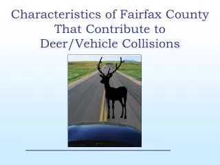
Characteristics of Fairfax County That Contribute toDeer/Vehicle Collisions
Executive Summary • Thousands of deer related accidents are reported each year • Virginia Ranks 7th in the nation for deer related accidents CNN online, 2006
Executive Summary • The 2006 Deer Management Study conducted by the Virginia Department of Game and Inland Fisheries states that “Deer/vehicle collisions are one of the most critical types of deer damage in Virginia”.
Executive Summary Solutions: • When addressing deer management solutions, cost and urban growth play a big part in the decision making process • Management practices used in the past include: • managed deer hunts • citizen awareness programs
Executive Summary Solutions: • Fairfax County completed a “Crash Abatement Program” funded by VDOT. Roadside reflectors were installed on 7 sections of county roadway • Both Virginia and Fairfax County governments have deer management programs • Deer/vehicle collisions have been addressed in the plans
Executive Summary Urban sprawl is the root of the problem X Leveling the human population X Building moratoriums X Cease new road projects All are unrealistic!
Executive Summary • Continued Deer Management Studies • Decrease the deer population • More effective deer management practices such as road barriers, signs and reduced speed limits on selective roadways. More realistic and cost-effective solutions!
Executive Summary • What characteristics of Fairfax County contribute to deer and vehicle accidents?
Goals • Use GIS to identify the characteristics of Fairfax County that contribute to deer/vehicle collisions • Analyze roads, human population, deer population, and deer habitat to prove or disprove that they were contributing factors • Apply deer/vehicle collision data to the characteristics and analyzed the results for relationships.
Objectives • Research related studies • Develop a plan and scope for the project • Identify the Fairfax County characteristics that I would analyze • Identify the data I would need for analysis • Make a data model
Objectives • Collect data • Manipulate the data files for use in the GIS • Extract the necessary data I needed • Import the files into my personal geodatabase • Begin project analysis
Data • The data used in the deer/vehicle project were obtained from local and national sources: • Fairfax County GIS Department • Virginia Department of Transportation • The Weldon Cooper Center at UVA • USGS • Virginia Department of Game and Inland Fisheries.
Data VDGIF “Virginia Deer Management Plan 2006-2015 • Deer population abundance data was taken from the PowerPoint version of the plan • All of the data is freely available to the public on the web The Virginia Department of Transportation • Deer and vehicle accident data for 2003 – 2005 through the Freedom of Information Act • The files were in vector format and ready for analysis.
Data Fairfax County GIS • Available free of charge for educational purposes • Basic Fairfax County vector data in a geodatabase The Weldon Cooper Center at the University of Virginia • provided the human population data • downloaded for free at: http://www3.ccps.virginia.edu/demographics/estimates/2005/0-main.html
Metadata, Projection and Storage • Metadata was included with most of the Fairfax County GIS data • Basic metadata was created for the data that I generated or converted • Personal geodatabase: • ensure the integrity of my original data files • prevent any data corruption during the analysis phase • make it easier to find the files
Metadata, Projection and Storage • Fairfax County GIS data - Virginia State Plane FIPS 4501 (Feet) • Applied this projection to all of the unprojected data except land cover raster data • Landcover dataset - NAD83 Albers Conical Equal Area • Converted the Fairfax County shapefile to a raster file and changed the projection
Analysis The goal of this project was to identify the characteristics of Fairfax County that contribute to deer/vehicle collisions • Analyzed the incidents of deer/vehicle incidents in Virginia and Fairfax County • Applied data from five basic areas: deer population, human population, roads, and land use • Analyzed the resulting data to establish a relationship between the focus areas and deer/vehicle accidents in the county
Analysis – Deer/Vehicle Accidents • How Fairfax County ranks in relation to other Virginia counties • Increase in incidents from one year to the next in Fairfax County *The incident data from VDOT was a spreadsheet of all vehicle accidents reported for the years 2002 – 2005. I used the data from 2003 – 2004.
Analysis - Collisions Analysis- • VDOT excel incident report > format each year (2003, 2004) > convert to dBase file > join with Virginia county shapefile > select by attribute “deer” collisions > new layers of deer/vehicle incidents in Virginia per county per year > layout > MAP 1-A 2. For 2003 and 2004 select by attribute “Fairfax County” > new layers of incidents in Fairfax County per year > summarize the total incidents per year > calculate the change between 2003 and 2004 > layout > MAP 1-B
Analysis-Deer Population • The deer population in Virginia, as measured by VDGIF, is an estimate • Deer population for Fairfax County is not comparable to the other counties mostly due to firearm restrictions in the county • It is manipulated by VDGIF • Used VDGIF data to show the “suggested” relationship to other Virginia Counties • The relationship is informative • Provides a comparative reference for the deer population in Fairfax County.
Analysis Analysis-Deer Population • PowerPoint data > Excel spreadsheet > Format > Database file • Database file > join to Virginia boundary shapefile > “VA deer population” layer • From “VA deer population” and “Deer density” layers > apply quantity symbology > graduated color map of the deer population in Virginia per county > layout > MAP 2-A
Analysis – Human Population Assumption - the population in Fairfax County has an indirect relationship in the study • Increase of people in a defined area • less deer habitat • more cars on the road • more roadways • more deer/ vehicle collisions • The population for surrounding counties was important to analyze because of the nature of the workforce in the Northern Virginia area
Analysis Analysis-State and N. VA Counties • UVA data > Excel spreadsheet > Format > Database file • Database file > join to Virginia Counties shapefile > “VA population” layer • From “VA population” layer > apply quantity symbology > graduated color map of the population in Virginia > layout > MAP 3-A
Analysis - Roads • Three thousand, one hundred and twenty eight miles of roadway crisscross through Fairfax County • Four interstates, three U.S. roads, and 18 state roads which alone account for 14% of measured roadway • More vehicles will choose the major road routes over the secondary roads resulting in a higher chance of deer/vehicle collisions • Speed is a factor in many vehicle collisions and I assume that deer collisions are not the exception.
Analysis - Roads Assumption: Road characteristics would have an impact on the number of deer/ vehicle collisions in Fairfax County • Total length- total length of the major and secondary road data from Fairfax County GIS • Type- Interstate, primary, secondary • Speed- attribute of the road data
Analysis-Roads Analysis-Total Length and Type • Major roads and secondary roads > use summarize to get the total length of roads in Fairfax County • Major roads and secondary roads > use layer properties to symbolize unique values (NAME Field) > Layout > MAP 4-A
Analysis-Roads Analysis-Speed Road shapefile > select roads with a speed limit greater than or equal to 45 mph. > Select by location all 2004 deer/vehicle collisions that intersect the selected roads > create layer of 2004 deer/vehicle incidents on roads that have a speed limit of 45 mph or more > layout > MAP 4-B
Analysis – Road Length and Location • Assumption: the length and location of roads in Fairfax County affects the area of continuous deer habitat • Deer will wander from one habitat area to another looking for food, water, coverage or space • Analyzed the FCPA and NON-FCPA shapefiles from Fairfax GIS with relation to the road files to see if the habitat (parks) were splintered or divided by a roadway.
Analysis-Roads Analysis-Habitat (Parks) FCPA and NON-FCPA parks > add road shapefiles > select by location FCPA parks that intersect roads > add to the selection all NON-FCPA parks that intersect roads > zoom in to selected park areas > analyze for those parks that are divided or splintered by roads > layout > MAP 4-C
Analysis – Land Use • Fact: the quantity and quality of deer habitat directly affects the deer population • Assumption: The land use patterns in Fairfax County affect the total area of deer habitat • Deer habitat, as defined by VDGIF, is the sum of forested, open/agriculture, and wetland land areas
Analysis – Land Use • 2001 U.S. Geological Survey’s National Land Cover Dataset (NLCD) • Deer Habitat = deciduous forest, evergreen forest, mixed forest, shrub/scrub, sedge/herbaceous, pasture/hay, cultivated crops, woody wetlands, and estuarine scrub/shrub wetland • According to figures based on the 1992 Land Cover Dataset, 61 percent of the land in Fairfax County was deer habitat (VDGIF Deer Management Plan)***
Analysis-Land Use Analysis • Fairfax County boundary shapefile > use project raster > new raster file of the boundary that has the same projection as the land cover raster file • Use raster calculator to select data classes for deer habitat area > new raster file of deer habitat area in Fairfax County > calculate the percent of deer habitat in Fairfax County > reclassify > MAP 5-A
Conclusion • The deer/vehicle collisions in Fairfax County are the third highest in the state of Virginia • All characteristics of Fairfax County contribute to deer/vehicle accidents • Not one single characteristic can be identified as the “main” reason
Conclusion • Deer population in the county is steady • Their mere presence in an urban area like Fairfax County is a contributing factor in the study • Deer are forced to cross roads for food, water and coverage and their habitat is slowly being divided or encroached upon • Length of roads and the posted speed limits on the roads also seem to impact the deer/auto collision rate in the county • The higher speed limits and sheer number of cars on the roads result in a higher chance of hitting a deer
Conclusion • A consistent human population growth in the county and in the Northern Virginia area seems to impact all of the characteristics analyzed in the study • The continued influx of people into Fairfax County and the surrounding metropolitan area creates a need for more houses, buildings, and roads. Each need impacts the overall deer/vehicle collision rate.
Conclusion • The solution to the deer/vehicle collision rate in Fairfax County is as complex as the characteristics that contribute to it • The most effective solutions like placing a moratorium on building or roads are highly unlikely • Cost effective solutions that should be considered: • electrical road signs at “hot spots” • reduced speed limits during the deer mating season • public awareness • Managed deer hunts
Future Research • Deer management and study should be an ongoing project • “Hot spot areas” can be studied • Take the findings from this study and conduct a more in depth analysis • Results from deer management practices already in use should be analyzed for effectiveness.
REFERENCES • Virginia Department of Game and Inland Fisheries. 2006. Virginia Deer Management Plan; 2000-2015 • U.S. Department of Interior, Geological Survey. 2001. National Land Cover Dataset. Digital Data • The Waldon Cooper Center For Public Services, University of Virginia. 2005. Population Estimates. Digital Data • Fairfax County GIS Department, Fairfax County. Geographic Information Services. GIS Data. 2006. Fairfax, Virginia 22035 • Virginia Department of Transportation. Public Information Department. 2003-2005. GIS Data