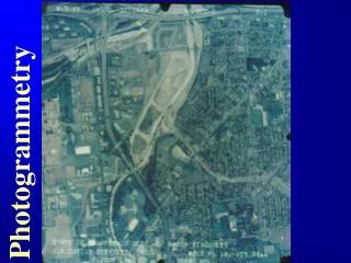
GPS / GIS & Photogrammetry Online
190 likes | 359 Vues
GPS / GIS & Photogrammetry Online. “Connecting Albertans”: URISA Alberta Conference 1999. Jeff Thurston Department of Renewable Resources University of Alberta Edmonton, Canada T6G 2H1. What we are doing?. theory and applications of surveying. theory and applications of GPS.

GPS / GIS & Photogrammetry Online
E N D
Presentation Transcript
GPS / GIS & Photogrammetry Online “Connecting Albertans”: URISA Alberta Conference 1999 Jeff Thurston Department of Renewable Resources University of Alberta Edmonton, Canada T6G 2H1
What we are doing? theory and applications of surveying theory and applications of GPS theory and application of photogrammetry (aerial imaging) Theory and application ofgeographic information systems (GIS)
Where are we doing this? • undergraduate forestry program • Environmental Resource Management Program, Extension • GPS / GIS Online International (Fall 1999) http://rrgpsgis.forsci.ualberta.ca
Course Content Lecture #1 Survey measurements / definitionsLecture #2 Coordinates, distances, traversesLecture #3 Differential levellingLecture #4 Traverse and angle definitionsLecture #5 Measurements, error of closureLecture #6 Closure, bearingsLecture #7 Topography, rasters, vectorsLecture #8 Mapping, topology, spatial entitiesLecture #9 Introduction to GPSLecture #10 Status, constellations, DGPSLecture #11 Base stations, data, featuringLecture #12 GPS / GIS data captureLecture #13 Movie: GPSLecture #14 Remote SensingLecture #15 Intro to aerial photogrammetryLecture #16 EXAM (surveying/GPS)Lecture #17 Photo scalesLecture #18 Base/height ratios, displacementLecture #19 Stereoscopy, parallax, areasLecture #20 Mosaics, orthophotos, spectrumLecture #21 Forest classificationLecture #22 Photo interpretationLecture #23 Interpretation, stands, keys Lecture #24 Photogrammetry, lasers, orthosLecture #25 Integration of technologiesLecture #26 Climate & meteorological technologies
Integration LaserUltra - Sonics Email Grades New Technology GPS SV Data Online Total Stations JAVA GISMaps Course Notes Aerial Photos
Interaction Email Grades New Technologies LaserUltra - Sonics GPS SV Data Online Total Stations JAVA GISMaps Course Notes Aerial Photos
Other Applications Faculty of Agriculture, Forestry,and Home Economics • agricultural land management • cropping systems rotation • precision farming • hydrological delineation • buffer distancing • soil fertility • utilities and corridors • economic inputs / outputs • transportation
Our Approach • allows students anywhere access to GPS / GIS and photogrammetry theory • recognizes and understands the importance of integrated technologies (real applications) • capitalizes upon open architectures (efficiency) • recognizes educational materials developed on high speed networks are delivered on low speed dialups (access)
Where are we going? • increased use of JAVA • developing databases of interactive “scenarios” • online visualization & modeling • use of real-time data and live applications • remote location real-time labs • online stereoscopy • multi - language GPS/GIS/photogrammetry modules
The Future / Needs • increased education and training in multiple and integrated technology applications and use • use and development of interactive technologies for delivery anywhere and anytime • innovative and unique partnerships between industry, government and institutions to acquire technologies, develop, and distribute educational materials • research and development to meet new applications and emerging new “geo-technologies”.
Further Information Contact:Jeff.Thurston@ualberta.ca Servers:GPS / GIShttp://rrgpsgis.forsci. ualberta.ca GPShttp://rrgps.forsci.ualberta.ca GPS Working Group / JAVAhttp://www.ualberta.ca/~norris/gps/ Online Course Development (GPS/GIS)http://rrgpsgis.forsci.ualberta.ca/info.html
Acknowledgement: Mike Abley - Department of Renewable Resources Ken Crossman - Department of Computing and Network Services Linda Janzen - Department of Renewable Resources Susan Stein - Department of Computing and Network Services Norris Weimer - Department of Computing and Network Services