Photogrammetry & Image Analysis
Photogrammetry & Image Analysis . Photogrammetry. Originally, the science (or art?) of interpreting aerial photographs Stress on quantitative measurements Now includes analysis of digital images from many sources. Image from Avery. Interpretation of Aerial Photographs.

Photogrammetry & Image Analysis
E N D
Presentation Transcript
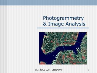
Photogrammetry & Image Analysis CS 128/ES 228 - Lecture 9b
Photogrammetry • Originally, the science (or art?) of interpreting aerial photographs • Stress on quantitative measurements • Now includes analysis of digital images from many sources Image from Avery. Interpretation of Aerial Photographs. CS 128/ES 228 - Lecture 9b
A hierarchy of remote sensing • Satellite sensing • Aerial photography • Ground-truthing Image from Avery. Interpretation of Aerial Photographs. CS 128/ES 228 - Lecture 9b
Perspectives • Vertical:- orthogonal perspective- planimetric map data • Oblique: - high oblique (includes horizon) - low oblique (no horizon) Image from Avery. Interpretation of Aerial Photographs. CS 128/ES 228 - Lecture 9b
Scale Determine from: • Plane altitudeRF = lens focal length altitude of plane • Known ground features Top image from Avery. Interpretation of Aerial Photographs. Bottom images from Ben Meadows catalog (L), Olean NW DOQQ ® CS 128/ES 228 - Lecture 9b
Problems Plane altitude • determining altitude (barometer, radar altimeter) • variation among photos • uneven terrain Known ground features: need • objects of known size & large enough for accurate measurement, or • pair of points for distance measure CS 128/ES 228 - Lecture 9b
Planimetric view • Perfectly vertical (orthogonal) perspective • All features in correct horizontal positions • Impossible unless at infinite height CS 128/ES 228 - Lecture 9b
The principle point • Point directly under camera lens (‘nadir’) • Elevated objects lean away from PP • Depressed objects lean toward PP • Causes image displacement Images from Avery. Interpretation of Aerial Photographs. CS 128/ES 228 - Lecture 9b
Vertical relief causes displacement • Transmission line is straight - why does the line appear straight in one photo and jagged in second? • In left stereogram, line is ~ on nadir; in right stereogram, far from nadir Image from Avery. Interpretation of Aerial Photographs. CS 128/ES 228 - Lecture 9b
Image displacement: • Source of error in horizontal locations, but • Permits estimation of feature elevations stereoscopic parallax Image from Avery. Interpretation of Aerial Photographs. CS 128/ES 228 - Lecture 9b
Stereoscopic photo pairs Image from Avery. Interpretation of Aerial Photographs. CS 128/ES 228 - Lecture 9b
Stereoscopes • need pair of overlapping photos • different principle points results in parallax • used to create topographic contours CS 128/ES 228 - Lecture 9b
Shadows • Need sun angle • Object must be vertical • Shadow must come from top and fall on level ground • H = L x tan(α) Image from Avery. Interpretation of Aerial Photographs.\ H = L x tan(α) CS 128/ES 228 - Lecture 9b
Rectification of aerial photographs Rectification: process of geometric correction that turns an aerial photograph into a planimetric (map-like) image Problems: • lens distortion • Earth curvature • camera tilt • terrain relief CS 128/ES 228 - Lecture 9b
Rectification process • Scan aerial photograph at high resolution • Locate ground control points on scanned image: ≥3 for affine transformation ≥5 for rubbersheeting • Combine with DEM to correct relief displacement • Rectify to a ground coordinate system CS 128/ES 228 - Lecture 9b
Relief distortion Objects at different distances form the lens will be distorted CS 128/ES 228 - Lecture 9b
Result: digital orthophotograph • USGS supplies in DOQ format • NYS GIS site provides freecolored infrared DOQQs CS 128/ES 228 - Lecture 9b
Urban areas: building tilt In urban areas, tall buildings seem to lean toward the principal point of the photograph Corrected by building a DTM of each building Permits virtual reality “flyovers” Thorpe, A. Digital orthophotography in New York City. www.sanborn.com/Pdfs/Article_DOI_Thorpe.pdf CS 128/ES 228 - Lecture 9b
Image Analysis • Identification of objects • Assigning attributes to objects or areas • Assessing the significance of patterns • Can be: • Visual interpretation • Computer-assisted image analysis CS 128/ES 228 - Lecture 9b
Landsat Images • Landsat 1-4 launched 1972 – ’82; expired • Landsat 5 & 7 launched 1985 & 1999; both operational • TM: thematic mapper. - 7 spectral bands- designed primarily for ES themes http://landsat.gsfc.nasa.gov/project/L7images.html CS 128/ES 228 - Lecture 9b
TM Applications CS 128/ES 228 - Lecture 9b
Hydrology example Images from Avery. Interpretation of Aerial Photographs. CS 128/ES 228 - Lecture 9b
Terra (and EOS) • Terra launched • Carries 5 instruments; the MSS imager is called ASTER (from Japan) • 14 spectral bands:- 3 VIS/near IR (15 m)- 6 short IR (30 m)- 5 thermal IR (90 m) Images from www.nasa.gov CS 128/ES 228 - Lecture 9b
ASTER spectral signature library “Welcome to the ASTER spectral library, a compilation of almost 2000 spectra of natural and man made materials.” http://speclib.jpl.nasa.gov CS 128/ES 228 - Lecture 9b
Classification schemes 1.a Unsupervised: raw data analyzed for clusters 1.b Supervised: prior categories imposed 2. Classification of new data 3. Ground truthing … Lo & Yeung. Concepts and Techniques of Geographic Information Systems CS 128/ES 228 - Lecture 9b
And that’s the fun part … CS 128/ES 228 - Lecture 9b